

Starting along the Greeley Ponds Trail.
A creek crossing shortly into the hike.
The Greeley Ponds Trail slowly gains elevation as it leads through pretty forest.
A boardwalk presumably in place for when the ground gets muddy.
Another creek crossing.
Junction with the Mount Osceola Trail.
The Mount Osceola Trail is very rocky, large boulders slowing down progress.
Tamer portion of the trail.
Then the Mount Osceola Trail starts to climb more steeply.
The Mount Osceola Trail ascends in this manner for some time.
Very bouldery.
View back as I progress along the Mount Osceola Trail.
A switchback higher up.
Close-up down toward Greeley Ponds on the way up.
The trail emerges into this small treeless section. The route leads up the face on the right, Class 2.
View down the face.
More ascending on the rocky Mount Osceola Trail.
Finally, the trail leads to a move at the top of an eroded gully, seen above, marking the top of the steep section.
View back down the eroded move.
Onward to Mount Osceola East Peak.
The trail is still very pretty, and far less steep.
Mount Osceola East Peak, nothing really to see here.
Descending from Mount Osceola East Peak to the saddle with Mount Osceola.
A viewpoint of Mount Osceola ahead.
Progress down to the saddle.
I reached the Mount Osceola chimney move, seen left. An easier option is available on the right here. Both lead to the same place.
Close-up of the Class 3 chimney move used to get up to Mount Osceola.
View back down the Class 3 chimney move.
View back toward Mount Osceola East Peak as I make my way to Mount Osceola.
It's a pleasant hike up a relatively light grade to the summit.
The trail continues along the ridge. A bit before the summit, this is a shot back toward the East Peak.
Mount Osceola seen ahead through the trees.
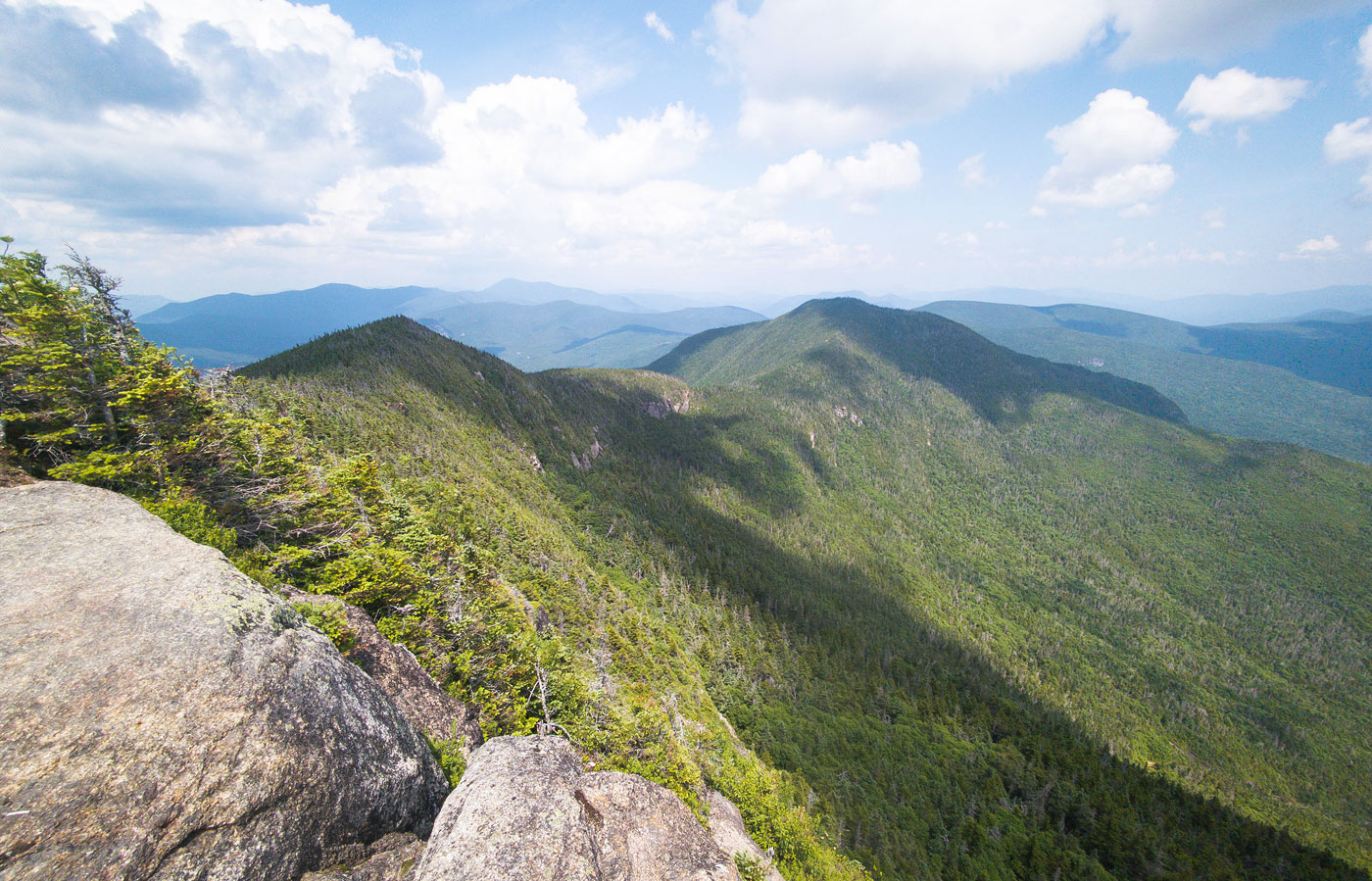
Mount Osceola summit, view southeast toward Mount Osceola East Peak.
Close-up toward Mount Osceola East Peak.
Mount Osceola summit, view southwest.
A quick detour to check out Greeley Ponds.
Upper Greeley Pond. The mosquitos were so bad that I didn't venture to the lower pond, oh well.
Hire me or show me some love!
Hire/refer me as a web developer or send me a few bucks if you find my site useful. I’m not sponsored, so all fees are out-of-pocket and my time preparing trip reports is unpaid. I really appreciate it!