

At Marshall Pass, about to start along the Colorado Trail (left). Mount Ouray is visible above. The standard route continues along the road for a bit before another road leads to a bushwhack. I skipped the bushwhack by taking the Colorado Trail.
Along the Colorado Trail, which is just a road at first. Antora Peak visible to the south.
The Colorado Trail's initial dirt road turns into a trail.
Along the Colorado Trail, which leads through the forest.
The Colorado Trail emerges from the trees. I turned right here and headed up the grassy/talus slope.
Views as I ascend the slope. The ridge I'll be on is visible top right.
Looking back at the ascent slope I took. The trees the Colorado Trail emerged from are visible on the left.
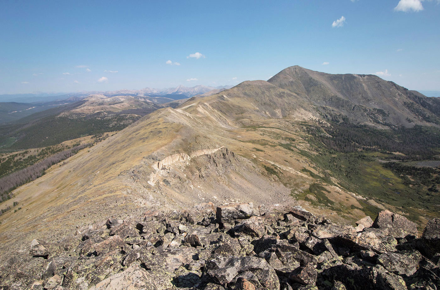
I made it to the ridge - this is a view toward the standard route. You can see the trees leading to the ridge that would have made the route a bit bushwhacky. My route was a little longer, but avoided all deadfall-hopping.
Mount Ouray ahead.
Class 2 ridge.
Looking back as I start ascending Mount Ouray.
Minor obstacle, avoidable on the left using a Class 2 social trail.
Avoiding the only obstacle.
Looking back along the right, Antora Peak visible on the left.
Push to the summit of Mount Ouray.
Looking back at the ridge I came up. The standard route is visible on the left. My route came up the bump at the end of the ridge.
Mount Ouray summit, view toward Chipeta Mountain.
Wide shot from Mount Ouray at the ridgeline to come, ending with Chipeta Mountain.
After coming down from Mount Ouray, headed north along the ridge toward Chipeta Mountain South (the bump in front of Chipeta Mountain).
About halfway along the ridge, a view toward the basin separating Mount Ouray (right) and Chipeta Mountain (left).
Continuing along the ridge.
At a low point on the ridge, where I will be returning later to descend back to the Colorado Trail (left, out of frame).
Looking back toward Mount Ouray.
Heading up to Chipeta Mountain, only minor Class 2.
Another shot back toward Mount Ouray.
Heading down Chipeta Mountain South's inconvenient summit, onward to Chipeta proper.
Chipeta Mountain.
Class 2.
Looking back toward Chipeta Mountain South (right) and Mount Ouray (left).
Approaching Chipeta Mountain's summit.
Summit view, looking north toward the Collegiate Peaks.
Back at the low point on the ridge I mentioned earlier, dropping down to the Colorado Trail.
Looking back up toward the ridge.
Nice views as I approach the Colorado Trail from this spur trail from the ridge.
Along the Colorado Trail, which I took back to Marshall Pass.
Hire me or show me some love!
Hire/refer me as a web developer or send me a few bucks if you find my site useful. I’m not sponsored, so all fees are out-of-pocket and my time preparing trip reports is unpaid. I really appreciate it!