

Starting just outside Camp Lamoille, hike through the camp and look for a trail on the left.
We found a trail, but it wasn't the official trail. I highly, highly recommend looking for the official trail which stays to the left of the creek. Our route was rough and left us with scratches and complaints.
After a while going up the valley, this is a view looking back toward Camp Lamoille.
Mt. Gilbert looming ahead.
Approaching the end of the ascent up the valley.
Approaching the base of Mt. Gilbert.
Looking back down the valley after beginning the Mt. Gilbert ascent.
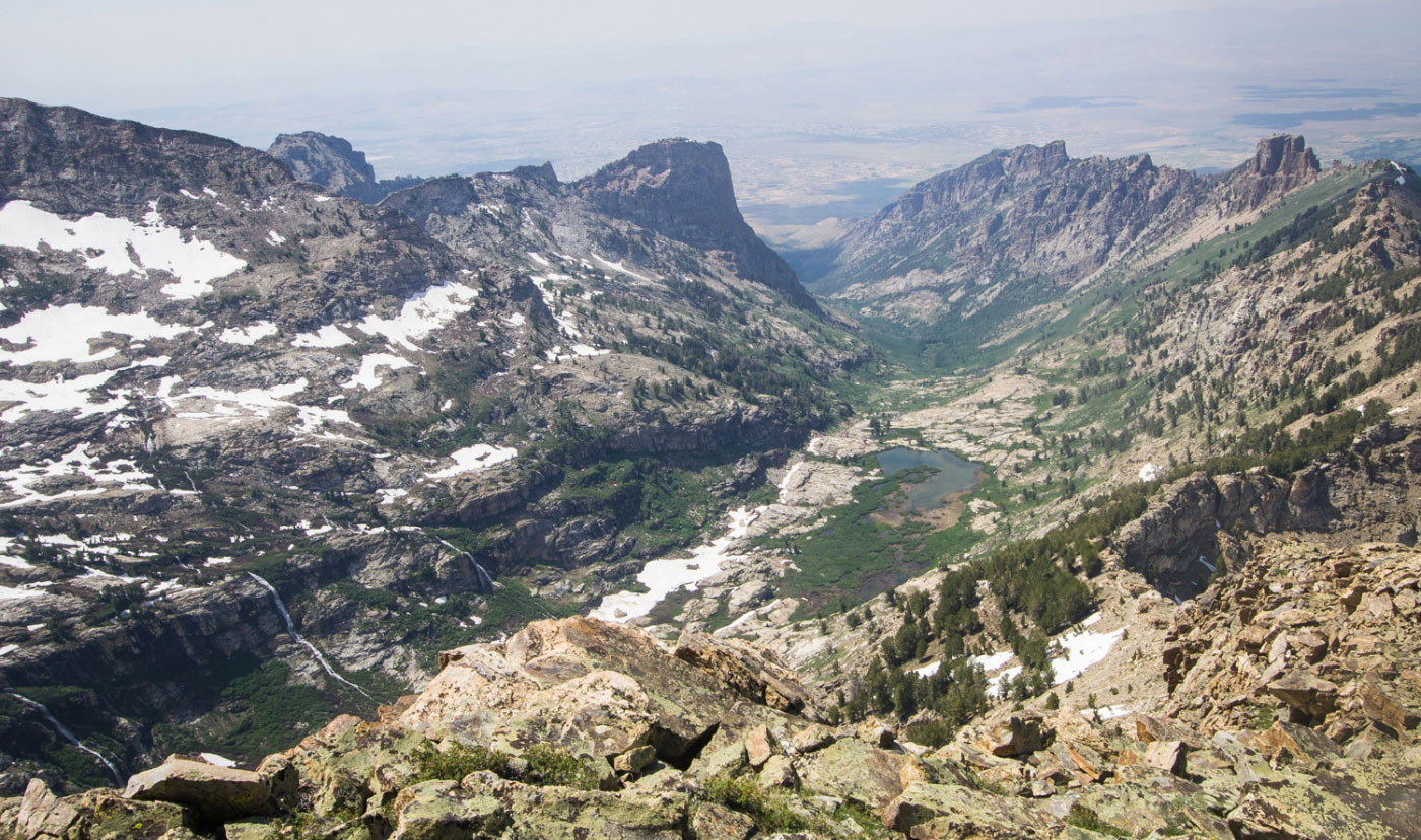
Looking back the way we came.
Resting before the snow field and then the scramble.
Our route went up the snow field ahead, and then continued right along the snow to the slid ground above.
Looking back from on the snow field.
A green bench before the long, fun scramble.
Looking back along the bench, the snow field we ascended below.
Headed up the scramble.
Looking back down the scramble.
Lots of fun Class 2+/3 moves.
At the ridge of Mt. Gilbert.
Almost at the summit.
Mt. Gilbert summit looking north.
North close up.
Mt. Gilbert summit looking south.
Down a gully on the northwest side of Mt. Gilbert. The ridgeline is Class 5 insanity, so we had to find another route around the ridge.
Once down the gully, we headed south along a convenient ledge between the west face of Mt. Gilbert and a sheer drop.
Continuing toward a snow-filled gully. We headed up the leftmost gully to that notch, but stayed on the rocks to the left of the snow (Class 3).
Looking back from within the gully.
At the top of the gully, looking north. Mt. Gilbert on the right (see the ridiculous ridge?), and the gully we came up on the left.
Continuing south, another crazy-looking ridge that we thankfully would not have to deal with.
Looking back toward Mt. Gilbert just above Echo Lake.
Echo Lake!
Almost at Echo Lake.
Looking down the canyon that Echo Lake drains into. We didn't go down this, as cool as it looks.
Echo Lake from the southwest.
The notch we chose to head toward.
Headed toward the notch.
Looking back at Echo Lake.
Waterfalls along our route.
At the notch we chose. We chose poorly, as we were greeted by Class 4 downclimbing. I assume the correct notch to head toward was farther east. Oops.
Our view northeast from the ridge.
Our Class 4 down climb.
Looking back up at the scramble. No joke.
Continuing down the slopes heading toward the valley.
An icy lake along the way.
Looking toward goat lake, but we headed down the valley instead of toward Goat Lake.
Puddle reflection along the way.
Almost at the valley floor.
We were determined to find the real trail this time, since the approach was ridiculous. The trail is on the east side of the creek and is pretty obvious the whole way back.
Looking back the way we came.
Crossing the creek.
Looking back toward Mt. Gilbert. We had approached it on the west side of the valley, but the trail leads back calmly on the east side of the valley.
Mt. Gilbert in the distance as the sun set.
Hire me or show me some love!
Hire/refer me as a web developer or send me a few bucks if you find my site useful. I’m not sponsored, so all fees are out-of-pocket and my time preparing trip reports is unpaid. I really appreciate it!