

Starting up to Mt. Massive. It was a little disheartening to be walking away from Mt. Elbert (leftmost peak in this photo).
Leaving the treeline on the way up Mt. Massive.
Mt. Massive up there int he center somewhere.
Looking back the way I came.
Along the ridgeline to Mt. Massive, with a view south toward Mt. Elbert and the long traverse to get there.
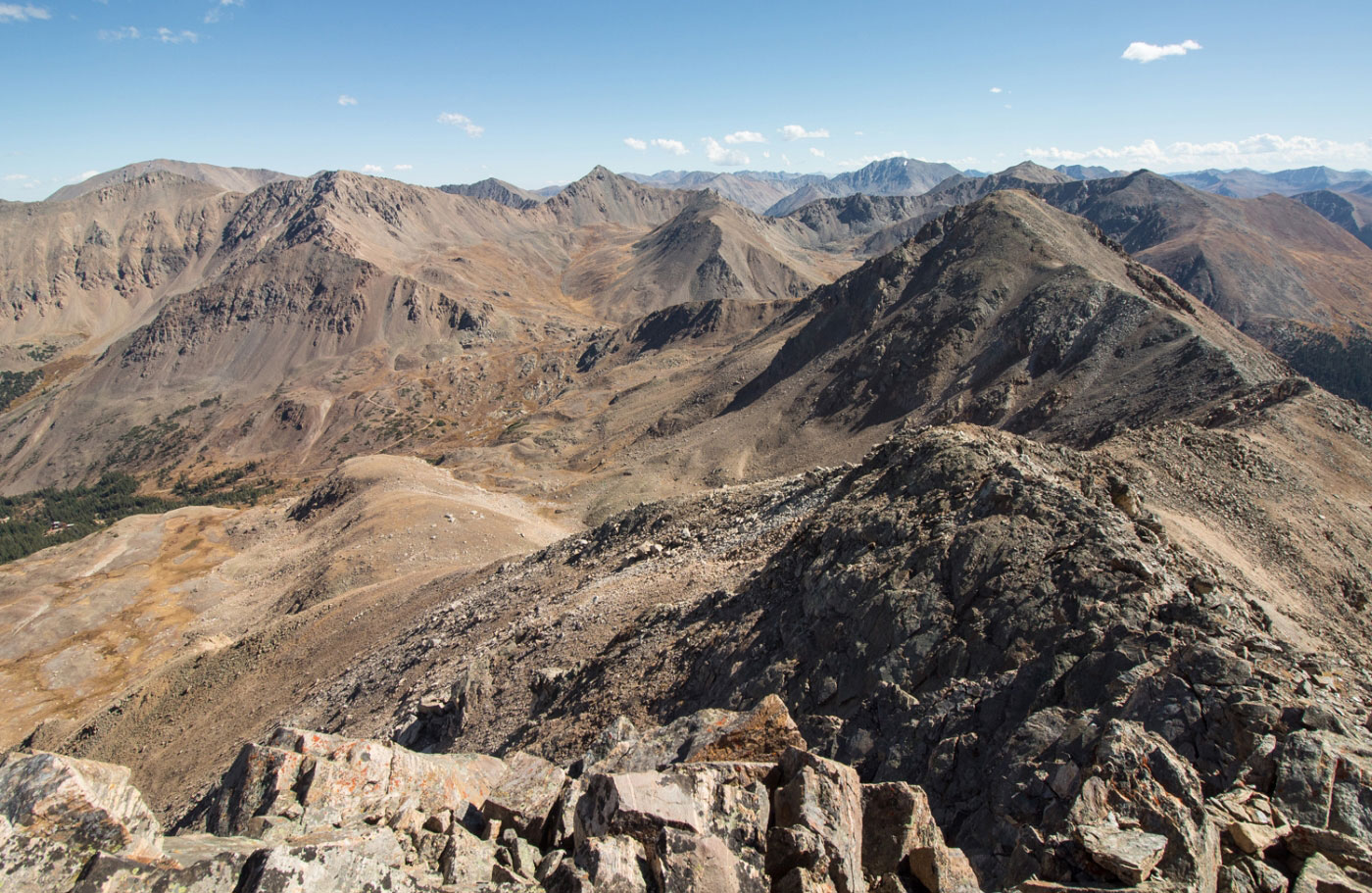
Looking down the ridgeline, Mt. Elbert on the ridge, and the Mt. Massive Trail I came up on the left.
Continuing up toward Mt. Massive.
Mt. Massive summit ahead.
Close-up of the traverse - Mt. Oklahoma on the right, Deer Mountain center, Peak 13736 and Mt. Champion on the left.
Heading along the ridge from Mt. Massive toward Mt. Massive - Northwest Peak.
Mt. Massive - Northwest Peak ahead.
Looking back toward Mt. Massive on the way to Mt. Massive - Northwest Peak.
Class 2 stuff to gain Mt. Massive - Northwest Peak.
Mt. Massive - Northwest Peak, looking toward Mt. Oklahoma and Deer Mountain, to come.
Looking back toward Mt. Massive, on the way down from Mt. Massive - Northwest Peak.
Mt. Oklahoma on the right. It's blocking Deer Mountain behind it, but you can see Peak 13736 and Mt. Champion just to its left.
Ridgeline to Mt. Oklahoma.
Mt. Oklahoma ahead.
Along the ridge to Mt. Oklahoma, looking back toward Mt. Massive.
Mt Oklahoma summit, looking toward Deer Mountain, next.
Deer Mountain on the far right.
Deer Mountain getting closer, slowly.
Flat section just before starting up Deer Mountain.
Along the ridge to Deer Mountain, looking back toward Mt. Oklahoma and Mt. Massive.
Approaching the Deer Mountain Class 3 section.
Class 3 section on Deer Mountain.
After the Deer Mountain Class 3 section, a short section of Class 2 before gaining the summit.
Deer Mountain summit, looking back toward Mt. Oklahoma.
Deer Mountain summit, looking along the ridge to Peak 13736 and Mt. Champion. You can also see the pointy Casco Peak farther left, French Mountain even farther left, and the start of the ridge to Mt. Elbert getting cut off on the far far left.
Mt. Elbert far left, Peak 13736 and Mt. Champion far right. Two bumps along the ridge to get to them.
Looking back toward Deer Mountain.
Peak 13736 (right) and Mt. Champion (left).
Class 2+ down-climb to get to the start of the ridge up to Peak 13736.
Along the ridge to Peak 13736, looking back toward Deer Mountain (left).
Peak 13736 summit, looking toward Mt. Champion (right), pointy Casco Peak center, and Mt. Elbert (far left). French Mountain is pictured between Casco and Elbert, but I went up that valley to Casco, skipping French.
Close-up of the ridge to Mt. Champion, Casco far left.
Approaching Mt. Champion summit.
Heading down from Mt. Champion, assuming I'll be going up the ridge to French Mountain - it started looking scary from here, but I tried anyway.
Ruins of some sort on the way down from Mt. Champion.
At the base of Mt. Champion, looking at the west ridge of French Mountain.
Looking back toward Mt. Champion and Peak 13736.
Close-up of the west ridge of French Mountain. I attempted it (not pictured for this route), but ultimately bailed and just went up the valley.
Looking down the valley toward Mt. Champion.
Looking up the valley toward Casco Peak.
Looking down the valley toward Mt. Champion, passing a lake.
Approaching the French/Frasco and Casco saddle.
Looking down the annoying scree slope to the saddle.
A disheartening sight taken from the saddle before starting up Casco. That's Mt. Elbert way out there, Bull Hill to its right, and the sun setting behind me.
Casco Peak ahead.
Almost at the Casco Peak summit, looking back toward French Mountain (right), and Mt. Champion (left).
Heading down from Casco Peak along the ridge to Bull Hill.
Looking back toward Casco Peak.
Ridge to Bull Hill, a sort-of social trail most of the way.
Approaching Bull Hill, Mt. Elbert on the left.
Close-up of Bull Hill.
Almost at the summit of Bull Hill, looking back toward Casco Peak. French Mountain is in the center, and Mt. Massive can be seen in the dying light on the right.
Bull Hill summit, looking toward Mt. Elbert. I lost light here, but there's still some easy Class 2 and 6 miles of walking down on the official Mt. Elbert Trail to go. You can see Mt. Massive on the left over there, too.
Hire me or show me some love!
Hire/refer me as a web developer or send me a few bucks if you find my site useful. I’m not sponsored, so all fees are out-of-pocket and my time preparing trip reports is unpaid. I really appreciate it!