

A view from where I parked, heading up the dirt road. Mt. Tukuhnikivatz far left, Mt. Peale far right.
Mt. Tukuhnikivatz first.
Mt. Tukuhnikivatz off to the left somewhere. If you look closely toward the center right, you can see the mini scramble section.
Mt. Peale visible as you head up Mt. Tukuhnikivatz.
Mt. Tukuhnikivatz. The clouds were a little scary, but whatever.
Looking back, my car is just off-frame to the left.
Mt. Tukuhnikivatz ahead.
Looking along the ridge toward Mt. Peale, some mountain goats hanging out.
The Class 2 crap headed up Mt. Tukuhnikivatz.
Mt. Tukuhnikivatz summit.
Mt. Tukuhnikivatz summit, looking toward Mt. Peale.
Back at the saddle, where the mountain goats hadn't moved, headed toward Mt. Peale.
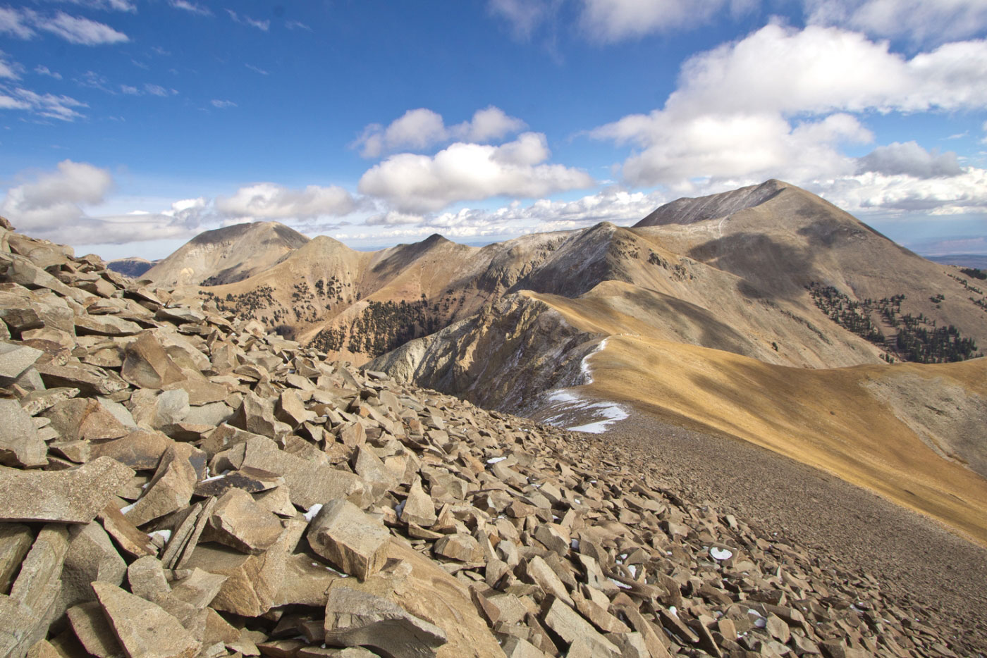
Along the ridge looking back at Mt. Tukuhnikivatz.
Approaching the mini scramble.
Class 3, Mt. Peale in the distance.
Looking back toward Mt. Tukuhnikivatz.
Mt. Tukuhnikivatz from along the knife edge ridge.
Continuing toward Mt. Peale after the scramble.
Looking back toward Mt. Tukuhnikivatz.
Mt. Tukuhnikivatz close-up.
The rest of the ridge to Mt. Peale.
Mt. Peale ahead.
Approaching Mt. Peale summit, Mt. Tukuhnikivatz way over there.
Wide shot from Mt. Peale of Mt. Tukuhnikivatz (left), Mt. Mellenthin (right).
Closeup of the whole ridge from Mt. Tukuhnikivatz.
Headed down the nonsense boulder field. Too steep for it to be fun.
It really wasn't the highlight of the day, for sure. I headed toward those trees down there, hoping the rocks would let up. They did. And there were cairns at the trees.
Looking up toward Mt. Peale about halfway down.
At the trees, where the rocks stopped being so aggravating.
Continuing cross-country back to the dirt road.
Looking back toward Mt. Peale after finding an exit trail leading to my car.
Hire me or show me some love!
Hire/refer me as a web developer or send me a few bucks if you find my site useful. I’m not sponsored, so all fees are out-of-pocket and my time preparing trip reports is unpaid. I really appreciate it!