

Starting from the end of the dirt road wash, continue along the wash on foot because it's wilderness and no vehicles are allowed. Please respect this. You can see the southern end of the Muddy Mountains on the right over there.
Lovell Wash cuts between the Muddies, center of this photo.
Approaching the mouth of Lovell Wash.
Looking back toward the mouth of Lovell Wash.
Nothing particularly crazy interesting, but Lovell Wash has some pretty highlights.
Looking back at some of the rock formations within Lovell Wash.
You can see Muddy Peak on the right. Continue through Lovell Wash up to the saddle.
Approaching the saddle of Muddy Peak and Muddy Benchmark.
Looking back down into Lovell Wash from the saddle.
Looking north toward the standard route up into the Muddies, really cool-looking sandstone features out there.
Continuing east along the slopes to the ridgeline just north of Muddy Peak.
Along the slopes, looking east toward the saddle and Muddy Benchmark (center).
Close-up of some more interesting red rocks you would get to see if coming via the standard route.
The ridgeline to Muddy Peak!
Close-up of the intimidating ridgeline. It ends up not being nearly as scary as it looks.
Looking back along the ridgeline, Muddy Benchmark visible on the left.
Approaching one of a few obstacles along the ridgeline.
Close-up of the Class 3 gully up Muddy Peak.
Class 3.
More Class 3. It's pretty sustained, but nothing too crazy.
Looking down the Class 3 section.
Muddy Peak summit ahead!
Muddy Peak summit, looking south. Lovell Wash visible on the right. Lake Mead in the distance.
Muddy Peak summit, looking north. Muddy Benchmark visible on the left.
Back at the saddle headed west toward Muddy Benchmark.
Looking back toward the saddle (left) and Muddy Peak (right).
Along the ridgeline to Muddy Benchmark (far left). There's a fun section of route-finding obstacles to come in order to get over that hump in the center. Look for a natural arch as you approach along the ridge.
A couple of natural arches. A Class 2+ scramble leads to higher ground just to my left.
The scramble zig-zags a little before spitting you out on the northern slopes of the obstacles.
Looking back down as I skirt the northern slopes of the obstacle.
I followed an animal trail along the slope.
The slope leads to this weakness in the cliffs. A single Class 3 move to get up and over and onto mellow ground.
What an abrupt change in pace. Muddy Benchmark ahead.
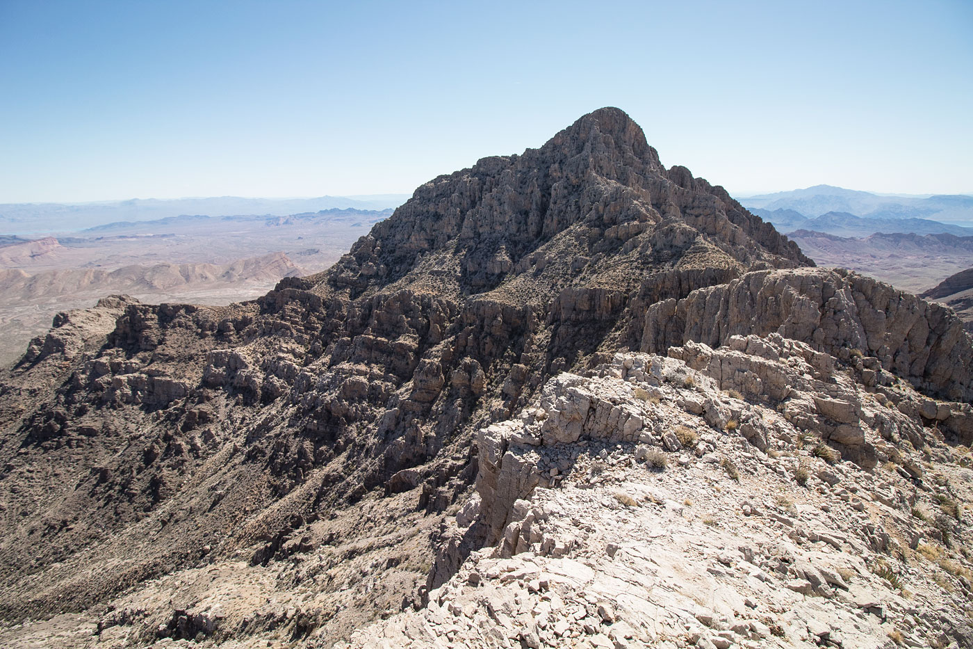
Looking east toward Muddy Peak, on the way up to Muddy Benchmark.
Muddy Peak (center) from Muddy Benchmark summit.
Muddy Benchmark summit, looking south toward the ridgeline I'd follow to get down. You can see the wash I follow on the left.
Entering the wash after descending the Class 2 slope.
Looking back toward the Muddy Mountains from within the wash.
Follow the wash for a while.
The mouth of West End Wash.
Some interesting colors and rock within West End Wash.
Impassable dryfall. Bypass on the left.
Looking back toward the dryfall and the bypass. Those cliffs are way bigger in real life than they appear in this photo.
Open desert at the mouth of West End Wash.
Looking back into West End Wash.
Traverse the open desert back to the trailhead.
Looking back toward West End Wash (left) and some interesting sandstone cliffs.
Hire me or show me some love!
Hire/refer me as a web developer or send me a few bucks if you find my site useful. I’m not sponsored, so all fees are out-of-pocket and my time preparing trip reports is unpaid. I really appreciate it!