I provide a free route map, but you can also download a hike/drive GPX to assist you and to help support my site. Before sharing my GPX tracks with others, please remember my site is a free resource and I'm charging nominal fees to offset my substantial costs.
GPX track added to your cart.
Mar 22, 2022 — North Ajo Peak was a nice sunset add-on that we had noticed earlier in the day. Along with its more impressive Class 5 southern neighbor, Ajo Peak, this pair forms a nice couple of pinnacles on the horizon. We didn't have time for Ajo Peak, but maybe one day we'll come back for it. This peak shouldn't be confused with the high-prominence high point of the Ajo Mountains, Mount Ajo. We navigated on on good dirt roads, then headed south on this less-good road starting here (32.34743, -112.90176). Hiking this would only add a mile or so round-trip.
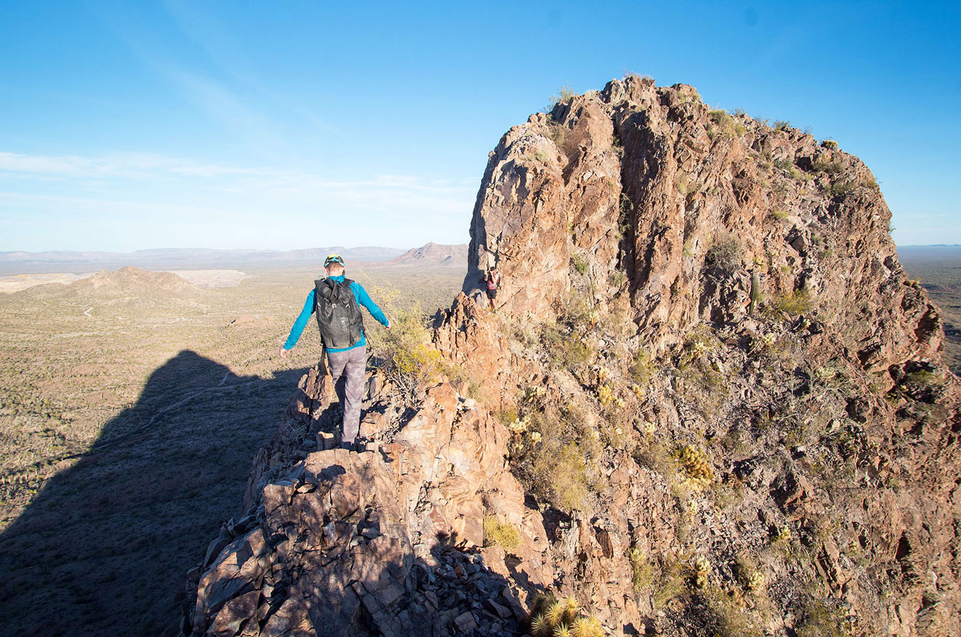
We traversed the desert, wrapping northwest around the south side of North Ajo Peak, the terrain mostly tame except for a few arroyos. Once at the south side of North Ajo Peak we made our way up a minor ridge that seemed like it might lead us toward the summit. With some Class 2 on scree, some light bushwhacking, and the occasional low Class 3 move, we were able to navigate the small rock ribs and outcrops that are difficult to describe with anything that will resemble helpfulnes. Now at the base of the sheer southern cliff face of North Ajo Peak, we were able to wrap up to its west ridge by pulling a series of Class 3 moves on solid rock that hug the cliff base and then ascending Class 2.
Once on the ridgeline, I was immediately sure I'd be bailing on this one. An exposed Class 4 vertical knife-edge leads along the ridgeline, followed by some Class 3 scrambling. My friends coaxed me to get through it, but the breakable holds had me really regretting it. I took a photo on the way back of a Class 3 ledge workaround located 30 or so feet below the ridge. I recommend taking this option instead. While still somewhat exposed, it doesn't require any exposed Class 4 climbing.
Past the knife edge was a final series of chutes situated next to each other. My friends, as they do, took the first option presented to them, Class 4. I popped over to the chute to the right, which was a little brushy, but only Class 2+/3. The sunset summit views were nice, but I wish I had known about that ledge option for the way back. Descending that Class 4 ridge was not fun for me on the way down.
Please consider helping me out if you find my site useful. I'm not sponsored, so all site fees are out-of-pocket and my time preparing these trip reports is unpaid. You can also hire me as a web developer. I really appreciate it!


If you find my site helpful, please help me replace my many broken cameras, fund my website fees (hosting, APIs, security), or just support my countless hours of work. I pay for all expenses myself, and all trip reports I post are unpaid and unsponsored, so any support is really appreciated!
If using PayPal, please select their option for "Sending to a friend" so they don't take out fees, thank you.
My site is free to use, but consider sending me a few bucks to help keep it running. Thanks in advance!