

Starting from the trailhead along the dirt road.
The dirt road narrows into a beautiful trail, paralleling a stream.
Looking back toward Ptarmigan Peak, which is the last peak in this loop.
Continuing up to North Schell Peak.
Looking back, you can see the basin and the ridgeline that comprises this route.
Continuing up the shallow gully.
Looking back as the trail starts to fade away.
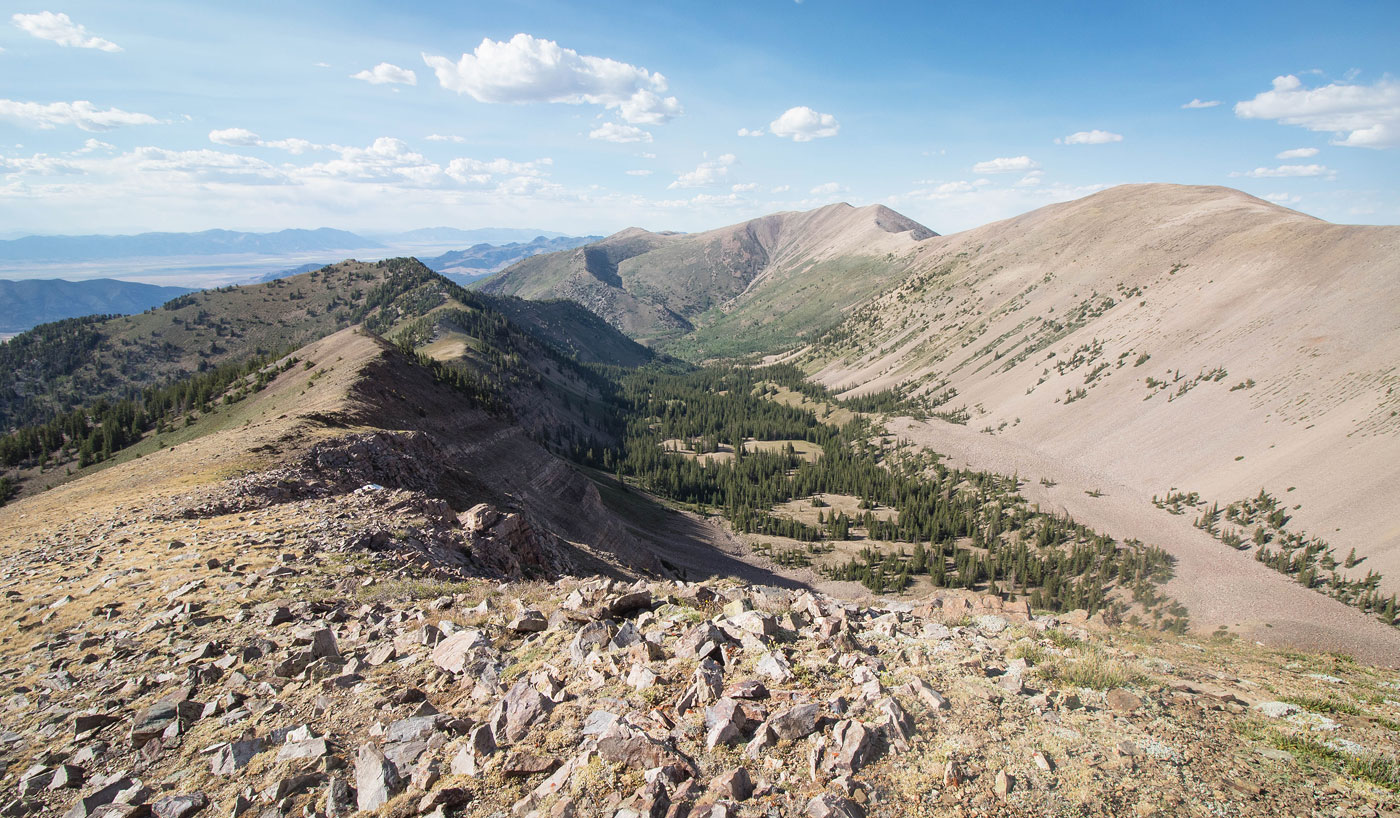
Nearing the head of the shallow gully.
North Schell Peak is up there. The trail ends shortly and I ascended the slope.
Looking back down the slope.
North Schell Peak ahead.
North Schell Peak ahead, the ridge traverse visible on the right.
Looking back from the summit of North Schell Peak.
Coming down the south side of North Schell Peak along the ridge.
Onward to Middle Schell Peak, looking back toward North Schell Peak. The trailhead is somewhere down there on the left.
Middle Schell Peak ahead.
Looking back toward North Schell Peak.
Coming down from Middle Schell, onward to Uinta Peak.
Looking back toward the ridgeline I've completed so far.
Continuing down from Middle Schell Peak. Uinta Peak visible center, Taft Peak on the left.
A particularly rocky section along the ridge on the way to Uinta Peak.
Heading up to Uinta Peak.
Looking back toward the ridgeline, Ptarmigan Peak on the opposite side of the basin visible on the left.
Heading down from Uinta Peak on the way to Taft Peak. Far right you can see South Schell Peak.
On the way up to South Schell Peak, Uinta Peak center, looking back the way I came.
Ascent to Taft Peak.
Taft Peak summit, view toward South Schell Peak (right) and a couple other 11ers in the High Schells.
Close-up from Taft Peak summit view toward Mount Moriah (left) and Wheeler Peak (far right).
Back on Uinta Peak looking along the ridge to Peak 11345, Ptarmigan Peak visible right.
View of the basin from the saddle of Uinta Peak and Peak 11345.
Looking toward South Schell Peak on the way up to Peak 11345.
Peak 11345 continuing along the ridge to Ptarmigan Peak (left).
Onward to Ptarmigan Peak.
Some minor bushwhacking, nothing serious.
Continuing along the ridge to Ptarmigan, North Schell visible top right.
Looking back at my progress to Ptarmigan Peak. Uinta Peak visible center left.
Approaching Ptarmigan Peak summit.
Looking back again.
Just past the Ptarmigan Peak summit, crazy cliffs on the right preventing easy access down into the basin.
Looking back before starting the descent.
The ridgeline descent from Ptarmigan Peak.
Very steep at points. The shadowy gully on the top left is the gully I ascended to get to North Schell earlier in the day.
Looking back along the ridgeline toward Ptarmigan Peak. You can see the cliffs on the peak's east side.
Steep descent off the ridge.
Looking back up my chosen steep descent. There's probably plenty of other options.
An animal trail brought me down to the official trail that leads into the basin. I followed the trail back to the trailhead, completing the loop.
Hire me or show me some love!
Hire/refer me as a web developer or send me a few bucks if you find my site useful. I’m not sponsored, so all fees are out-of-pocket and my time preparing trip reports is unpaid. I really appreciate it!