

Starting off along an old mining road into the wilderness area. Palen Mountain seen top right. Our ascent leads to the peak's right, descent comes from left of center.
Heading up a rocky slope to reach the ascent gully.
Almost within the ascent gully after a bunch of talus-hopping.
Looking back as we enter the ascent gully.
Lots of Class 2, and we gained elevation quickly.
A particularly cool dryfall obstacle.
Progress up the gully.
View back as we continue scrambling up.
View back as the drainage begins to open up.
One of many bouldery obstacles.
Another shot back, much higher up in the gully.
Nearing the top of the narrow portion of the gully.
The gully opens into a slope, leading to Palen Mountain's north ridge.
View back from the north ridge, the gully we came out of seen on the right.
Class 2 around a rock outcropping.
Now along the ridge crest to gain the summit.
Class 2/2+, fun scrambling on solid rock.
More ridgeline scrambling, Class 2+ seen ahead, just below the summit.
Palen Mountain summit, view northeast. Granite Mountain seen top left, Little Maria Mountains on the right.
View toward the trailhead, right of center.
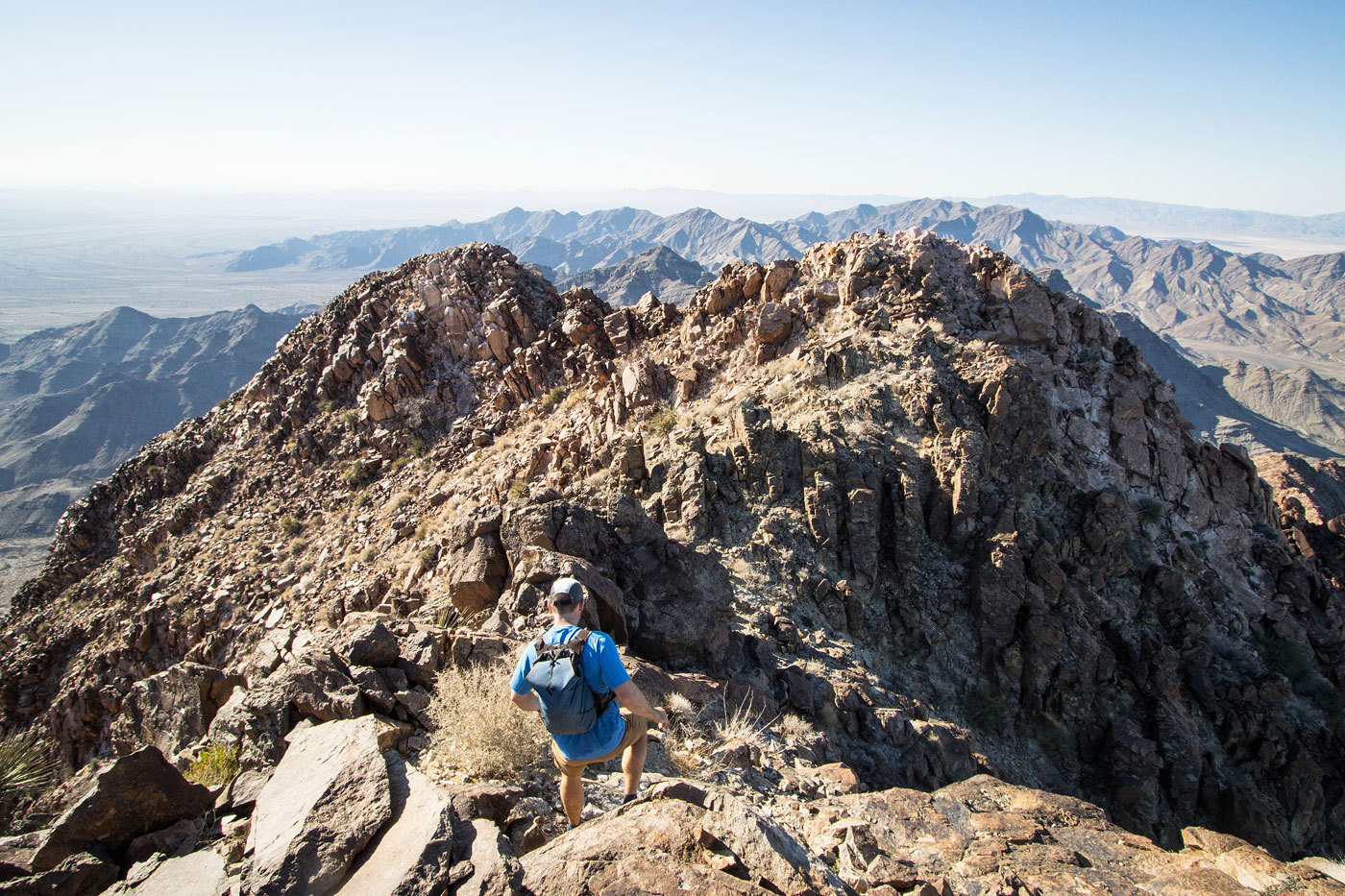
Onward for the descent route option, not recommended. The scramble along the ridge is cute for a while.
And then we had to drop down into the steep slope seen center. The expansive views were nice, though.
A weakness within a cliff band on the way down.
Class 2 down the weakness.
More progress down the tedious, steep slope.
View back up at our descent.
Eventually the slope mellows out a bit and we were pushed into the major wash, seen below.
View back up.
Entering the wash, though often it made more sense to just stick to the slopes where there were fewer boulders.
View back at the descent wash.
A fun water-carved feature within the wash.
We met up with the mining road and took it back to the trailhead.
Hire me or show me some love!
Hire/refer me as a web developer or send me a few bucks if you find my site useful. I’m not sponsored, so all fees are out-of-pocket and my time preparing trip reports is unpaid. I really appreciate it!