

Starting up from the free campsite parking area to the bench above.
Following the bench on a social trail.
Some petrified wood along the way.
After wrapping around the bench, the gully to scramble up comes into view (right). A social trail leads right to it.
Heading up the gully.
At the top of the gully, looking back down.
Walking across the mesa top on the way to Pandora's Box.
Entering Pandora's Box Canyon.
First rappel.
A bunch of rappels and obstacles, nothing particularly crazy.
Fun short down-climbs.
Pandora's Box opens up from narrows into wider sections like this one a few times.
The R rated section comes up shortly after this. In the center of this photo is a ramp that you can use to avoid the R section by heading up the ramp and keeping to the right side to get back down into the canyon.
If you chose to do the R rated section, here it is.
Entering back into narrows.
Some more beautiful narrows a bit before the final rappel.
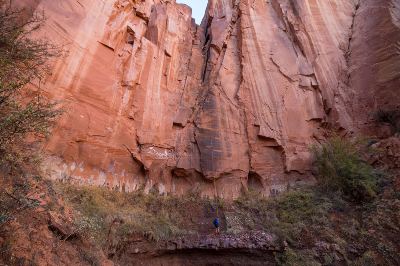
Final rappel.
Looking up at the rappel.
Continuing out of Pandora's Box toward Spring Creek Canyon.
Junction with Spring Creek Canyon. Apparently there's a scramble route if you go left, but we took the easier route - head down Spring Creek Canyon and join the Chimney Rock Trail.
Pretty fall colors within Spring Creek Canyon.
Junction with the Chimney Rock Trail. We came from the right in this photo and went left. Behind me is further down-stream within Spring Creek Canyon.
Heading up toward Mummy Cliff - Chimney Rock Trail becomes apparent soon. We ran out of daylight for photos.
Hire me or show me some love!
Hire/refer me as a web developer or send me a few bucks if you find my site useful. I’m not sponsored, so all fees are out-of-pocket and my time preparing trip reports is unpaid. I really appreciate it!