

Starting from Black Joe Mine Road, we headed through this underpass. Peanut Peak visible center.
Within a wash, descending until we found a good spot to start up Peanut Peak, seen center.
Looking back at the wash as we start up Peanut Peak. There were a few little arroyos we had to navigate below.
Peanut Peak ahead.
Ridgeline leading to the summit.
Another shot back. Mount Wilson visible in the distance.
Peanut Peak summit, view toward Jelly Peak and Sandwich Peak, both center. Butter Peak is out of frame on the left. It's just a minor bump that probably shouldn't have a name.
On the way to Jelly Peak.
View back toward Peanut and Butter Peaks as we head up some Class 2 up to Jelly Peak.
Jelly Peak, view toward the ridgeline leading to Sandwich Peak (seen on the left).
Jelly Peak, view southwest.
Onward to Sandwich Peak, the mesa in the center.
Along the ridgeline down to the eastern saddle of Sandwich Peak. Class 2 section seen ahead.
A view north from the eastern saddle toward Fortress Peak.
View back as we finish some Class 2 to get to the meastop.
Easy walking along the mesatop to Sandwich Peak.
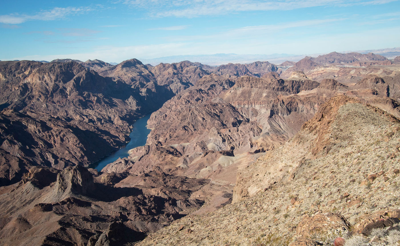
Sandwich Peak summit, view northwest into the Black Canyon.
We backtracked to find a way down. This is a view north toward Fortress Peak and White Rock Canyon Peak. You can also see the bridge over the Hoover Dam top right.
Class 2 descent back into the wash we came in on. The car is in the distance on the top right in this photo.
Hire me or show me some love!
Hire/refer me as a web developer or send me a few bucks if you find my site useful. I’m not sponsored, so all fees are out-of-pocket and my time preparing trip reports is unpaid. I really appreciate it!