Hike Petroglyph Canyon, Mount Sutor, Canine Crag, Ecru Peak Loop Sloan Canyon National Conservation Area, NV


Along the Petroglyph Canyon Trail. Mount Sutor visible top left.
The Petroglyph Canyon Trail drops down into the canyon after heading through the desert for a short time.
Petroglyph Canyon.
Class 2 dryfall obstacle.
Class 2/3 dryfall obstacles in a narrower section of Petroglyph Canyon.
Looking back through the narrow section in Petroglyph Canyon.
Petroglyphs for which the canyon is named. There are a ton of them. Please respect them.
Shortly after the petroglyphs, I kept left at a fork and left the official trail. The resulting wash seen here is less wide, but still easily traveled.
I decided to leave the wash to ascend to Mount Sutor. There's no one "correct" spot to do so. The slope is pretty much consistent the whole way up.
View down into Petroglyph Canyon as I ascend Class 2 to Mount Sutor.
Mount Sutor ahead.
Mount Sutor ahead, view toward the route to come on the right. I continued along the Mount Sutor south ridge for a bit before descending to the west, where the terrain was less steep and loose.
Canine Crag is next.
Badlands before Canine Crag.
Cute section of fun badlands navigation before reaching the base of Canine Crag.
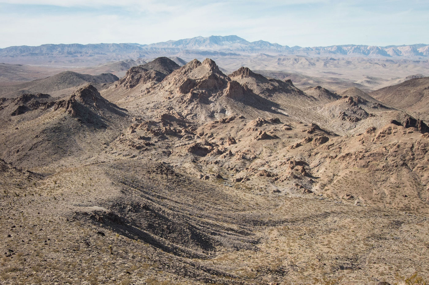
Summit of Canine Crag, view toward Mount Sutor.
Summit of Canine Crag, view toward Feline Fang (left) and Mystic Mountain (top right).
Class 3 for Feline Fang.
Feline Fang, view toward Canine Crag.
Feline Fang, view toward Ecru Peak. You can see the official Petroglyph Canyon Trail bottom left. Taking this trail would lead back to the trailhead, but I wanted more peaks.
Short knife-edge-like section on the way up to Ecru Peak. View toward Feline Fang. Mount Sutor visible in the background.
Ecru Peak summit, view toward Mystic Mountain, center. I descended into the clear section on the left in this photo.
Descending the slope to the base of Ecru Peak, where this wash separated me from Mystic Mountain. Now for one of the bigger vertical sections of the day.
On the way up Mystic Mountain's south slope, view back toward Ecru Peak (center). I descended from the slope on the right in this photo. You can descend from Ecru Peak using all sorts of route options.
Summit of Mystic Mountain, view toward Mount Sutor (far left), Canine Crag, Feline Fang, and Ecru Peak (far right).
Continuing to High Topper Peak, just a bump along the ridge.
High Topper Peak summit, view toward Canine Crag and Feline Fang (far left) and Mystic Mountain (far right). From the summit of High Topper Peak, I could see the trailhead (behind me in this photo). I descended the Class 2 slope, which was just more volcanic bouldery stuff like I'd experienced for much of the day already. I picked up the trail and got back to my car from there.
Hire me or show me some love!
Hire/refer me as a web developer or send me a few bucks if you find my site useful. I’m not sponsored, so all fees are out-of-pocket and my time preparing trip reports is unpaid. I really appreciate it!