I provide a free route map, but you can also download a hike/drive GPX to assist you and to help support my site. Before sharing my GPX tracks with others, please remember my site is a free resource and I'm charging nominal fees to offset my substantial costs.
GPX track added to your cart.
Jan 21, 2023 — Picketpost Mountain is a gorgeous butte just off AZ-60, a standalone peak with cliffs on all sides, though a Class 3 route that's nearly a full-on trail leads to its summit. The hike is close enough to Phoenix that it gets a bunch of attention and is known as a classic scramble, but far enough away that it's not overrun. Any car can reach the Picket Post Trailhead, which is complete with a bathroom and lots of trail signage. This trailhead is used for accessing the Arizona Trail as well as the peak, and it seems popular for equestrians.
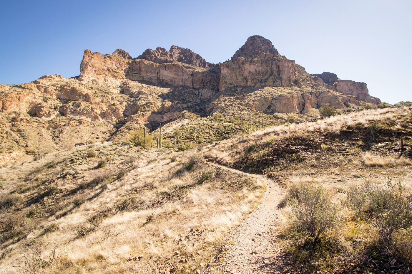
I set out along the Arizona Trail, which crosses a pretty creek before heading south for a half mile or so. Along the way I passed a sign pointing left for "Picketpost Trailhead", a bit confusing since the correct trail for reaching the peak leads right, and someone crossed out the arrow and wrote in their own notes. Soon I reached an unmarked trail that came in on the left, leaving the Arizona Trail and heading east. This trail is easy to follow and switchbacks up the northwest slope of Picketpost Mountain. Ahead I could see the steep gully where the route ascends the peak, a vital weakness surrounded by bright yellow cliffs.
Ascending more steeply, the trail heads up toward the base of this lower cliff band, some Class 2 scrambling along the way. There are various social trail options that lead generally in the correct direction, but I had to pay attention to stick to the main trail. Once at the cliff base, the trail traverses tot he right toward the mouth of the weakness, where the fun begins. Arrows painted on rocks point the way, though it's clear where to go and the graffiti is probably not necessary. I wrapped around into the drainage, where the trail keeps to the left side. A few short sets of Class 3 led me up fun sections of solid rock. The route ascends a few hundred feet through this narrow drainage. After a particularly pretty section of sloped rock complete with a trickle of water, the route leads out of the drainage on the left and a Class 2+ move leads to the slope above. The trail climbs steeply from here, keeping to the slope or the most part and entering the drainage higher up for a short time. It then emerges at the base of an upper cliff band above and continues to the mesatop above.
Once above the slope and on the mesatop, the hike changes drastically. Replacing the steeper scrambling, it was now a pleasant stroll through a wide, grassy summit area. The summit views from Picketpost Mountain were nice, Pinal Peak seen nearby and Weavers Needle in the Superstition Mountains visible in the distance. However, Picketpost Mountain is a bit on its own so much of the surrounding landscape is comprised of rolling hills.
Please consider helping me out if you find my site useful. I'm not sponsored, so all site fees are out-of-pocket and my time preparing these trip reports is unpaid. You can also hire me as a web developer. I really appreciate it!


If you find my site helpful, please help me replace my many broken cameras, fund my website fees (hosting, APIs, security), or just support my countless hours of work. I pay for all expenses myself, and all trip reports I post are unpaid and unsponsored, so any support is really appreciated!
If using PayPal, please select their option for "Sending to a friend" so they don't take out fees, thank you.
My site is free to use, but consider sending me a few bucks to help keep it running. Thanks in advance!