

The first couple of miles are an easy uphill following a stream.
There are a few breaks in the trees where you can see some semblance of progress.
Waterfall along Watson Path
Okay, then it gets steep.
Almost at the timber line!
A scramble before Mount Madison summit.
Mount Madison summit.
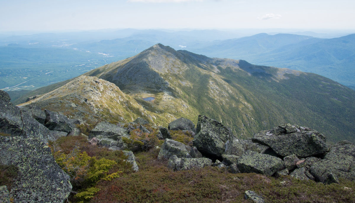
Star Lake, at the saddle between Mount Madison and Mount Adams.
Looking over Star Lake back toward Mount Madison before ascending Mount Adams.
Star Lake far below.
Scramble to the top of Mount Adams.
A small 3rd class section to the top of Mount Adams.
Mount Adams summit.
Mount Washington in the distance, still far to go for the halfway point.
Almost to Mount Jefferson, looking back toward Mount Adams.
Mount Jefferson summit.
Mount Clay and Mount Washington in the distance.
Mount Clay summit, looking back toward Mount Jefferson, Adams, and Madison.
Heading toward Mt. Washington.
Almost to Mt. Washington summit, looking back toward Clay and Jefferson.
The halfway point, only a short, rocky mess away!
Mt. Monroe is next.
Mt. Monroe summit ahead.
Looking back toward Mt. Washington.
Looking ahead toward Mt. Franklin and Mt. Eisenhower.
Summit of Mt. Eisenhower, looking toward Mt. Monroe.
Getting lower in elevation, finally seeing some trees again.
Almost at the summit of Mt. Pierce, looking back toward Mt. Eisenhower.
Mt. Pierce summit.
Back into the woods.
Some pretty steep parts.
Almost to Mt. Jackson, looking back toward the range from a bog. Wow.
Teeny scramble to the Mt. Jackson summit.
Mt. Jackson, the last one!
Heading back down, only a few miles to the trailhead.
Hire me or show me some love!
Hire/refer me as a web developer or send me a few bucks if you find my site useful. I’m not sponsored, so all fees are out-of-pocket and my time preparing trip reports is unpaid. I really appreciate it!