

View from Lakeview Overlook.
Follow the ridgeline to make the route interesting, or take the Historic Railroad Trail most of the way. My route follows the ridge.
Looking back toward Lakeview Overlook.
Great views of Lake Mead from high above on the left.
Promontory Point visible far top left in this photo. Head down to the Historic Railroad Trail below for a bit to avoid cliffs.
Follow the Historic Railroad Trail for a bit before ascending up and around to the north of a big butte.
Promontory Point visible in the back left. Go around the rock outcrop in the foreground on the left.
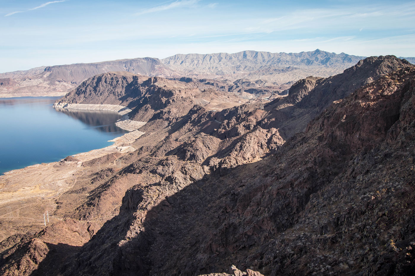
View of the carrying-ons of the Hoover Dam.
The route takes you along a steep slope. It's a really interesting view of Lake Mead that didn't translate well in photos, unfortunately.
Looking back toward the saddle from the top of the slope. I ascended from the left to where I'm standing currently.
Continue along the ridgeline along mellow terrain to gain Promontory Point's summit.
Almost at Promontory Point's summit, looking back along the ridge.
Promontory Point ahead.
Promontory Point summit, looking west along the route I came. Uranus is visible top right, my next destination.
Promontory Point summit looking south toward the Hoover Dam.
Promontory Point summit looking east toward Fortification Hill.
Promontory Point summit looking north toward Lake Mead.
Back at the trailhead, I headed west toward Rough Benchmark. You can see Promontory Point right of center.
Social trail leading halfway up Rough Benchmark.
Above some Class 2, view back toward the trailhead.
Eastern sub-ridge of Rough Benchmark. I kept left of the rocky ridge.
View from just below the summit, some fun Class 2/3 navigation to come behind me. You can see the eastern sub-ridge I came from on the right in this photo.
Rough Benchmark summit, view west. You can see I-11 of course, but also Pluto and Uranus on the right.
Class 2/3 as I headed along Rough Benchmark's west ridge.
Crux of the day was coming down from Rough Benchmark. You can see how craggy the ridge is. Pluto is next, visible on the right.
At the saddle with Pluto, Pluto visible top right. Uranus visible left of center.
View back toward Rough Benchmark.
Class 2 to Pluto.
Pluto summit, view toward Promontory Point (left).
Ridgeline from Pluto to Uranus. After getting Uranus, I dropped to the saddle visible center and headed to the right, where I'd pick up the Historic Railroad Trail. To get to Uranus, I recommend keeping to the right of the ridge.
The route I took was just to the left of the grassy slope right of center.
Almost up Uranus, view back toward Pluto (center).
Back at the saddle, I dropped down to the Historic Railroad Trail (visible center).
Looking back toward the saddle once on the Historic Railroad Trail.
I followed the Historic Railroad Trail back to the trailhead. Once below the trailhead, a Class 2 slope led to the left of the trail to get up to the Lakeview Overlook where my car was parked.
Hire me or show me some love!
Hire/refer me as a web developer or send me a few bucks if you find my site useful. I’m not sponsored, so all fees are out-of-pocket and my time preparing trip reports is unpaid. I really appreciate it!