

Maroon Lake in autumn is pretty much too perfect.
Heading toward Crater Lake, following West Maroon Creek.
Pyramid Peak visible to the south, while along the trail.
View back toward Maroon Lake.
The Maroons, taken just before leaving the main trail and heading up the Pyramid Peak Trail.
Starting along the Pyramid Peak Trail.
Looking back toward Maroon Lake along the Pyramid Trail.
Talus/scree with a trail to more easily navigate through this.
View toward the Maroons as I work my way up the switchbacks.
Continuing up the trail, just before entering the basin just north of Pyramid Peak, where a big boulder field waits.
Entering the boulder field, Pyramid Peak visible center.
Continuing through the boulder field.
Looking back the way I came through the boulder field.
Another progress shot through the boulder field. Pyramid Peak center. The route curves around to the left.
View of the slope to ascend to gain the saddle (center). The snow made it more difficult.
Heading up the slope, view back into the basin. Pyramid Peak out of shot top left.
Class 2 slope.
Snow falling off Pyramid Peak as I headed up the slope.
Continuing up the steep slope, the saddle just ahead.
Looking back down the slope.
At the saddle, view west toward Pyramid Peak's east slope.
My new friend Joe enjoying the views south as we started along the ridge.
View southeast as we work along the ridge.
View west, as we work along the south side of Pyramid Peak's northeast ridge.
Interesting little catwalk feature.
Approaching the Class 4 section ahead, a steep gully on a lighter-colored wall. This is where the social trail isn't super obvious.
Class 4. The rock is fairly loose, but the scramble is fun anyway. We were happy for no more snow.
View down the exposure on the Class 4 section.
More Class 4.
View north toward the northeast ridge of Pyramid, the way we came.
More fun ledges just below the summit.
The trail continues more obviously for a bit.
View south as we continue up the scramble.
Last bit of Class 3 to the summit.
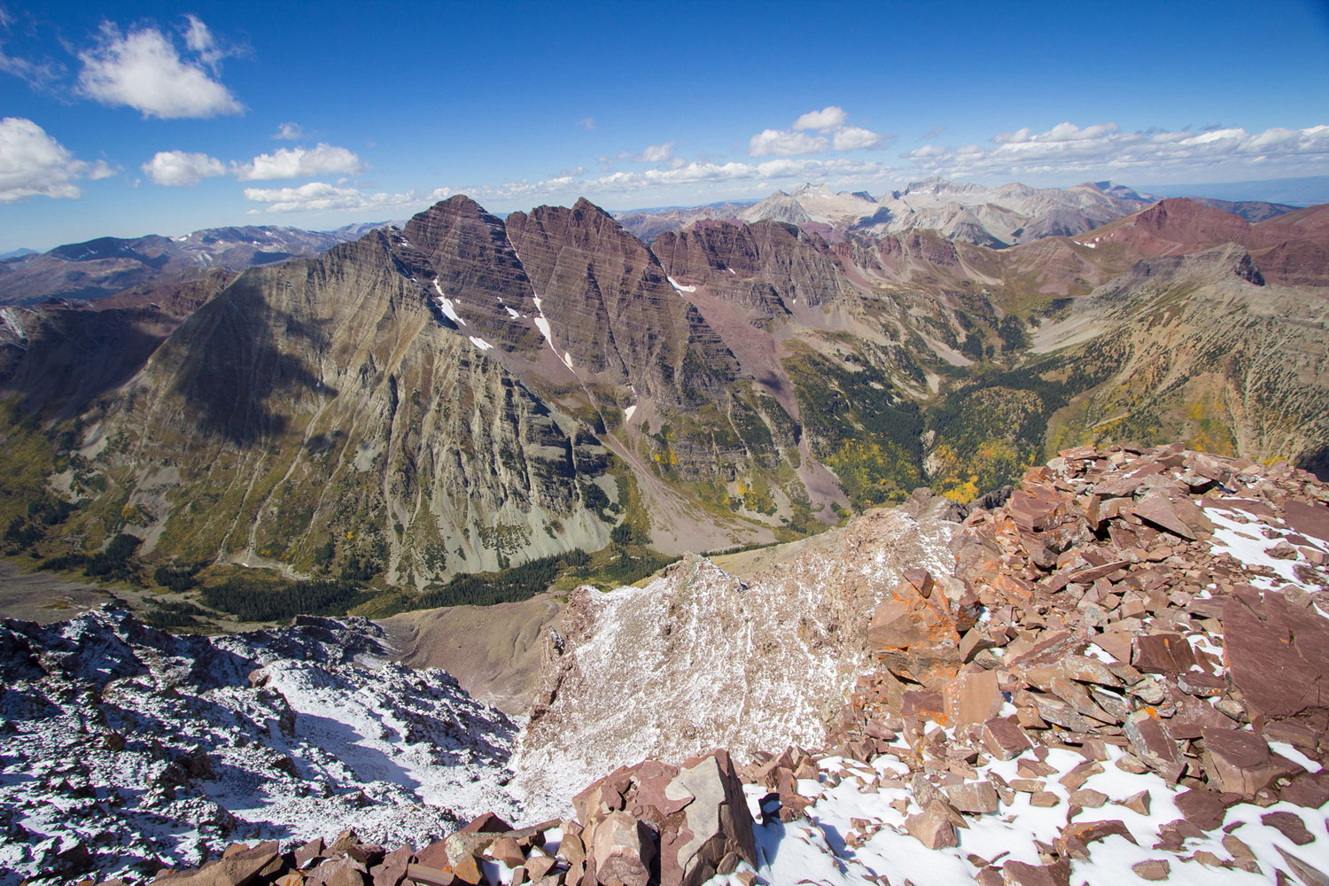
Pyramid Peak, view west to the Maroons.
Maroons close-up.
View north from Pyramid Peak summit.
Pyramid Peak summit, view south.
On the way back, I got another shot of the Class 2 approach slope without snow. Significantly less intimidating.
Hire me or show me some love!
Hire/refer me as a web developer or send me a few bucks if you find my site useful. I’m not sponsored, so all fees are out-of-pocket and my time preparing trip reports is unpaid. I really appreciate it!