

Starting out from the Wildcat Trailhead.
Cutting off onto the standard Subway route.
Heading down toward Left Fork of North Creek.
Left Fork of North Creek on the right.
Class 2 scramble down to get into Left Fork of North Creek.
First set of swimmers.
My camera got wet at the second swimmer and I continued the day with Josh's phone camera.
After finding the jug arch, this is the short Class 4 move section leading up the gully. The webbing you see here was placed by us temporarily. I recommend taking webbing or a rope on this trip for sure.
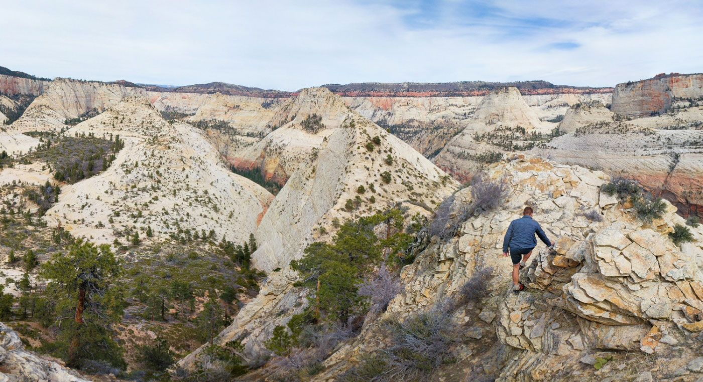
Left Fork of North Creek below, as we head up to the south rim.
At the south rim above Left Fork of North Creek. Greatheat Mesa in the distance. Rabbit Ears Peak is behind that.
Continuing in washes, etc.
Looking back the way we came, North Guardian Angel in the distance.
Taking in the views of South Guardian Angel.
Pano of South Guardian Angel along the route we chose.
Continuing toward Rabbit Ears Peak. Finally, a first glance at it. It's the pointy one just off right center.
Continuing down from our view of South Guardian Angel toward Rabbit Ears Peak (pointy thing just left of center).
Passing through some hoodoos.
Shawn stuck in quicksand.
More washes and canyons.
There's Rabbit Ears Peak (white peak on the left).
Looking back toward the hoodoos and South Gaurdian Angel.
Continuing up slickrock toward Rabbit Ears Peak.
Looking back toward South (left) and North (right) Guardian Angel peaks.
Class 3 slabs. Shawn and Josh on the left for size reference.
Looking down the slabs, the Guardian Angels in the distance. For reference, our day started behind North Guardian Angel (right).
Approaching the Class 4 section.
Shawn set up some webbing after getting through the dangerous and crumbly rock. We took the webbing back though ;)
Looking down at the Class 4 up climb.
The short ridge to the summit.
Looking back along the ridge, just after the Class 4 section. North Guardian Angel is visible in the center top.
Shawn at the summit of Rabbit Ears Peak. The cliff in the center is an incredible feat of nature not translatable through photos.
Looking southwest into Right Fork of North Creek.
Hire me or show me some love!
Hire/refer me as a web developer or send me a few bucks if you find my site useful. I’m not sponsored, so all fees are out-of-pocket and my time preparing trip reports is unpaid. I really appreciate it!