I provide a free route map, but you can also download a hike/drive GPX to assist you and to help support my site. Before sharing my GPX tracks with others, please remember my site is a free resource and I'm charging nominal fees to offset my substantial costs.
GPX track added to your cart.
Mar 14, 2019 — With the lovely sounds of the gun club (you can see their sign plastered on a hill as you drive I-11) and trucks on the Interstate, this traverse of a small range that clearly inconvenienced highway developers isn't exactly where you go for solitude, but the scramble is enjoyable. It summits four small peaks: Mt. Scorpion, Black Hill, Peak 3945, and then Railroad Peak.
Note that I started from the college library parking lot and just traversed through the desert, but a year later I revisited the area and there is a lot of construction. You may have to improvise a little to get around fences to approach the route.
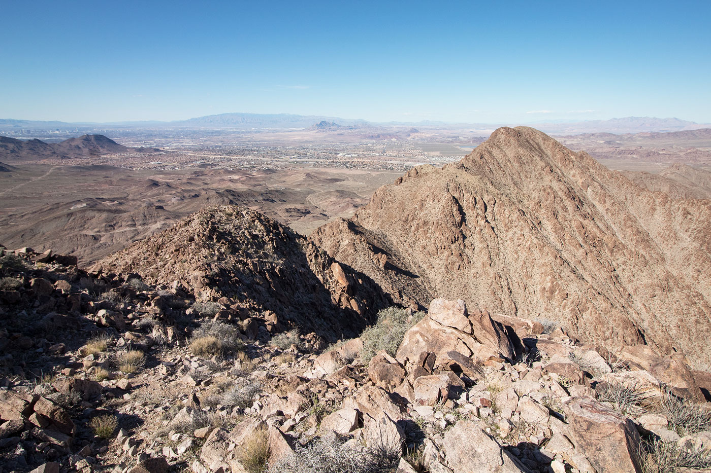
I've seen the Railroad Peaks countless times driving from Las Vegas to Boulder City, but they never felt too appealing. Finally, with an afternoon to kill, I parked at a college library parking lot and trudged through cleared desert that is likely soon to be the ever-growing Las Vegas sprawl, past power lines, and up to the base of the north end of the traverse. A dirt road leads you part of the way up the first peak, and a social trail leads up some Class 2 to Mt. Scorpion's summit register. For some reason, the register was on a sub-peak of the true Mt. Scorpion, so that was weird. Continue south up to Black Hill with no real obstacles, and then check out the pretty ridgeline from Black Hill over to Railroad Peak. There are a couple of easy Class 3 moves that are likely avoidable if you keep just east of the ridge, and some very light route-finding. Go over the hump that is Peak 3954 and down to the saddle beneath Railroad Peak. Note the gully on the right that will be your descent later. Railroad Peak has some more easy Class 3 moves and a couple of false summits, but you get nice views of the whole ridgeline and the surrounding desert, as well as a bit of quiet.
From the saddle of Peak 3945 and Railroad Peak, head down the Class 2 loose gully and use any number of dirt roads, washes, etc. to get back. Additionally, I tacked on Railroad Hill, which was a short Class 2 jaunt to add to the loop. My return route looks silly on the map, but it felt reasonable as I was doing it.
Also, I'm not totally sure these peaks are on BLM land. The ownership of the land was unclear to me.
Please consider helping me out if you find my site useful. I'm not sponsored, so all site fees are out-of-pocket and my time preparing these trip reports is unpaid. You can also hire me as a web developer. I really appreciate it!


If you find my site helpful, please help me replace my many broken cameras, fund my website fees (hosting, APIs, security), or just support my countless hours of work. I pay for all expenses myself, and all trip reports I post are unpaid and unsponsored, so any support is really appreciated!
If using PayPal, please select their option for "Sending to a friend" so they don't take out fees, thank you.
My site is free to use, but consider sending me a few bucks to help keep it running. Thanks in advance!