

Miller Creek Trailhead. A sign points left for hikers to get around the fence.
Gorgeous meadows at the base of the Rincon Mountains. Rincon Peak is up on the left somewhere. Happy Valley Lookout (a sub-peak of Mica Mountain) is visible on the right. The trail leads up to the saddle on the right of center in this photo.
Heading through the meadow.
View back.
Overall the Miller Creek Trail was in great shape.
There were a few times the trail crossed Miller Creek, like here, where you need to look out for the trail on the opposite side.
Entering Saguaro National Park.
The trail is easier to follow than it appears in the next few photos, but it is bouldery and sometimes quite steep, and cairns help when it's not totally clear.
View back, Rincon Peak up there on the right somewhere.
Progress along the Miller Creek Trail as it ascends through the bouldery terrain.
Steeper section of the trail.
Rincon Peak visible top left.
The trail led through some lightly forested sections, but mostly ascended on big bouldery terrain.
View back.
More progress up the eastern slope of the Rincon Mountains.
Rincon Peak over there. The trail switchbacks and wanders up the slope.
The Miller Creek Trail ascends into a forested gully.
Forested gully, shaded and pleasant.
Approaching Happy Valley Saddle.
Happy Valley Saddle, view toward Rincon Peak. Yeah, it's far away.
Passing Happy Valley Campground.
A nice little creek.
Cute waterfall.
The trail heads south.
Helpful trail sign.
The trail continues south, Rincon Peak visible ahead. The trail hugs the eastern slope of the Rincon Mountains rather than ascend to the ridgeline.
View back, Happy Valley Lookout (the peak I mentioned earlier) visible on the left.
The trail feels a bit long udring this extended section, but it's mostly pleasant walking with some switchbacks and varying levels of steepness.
Rincon Peak ahead.
View back, Mica Mountain poking out from behind Happy Valley Lookout on the right.
Forested section of the trail.
Rincon Peak ahead. The trail has some super minor overgrowth in sections, but is never hard to follow.
Passing a trickling spring on slickrock. I don't know if it's seasonal or year-round.
View back, Mica Mountain visible in the distance.
The trail then steepens as it heads up to Rincon Peak.
Very steep for around 800 vertical feet.
A switchback as the trail heads steeply up to Rincon Peak.
Summit register below Rincon Peak.
Almost up to Rincon Peak's summit, view south.
Last bit to the summit.
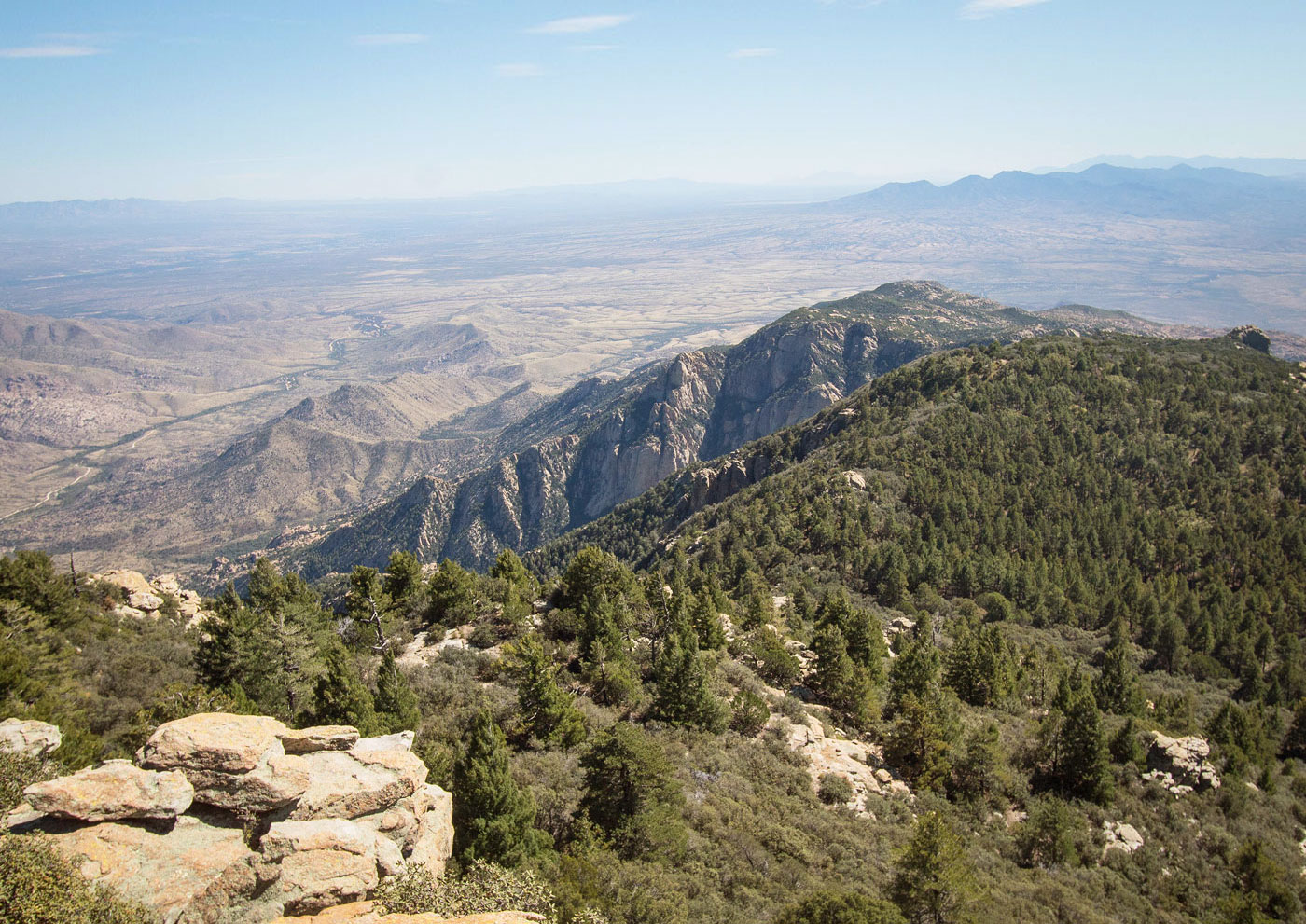
Rincon Peak summit ahead, view north toward Mica Mountain. Happy Valley Saddle visible center.
Close-up toward Mica Mountain (top left), Happy Valley Lookout (center), Happy Valley Saddle (right of center).
Just another shot toward Mica and the long southern ridge of the Rincon Mountains.
Close-up south.
Hire me or show me some love!
Hire/refer me as a web developer or send me a few bucks if you find my site useful. I’m not sponsored, so all fees are out-of-pocket and my time preparing trip reports is unpaid. I really appreciate it!