I provide a free route map, but you can also download a hike/drive GPX to assist you and to help support my site. Before sharing my GPX tracks with others, please remember my site is a free resource and I'm charging nominal fees to offset my substantial costs.
GPX track added to your cart.
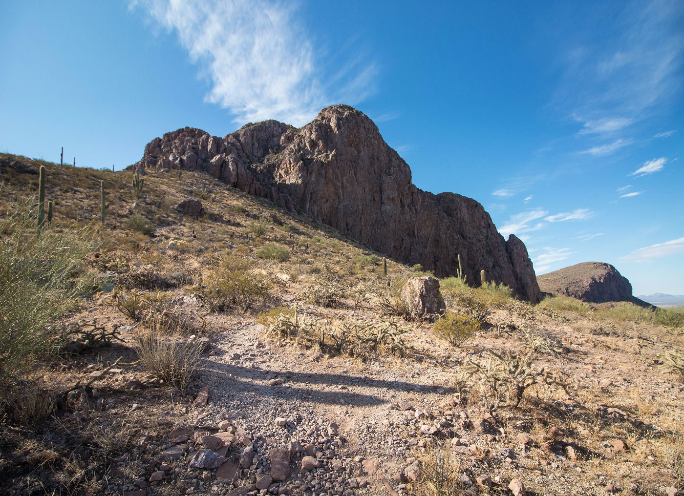
Nov 11, 2019 — Safford Peak stands out as you enter Tucson from the north, a peak known to some locals as Sombrero Peak. It's a pretty-looking peak from the highway, but much better en-route. The trailhead begins in Sanctuary Cove, which requests a small donation to park there. A trail leads past a rock labyrinth (if you want to add in some extra unnecessary hiking), and then starts ascending to the west. The route to the summit is a pretty clear social trail and surprisingly easy to follow except for one section, located shortly after starting the route. I included both my ascent and descent routes on my map - it just seemed like there was no one option to get to higher ground, except for a few cairns on less well-maintained trails. Perhaps the route has been obscured to prevent easy access? Anyway, the trail continues south past the less-obvious section and is easy to follow as it weaves up the east slope of Safford Peak. The trail then wraps around the south side of the peak and ascends on the west side on a Class 2 talus field. A Class 2+ move leads to the summit. You can see Panther Peak to the west, and apparently there's a nice ridgeline traverse to get there.
Please consider helping me out if you find my site useful. I'm not sponsored, so all site fees are out-of-pocket and my time preparing these trip reports is unpaid. You can also hire me as a web developer. I really appreciate it!


If you find my site helpful, please help me replace my many broken cameras, fund my website fees (hosting, APIs, security), or just support my countless hours of work. I pay for all expenses myself, and all trip reports I post are unpaid and unsponsored, so any support is really appreciated!
If using PayPal, please select their option for "Sending to a friend" so they don't take out fees, thank you.
My site is free to use, but consider sending me a few bucks to help keep it running. Thanks in advance!