

Start of the ridgeline to Salsberry Peak, visible ahead on the left.
Lots of bumps along the ridgeline.
Looking back toward Salsberry Pass (left), Sheephead Mountain visible top center.
Salsberry Peak left of center.
Looking back as we continue along the ridge, Ibex Peak visible top left.
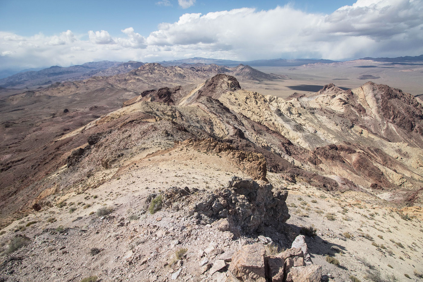
Large "blob" of bright yellow rock ahead on the right.
We got a little concerned momentarily that there would be no way to continue along the ridgeline.
But it was only Class 2 on the bright rock. Sheephead Mountain top left, Ibex Peak top center.
Close-up toward the colorful rock Class 2 stuff.
Salsberry Peak ahead, just some obstacles in the way along the ridgeline.
Class 3 volcanic-looking rock section. Pretty solid.
Some pinnacles along the ridgeline to wrap around.
Salsberry Peak head.
Looking back toward the ridgeline. You can see the Class 3 section on the left.
Easy slope up to the false summit (top right).
Looking back from the false summit.
Close-up toward the summit ridgeline, Class 2. Ibex Peak visible top left.
Summit of Salsberry Peak, view back along the ridgeline.
Close-up toward Longridge Peak (left) and Jubilee Mountain (right).
Close-up toward Epaulet Peak (left) and Calico Peak (right).
View toward our chosen descent drainage. We backtracked to the false summit and then dropped in. Sheephead Mountain visible left of center, Ibex Peak top right.
Class 2+ drainage descent, the least fun part of the day.
The drainage opens up into the desert.
View back toward Salsberry Peak as we head through the desert.
Ibex Peak still quite far away. You can see the good dirt road we'd follow for a while in the center.
Salsberry Peak top right, Epaulet Peak top left.
After following the good dirt road, we continued on this eroded dirt road. View looking back toward Salsberry Peak (top right).
Ibex Peak ahead.
We found a ridgeline that looked pleasant and started up.
View back down the ridgeline. We came up the drainage on the left. Salsberry Peak visible top right.
Ibex Peak ahead.
Looking back along the ridgeline, Sheephead Mountain visible center.
Close-up toward Epaulet (left) Salsberry (center), Sheephead (right).
After Ibex Peak, we followed its north ridge toward Sheephead Mountain (visible center).
Navigating the somewhat annoying hills below the summit of Sheephead Mountain.
Looking back at the ups-and-downs we came across, view toward Ibex Peak.
Class 2 to the summit block of Sheephead Mountain.
View back up the slope we ascended. It was colorful, but loose.
We wrapped around to the left and found a weakness in the summit block (Class 2). We also saw a cairn, marking that we had found the standard route.
Sheephead Mountain, view toward Ibex Peak. We ascended Sheephead from the hills on the right.
View toward Salsberry Peak.
Looking back toward Sheephead Mountain.
Beautiful colors on the descent from Sheephead.
We dropped down on the slopes, but the social trail we were following seemed to end.
Looking back up the slope we descended from Sheephead Mountain.
Continuing through the lovely desert, Salsberry Peak visible top right. We just wandered through the desert, found a wash, and made our way back to Salsberry Pass.
Hire me or show me some love!
Hire/refer me as a web developer or send me a few bucks if you find my site useful. I’m not sponsored, so all fees are out-of-pocket and my time preparing trip reports is unpaid. I really appreciate it!