stav is lost logo
  • Find Hikes
    • Most recent
    • Trip Report Index
    • Hikes by Region
    • Search Hikes
  • Map
  • About
  • Love
Hike Santiago Peak via Holy Jim Falls in Cleveland National Forest, California - Stav is Lost

Hike Santiago Peak via Holy Jim Falls Cleveland National Forest, CA

Class 1 15.9 miles 4200 gain 6-8 hrs Out and Back
Effort
Beauty
Personality
Solitude
DirectionsRoute MapDownload GPX

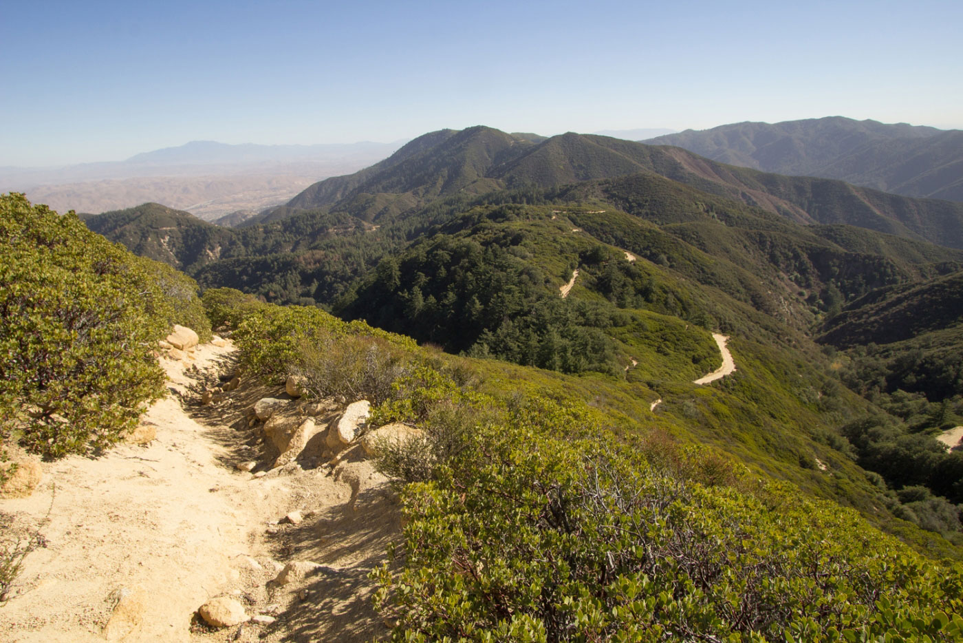
Dec 06, 2017 — Santiago Peak, the highest point of the Santa Ana Mountains, offers a nice, moderate grade to the summit, with really nice hilly views the whole way up. From the Holy Jim Trailhead, follow a road, passing some homes along the way. You'll get to the official trailhead, which leaves the dirt road and follows a well-beaten trail to the trickling Holy Jim Falls (probably just not the best time of year to visit). After the falls, go back a short way and continue up the trail toward Santiago Peak. Toward the top, you hit a dirt road. Going left follows the road to the summit, but going right, which seems counterintuitive, follows the road for a few hundred feet before a trail appears on the left, which is a much nicer approach to the summit than the road. The best views of the day were on this approach. I took the road on the way back to see what the difference was. Anyway, eventually, the prettier route (the trail) will meet back up with the road, which you have to follow to the Santiago Peak summit. Once at the summit, radio towers make it a little confusing to find the summit, but just keep following dirt roads that gain elevation, and soon the summit will be clear.

PEAKS ON HIKE
Elevation (ft) / Prominence (ft)
Peaks on hike
Elevation
Prominence
1
Santiago Peak
5687 ft
4387 rise

Show me some love

Please consider helping me out if you find my site useful. I'm not sponsored, so all site fees are out-of-pocket and my time preparing these trip reports is unpaid. You can also hire me as a web developer. I really appreciate it!

Thank you

Next HikePrev Hike
  • Next Hike
  • More Near Here
  • Prev Hike
photo protector Heading up the dirt road toward the trailhead. Locals only past this point, hence why you need to walk on a dirt road.
Heading up the dirt road toward the trailhead. Locals only past this point, hence why you need to walk on a dirt road.
photo protector Looking back along the dirt road, a house on the left.
Looking back along the dirt road, a house on the left.
photo protector Starting the official trail.
Starting the official trail.
photo protector No caption.
photo protector Into the canyon leading to Holy Jim Falls.
Into the canyon leading to Holy Jim Falls.
photo protector No caption.
photo protector Holy Jim Falls.
Holy Jim Falls.
photo protector Back at the junction - left goes back to the trailhead, right goes up to Santiago Peak.
Back at the junction - left goes back to the trailhead, right goes up to Santiago Peak.
photo protector No caption.
photo protector Switchbacks up the side of the mountain.
Switchbacks up the side of the mountain.
photo protector Views of Santiago Peak. See the little white towers on top of that mountain?
Views of Santiago Peak. See the little white towers on top of that mountain?
photo protector No caption.
photo protector A quick section of forest before hitting the road.
A quick section of forest before hitting the road.
photo protector Following the road to the right to find the trail.
Following the road to the right to find the trail.
photo protector Trail appears on the left (this photo was taken looking back the way I came).
Trail appears on the left (this photo was taken looking back the way I came).
photo protector No caption.
photo protector Great views along this ridge trail leading up to Santiago Peak. I highly recommend taking this rather than the road.
Great views along this ridge trail leading up to Santiago Peak. I highly recommend taking this rather than the road.
photo protector No caption.
photo protector Eventually, the trail meets back up with the road.
Eventually, the trail meets back up with the road.
photo protector No caption.
photo protector Follow the road to Santiago Peak.
Follow the road to Santiago Peak.
photo protector Santiago Peak summit.
Santiago Peak summit.
photo protector Close-up view toward a CA wildfire (left, far in the distance).
Close-up view toward a CA wildfire (left, far in the distance).
photo protector View looking southeast, down toward Holy Jim Canyon, the way I came.
View looking southeast, down toward Holy Jim Canyon, the way I came.
photo protector View looking southwest-ish toward the ocean.
View looking southwest-ish toward the ocean.

Show Me Some Love

If you find my site helpful, please help me replace my many broken cameras, fund my website fees (hosting, APIs, security), or just support my countless hours of work. I pay for all expenses myself, and all trip reports I post are unpaid and unsponsored, so any support is really appreciated!

If using PayPal, please select their option for "Sending to a friend" so they don't take out fees, thank you.

PayPalVenmoCash App

About  Contact  Love

© 2023 Stavros Basis.

DISCLAIMER: All activities you find on this site are dangerous. I am not responsible for anything you do in the outdoors. Please practice good ethics, and don't take any risks that put yourself or others in danger.


Thanks for visiting!

My site is free to use, but consider sending me a few bucks to help keep it running. Thanks in advance!

Sure!Nope.