I provide a free route map, but you can also download a hike/drive GPX to assist you and to help support my site. Before sharing my GPX tracks with others, please remember my site is a free resource and I'm charging nominal fees to offset my substantial costs.
GPX track added to your cart.
Apr 26, 2020 — After a very long Sonoran and Mojave Desert season this year, mostly due to COVID, but also my general over-psych for desert peakbagging, I was excited to get into some higher elevations to enjoy some greenery. I didn't realize quite how much I missed forests until I started this hike to Sawmill Mountain. I drove in very late, and made some wrong turns. Google Maps really messes you up. To stick to the main road, I recommend navigating to here: 37.46221, -114.26702 and then continuing south along this road that is suitable for all vehicles, though low clearance may struggle slightly.
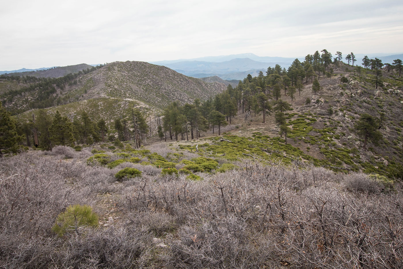
Some may prefer to do this route from East Pass a bit farther down the road, but I wanted to make the hike into a nice loop to get as much ridgeline view time as I could. I'm happy with my decision and I recommend making a similar loop as I did. I parked at the junction with a spur road and headed south along this road. I turned right when the slope became more mellow and less brushy/forested and continued along a mostly brush-free destroyed stumpland. I was thinking pretty low thoughts of this hike so far, but as I got higher, the views became nicer and eventually I would enter a forested section, leaving the deforested wasteland behind. The slope did have a slightly steeper section and there were a couple of brushy areas, but nothing crazy.
I continued though the pretty coniferous forest up to the summit of Sawmill Mountain, where finally the views became particularly gorgeous. To be fair, I might have found this to be extra pretty because it was such a stark change from the last few months' hikes. I continued east along the ridgeline, encountering only short sections of brush and steepness. I summitted a small peak along the ridge labeled Peak 7379, which had the best views of the day. I continued farther along the ridge and down to East Pass. I enjoyed the ridgeline enough that I eyes nearby Jacks Mountain, but it appeared to be significantly more brushy than my route so far. I hestitantly started up the slope from East Pass on my way to Jacks Mountain, picking my way around manzanitas and other unpleasantness, but really it wasn't so bad. A little character-building doesn't hurt, plus I wanted another peak after driving all the way the hell out here. There were sections of open slope free from brush that I somehow was able to locate regularly, and I made it to the summit before I knew it. There were a ton of bees all over and I was surprised none of them bothered me.
I descended Jacks Mountain a different way, which was far more brushy and unpleasant, so I removed that bit from my attached map. Return the way you came. Back at East Pass, I followed the nice road back to my car.
Please consider helping me out if you find my site useful. I'm not sponsored, so all site fees are out-of-pocket and my time preparing these trip reports is unpaid. You can also hire me as a web developer. I really appreciate it!


If you find my site helpful, please help me replace my many broken cameras, fund my website fees (hosting, APIs, security), or just support my countless hours of work. I pay for all expenses myself, and all trip reports I post are unpaid and unsponsored, so any support is really appreciated!
If using PayPal, please select their option for "Sending to a friend" so they don't take out fees, thank you.
My site is free to use, but consider sending me a few bucks to help keep it running. Thanks in advance!