

Starting through the desert on the way to Spencer Canyon.
Entering Spencer Canyon.
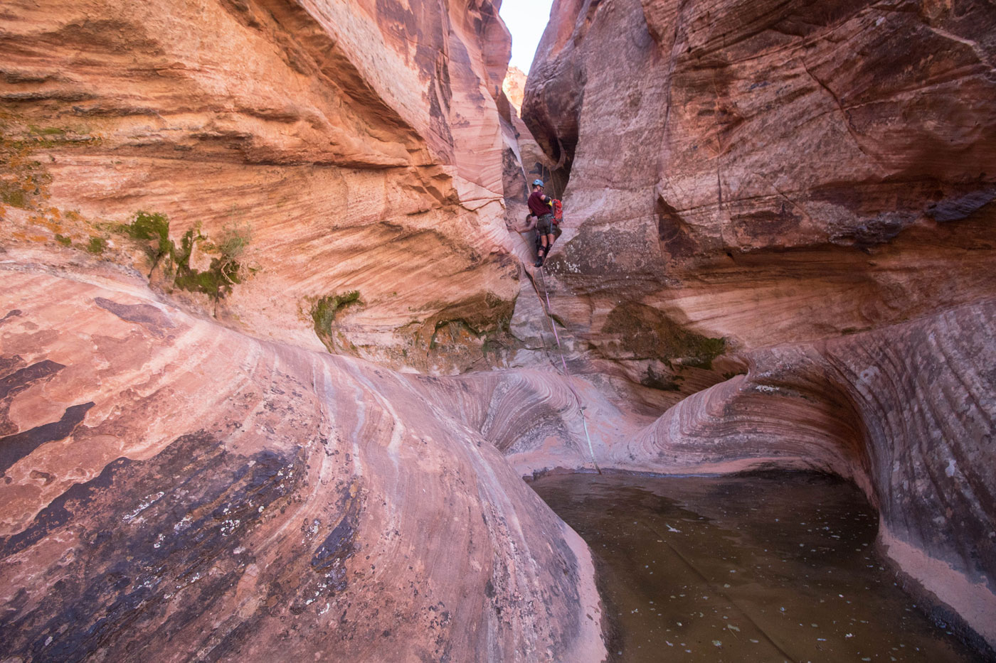
First rappel.
Slickrock downclimb after first rappel. The route leads into the narrows visible bottom right.
Spencer Canyon begins to narrow up a bit, some boulder-hopping required.
At the 90 degree turn, looking down an optional rappel. We saw nowhere to easily set up an anchor and instead opted to keep to the left and descend a narrow gully (out of frame on the left).
Descending the narrow gully.
Looking back toward the narrow gully.
Second rappel. Third rappel visible at the very top.
Photo by Shawn of Matt on the second rappel.
Looking back at the second rappel. You can also see the shitshow that is the 3rd rappel's webbing.
Bottom of the 3rd rappel.
Looking down into the 4th. Lolz at people who down climb this. It's super dangerous.
Within the narrows, too dark for good photos. View is looking back toward the second pool.
Third pool, easier to stem over than the second.
Exiting the dark narrows.
Pools to avoid.
Looking back at an avoidable pool via Class 3 bypass.
Stemming to avoid another shallow pool.
Spencer Canyon opens up, gorgeous tall walls.
At the junction where we turned right out of Spencer Canyon to locate an escape route.
Class 3 escape route.
Looking back down the Class 3 escape route.
Looking back at the gorgeous monoliths as we traverse the desert.
Heading through the desert to complete the loop.
Hire me or show me some love!
Hire/refer me as a web developer or send me a few bucks if you find my site useful. I’m not sponsored, so all fees are out-of-pocket and my time preparing trip reports is unpaid. I really appreciate it!