

Starting from Christmas Tree Pass Road at a turn out, Spirit Mountain the big hump in the distance. First, I followed this old road for a bit, then a social trail up to the hump ahead.
At the top of the hump, looking down a slope leading to the southwestern base of Spirit Mountain.
Once down, cairns helped navigate the hills and small arroyos. You're aiming for that prominent outcropping in the center of this photo.
Social trail leading up Spirit Mountain.
Looking back the way I came. You can see the initial hump I came up and over in the center.
Spirit Mountain in the center, now next to the prominent outcropping I mentioned previously. The route now continues to the right, staying fairly horizontal for a bit along the base of the cliffs.
Looking back along the base of the cliffs.
And now for the steeper ascent that lasts a while.
View back down at my progress.
Cairns helpfully guiding the way.
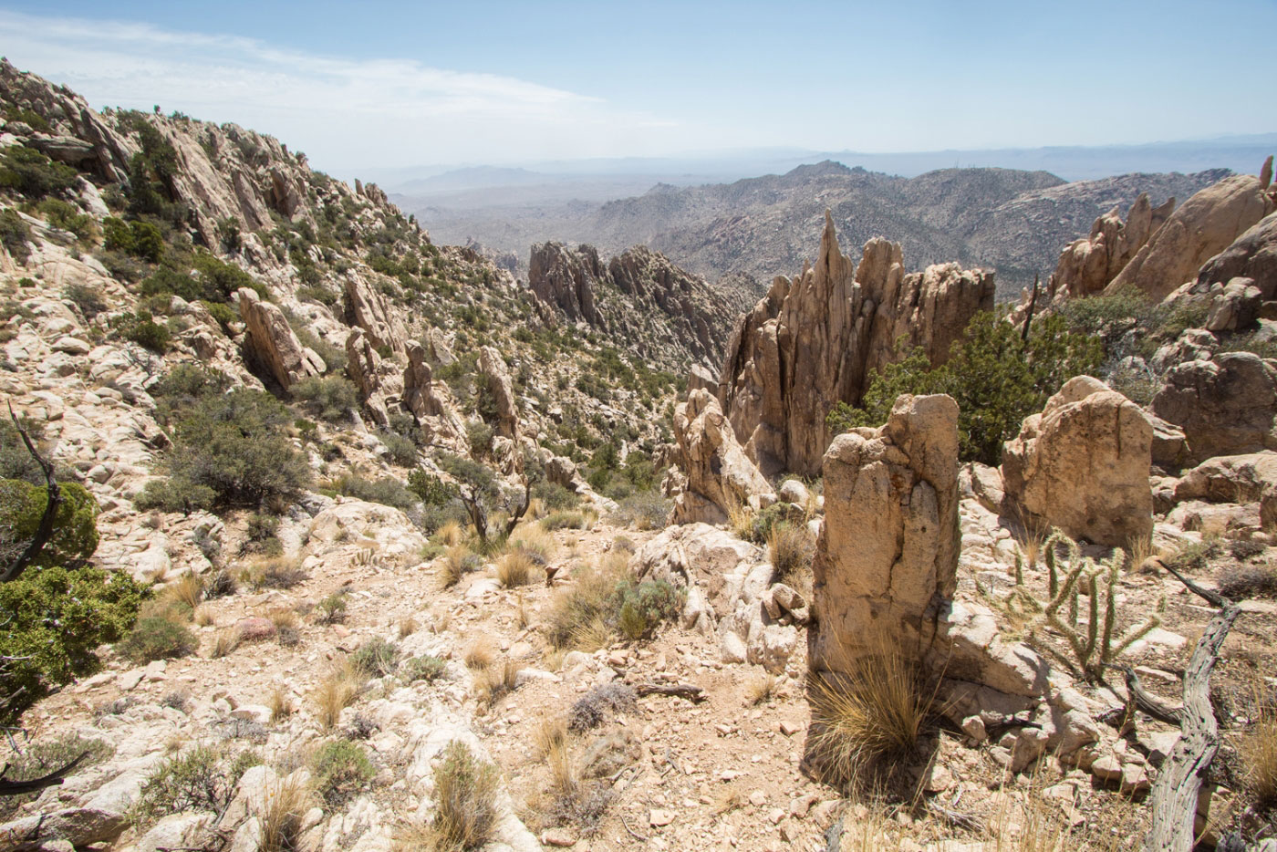
Cool pinnacles on the south ridge. The social trail continues making its way up.
Along the social trail, looking back the way I came (right in this photo).
Close-up of some pinnacles.
Spirit Mountain to the north.
Ascending a weakness in the cliffy upper reaches in order to gain the ridge.
Looking back at the pinnacle-filled section of the trail, now on the ridge.
Looking up toward Spirit Mountain as I head north along the ridge.
View back along the more tame ridge hike shortly before reaching the Class 3 rock rib move.
A shot of Matt (from my second time up Spirit Mountain) scrambling up the short, low Class 3 section. It heads up and over a rock rib, seen here.
Just past the Class 3 move, Class 2 to descend from the scramble rib obstacle. The summit is just ahead.
South view from Spirit Mountain.
Spirit Mountain summit, looking north. Colorado River seen below.
Hire me or show me some love!
Hire/refer me as a web developer or send me a few bucks if you find my site useful. I’m not sponsored, so all fees are out-of-pocket and my time preparing trip reports is unpaid. I really appreciate it!