

From where I parked, a view of my three peaks in the Stateline Widlerness. The high point visible center. View up is Peak 4425 on the left.
Approaching the major drainage on Peak 4425's northwestern side.
Within the drainage, pretty reasonable wash walking at first.
A short Class 2/3 section of narrows.
Farther up within the drainage. I stuck to the main fork.
View back at my progress. My car is somewhere in the center flat desert.
A fork, I kept right.
A Class 3 obstacle.
View back past all the significant obstacles when the drainage became more tame.
A minor gully and rock rib combo brought me to the summit on Class 2 terrain.
Another shot back just before the summit. I came from the drainage in the center.
Peak 4425 summit ahead.
Peak 4425 summit, view toward Clark Mountain and the massive solar fields seen along I-15.
Peak 4425 summit, view north at the substantial pinnacles along the ridgeline. Stateline Wilderness High Point visible center, my next peak.
I stuck to the crest initially, but then kept left around the pinnacle seen ahead.
View back toward Peak 4425.
Left around the pinnacle-filled ridge. There were still some nice Class 2/3 obstacles to overcome.
I scrambled back to the crest and saw that the rest of the ridge looked more tame. My next peak visible on the left. However, to reach the saddle center left of this photo, the ridgeline had some scary-looking rock outcroppings, so I stayed left of them when it came time.
View back at the traverse, Peak 4425 visible on the left.
View back toward the traverse from Peak 4425, the summit hidden behind somewhere. As you can see the ridgeline has a set of cliffs. I avoided these by coming down the Class 2 slope left of center in this photo.
Continuing along the ridgeline.
Class 2 most of the way up to Stateline Wilderness High Point.
View back at my progress from Peak 4425.
Class 3 toward the top of Stateline Wilderness High Point on ledge-y, fun limestone.
Another shot back.
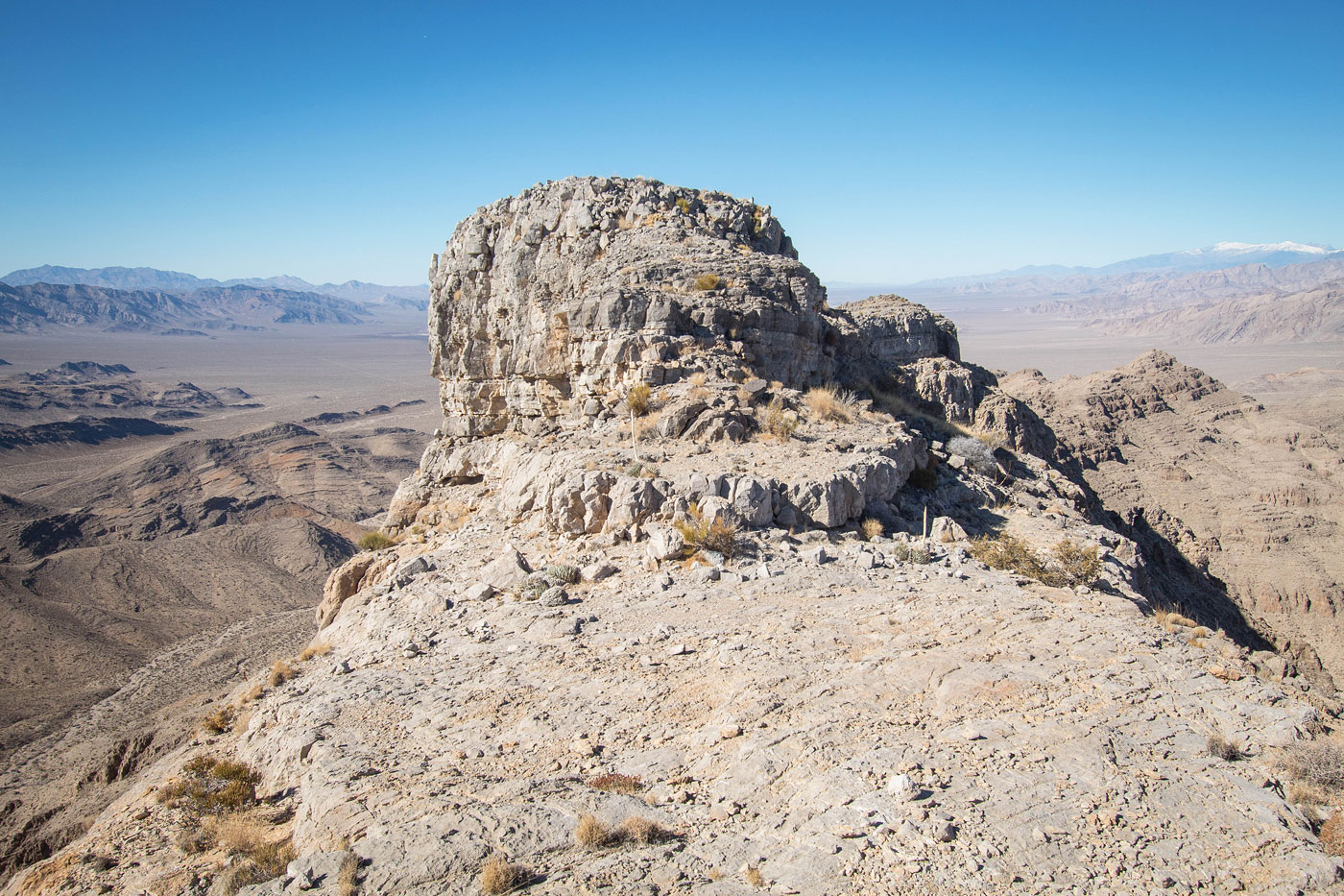
Stateline Wilderness High Point ahead. I took the gully seen center in this photo to reach the summit.
Class 2/3 gully.
Stateline Wilderness High Point summit!
Stateline Wilderness High Point summit, view north. You can see the meandering summit ridge ahead. This is where the crux of the route will be. Possibly avoidable by dropping around the cliffs on the left.
Along the ridgeline.
Class 3 move into a notch.
View back at the notch toward the Class 3 down-climb. It looks more serious than it was.
After a couple more Class 2/3 moves, I reached the end of the summit ridge. First a Class 3 section.
Looking back at the Class 3 section.
Then a Class 3+ downclimb. There might be a less scary-looking option on the left, but I didn't look too hard. This seemed reasonable enough for me.
View back up at the Class 3+ downclimb.
View back at the impressive, fun scramble from the north side of Stateline Wilderness High Point's summit ridge.
Along the ridgeline, some Class 2 and 3 here and there.
A shot back toward Stateline Wilderness High Point, much farther along the ridge.
Peak 4586 visible (though sun-washed) on the right. First is a small obstacle seen on the left. I avoided it by taking an animal trail that wrapped around its east side.
View back toward Stateline Wilderness High Point as I take an animal trail along a ledge around the obstacle.
Final Class 2/3 bit to the saddle shared with Peak 4586.
View back toward the descent to the saddle.
Class 2 up to Peak 4586.
Peak 4586 summit, view toward the traverse from Stateline Wilderness High Point, the peak seen on the left.
Peak 4586 summit, view north.
Heading south off Peak 4586. My car is somewhere in the desert on the left. Primm, CA is visible out there too.
A spur ridge that I chose to take, leading down Class 2/3 to the wash seen below.
I followed the wash and picked up this old road, seen on the left.
Along the old road, view back toward Peak 4586. The ridge I came down is seen center. This old road led to the road I drove in on.
Hire me or show me some love!
Hire/refer me as a web developer or send me a few bucks if you find my site useful. I’m not sponsored, so all fees are out-of-pocket and my time preparing trip reports is unpaid. I really appreciate it!