I provide a free route map, but you can also download a hike/drive GPX to assist you and to help support my site. Before sharing my GPX tracks with others, please remember my site is a free resource and I'm charging nominal fees to offset my substantial costs.
GPX track added to your cart.
Nov 06, 2022 — Tanque Verde Peak, like the other peaks in the Rincon Mountains, requires a long trail walk to reach its summit. After hiking Mica Mountain and Rincon Peak last year, I knew I needed to come back for this third major summit in the range. I chose to approach via the Tanque Verde Ridge Trail, which starts within Saguaro National Park and ascends gradually along the mountain's west ridge. Being close to Tucson means the trail is fairly popular, but aside from a few backpackers, I barely saw anyone after the first few miles.
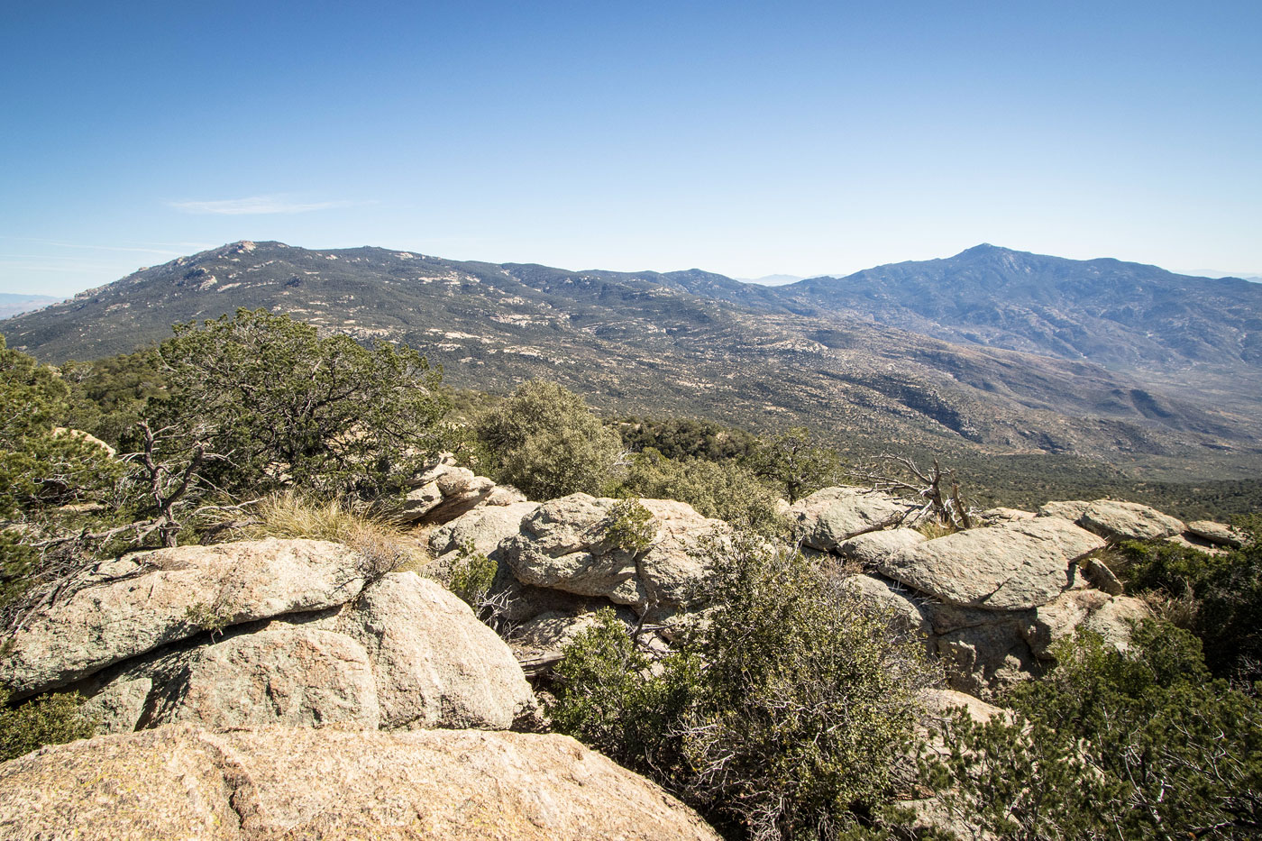
I set out in the desert heat through the cactus-riddled landscape because I can literally never start at even a remotely reasonable hour, the trail initially heading south to gain the start of the ridgeline. After wiggling around various rocky obstacles, the trail gained the ridge and started making vertical progress. Tanque Verde Peak's west ridge is wide enough that the trail rarely had expansive views, but there generally a view in at least one direction. I read the complaints of people who said the trail was overgrown, but it's in mostly excellent shape. It's just not a highway. The trail tended to keep just north of the crest, avoiding excessive steepness and unnecessary bumps when possible. I could see Mount Lemmon in the neighboring Santa Catalina Mountains, along with many other summits in that range.
A few ups and downs that added some extra vertical gain and eventually led to higher elevation where I'd escaped the heat somewhat and could enjoy the more grassy/shrubby terrain. While the hike is really nice, there's not a whole lot to say about it since the trail guides you along the ridge, but it is cool to see the slight shifts in vegetation during the trek's thousands of vertical gain. A bit before reaching the Juniper Basin Campground, the trail became slightly more overgrown and was therefore supplemented by cairns. While I didn't manage to get turned around, it could be easy to do if you're not paying attention. The trail was a little grassy at times, cloaking the occasional thorn bush that managed to draw more blood than it had a right to, but this was a rare occurence and likely only happened because I was actively trying to move quickly.
Slowly, trees started to pop up as I neared the campground, and they persisted for the remainder of the hike. It was definitely very cool to have hiked from below in the desert to this very different landscape. I continued through the forest as rock outcroppings unveiled themselves to the north and then I could spot the summit of Tanque Verde Peak. The trail steepened slightly during parts of the last few miles, but continued to be in excellent shape and was mostly mindless walking. I eventually reached a junction, a sign marking a short spur trail to the summit. I scrambled up a Class 2 section to gain the summit block, where I took in the views for a bit before heading back the same way.
Please consider helping me out if you find my site useful. I'm not sponsored, so all site fees are out-of-pocket and my time preparing these trip reports is unpaid. You can also hire me as a web developer. I really appreciate it!


If you find my site helpful, please help me replace my many broken cameras, fund my website fees (hosting, APIs, security), or just support my countless hours of work. I pay for all expenses myself, and all trip reports I post are unpaid and unsponsored, so any support is really appreciated!
If using PayPal, please select their option for "Sending to a friend" so they don't take out fees, thank you.
My site is free to use, but consider sending me a few bucks to help keep it running. Thanks in advance!