I provide a free route map, but you can also download a hike/drive GPX to assist you and to help support my site. Before sharing my GPX tracks with others, please remember my site is a free resource and I'm charging nominal fees to offset my substantial costs.
GPX track added to your cart.
Jan 15, 2020 — I set out with Austin and Bethany to The Fortress, a surprisingly fun little scramble conveniently located just south of Las Vegas. Rattlesnake Mountain would serve as some additional vertical gain to top out the day.
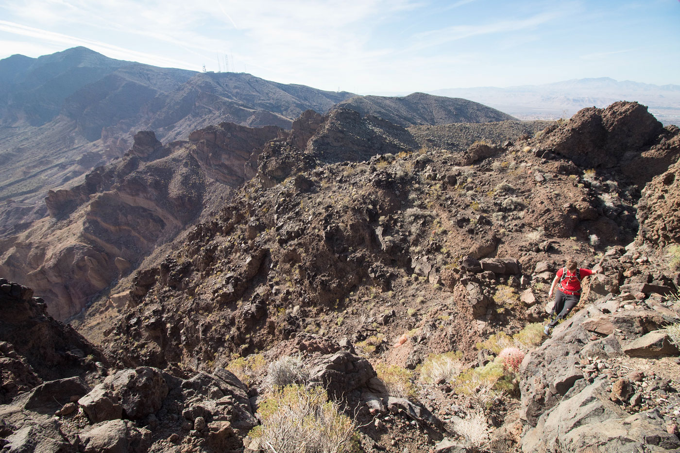
We began at the Anthem East Trailhead. The start of the trail was paved for accessibility, and soon turned to dirt. The long trail section that followed led east and was a bit of a mostly flat slog, the scenery not particularly interesting. Additionally, these trails form a bit of a confusing web, making navigating a little difficult. My general advice would be to stick left of any major hills, though even that might be confusing since the hills all kind of blend together and and nondescript. After a couple of missteps ourselves, which I've fixed on the attached map, we wound up just south of Rattlesnake Mountain. We left the trail and continued south through a wash with no trail. This wash led southeast to the base of The Fortress, where the wash forks. You can take the Class 2 right fork (which we used as our descent, and was just a lot of Class 2 boulder-hopping), or the much more fun and interesting Class 3 left fork (our ascent, slightly less annoying terrain and with some good scrambling moves). A couple of fun moves lead through a narrow section of conglomerate rock and up a steep Class 2 slope. Both route options lead to a small saddle just west of The Fortress, where a headwall that appears really sketchy from below ends up being far less daunting as we started the scramble. A short ramp leads up the steepest section (Class 3). The rock felt quite solid, but there are lots of little boulders and pebbles that make footing dubious. Just above this crux, a couple of zig-zags took us up Class 2+ ledges and onto a wide, steep slope. The slope continued around to the north side of The Fortress, where we were able to access the peak's summit.
Back at the trail system at the base of Rattlesnake Mountain, Austin and Bethany decided to sit out the second peak, and I don't blame them. It's kind of just a desert lump with comparable views to The Fortress. I headed up a heavily eroded road on the southwest side of Rattlesnake Mountain. Once the road ended, I continued north on Class 2 terrain to the ridge and followed the ridge to the summit of Rattlesnake Mountain. On the way down, I just continued along the ridge back to the trail system. Both options for ascending the peak were fine, though I'd say if you're just getting Rattlesnake Mountain, going up and down the west ridge would likely be more pleasant.
Please consider helping me out if you find my site useful. I'm not sponsored, so all site fees are out-of-pocket and my time preparing these trip reports is unpaid. You can also hire me as a web developer. I really appreciate it!


If you find my site helpful, please help me replace my many broken cameras, fund my website fees (hosting, APIs, security), or just support my countless hours of work. I pay for all expenses myself, and all trip reports I post are unpaid and unsponsored, so any support is really appreciated!
If using PayPal, please select their option for "Sending to a friend" so they don't take out fees, thank you.
My site is free to use, but consider sending me a few bucks to help keep it running. Thanks in advance!