I provide a free route map, but you can also download a hike/drive GPX to assist you and to help support my site. Before sharing my GPX tracks with others, please remember my site is a free resource and I'm charging nominal fees to offset my substantial costs.
GPX track added to your cart.
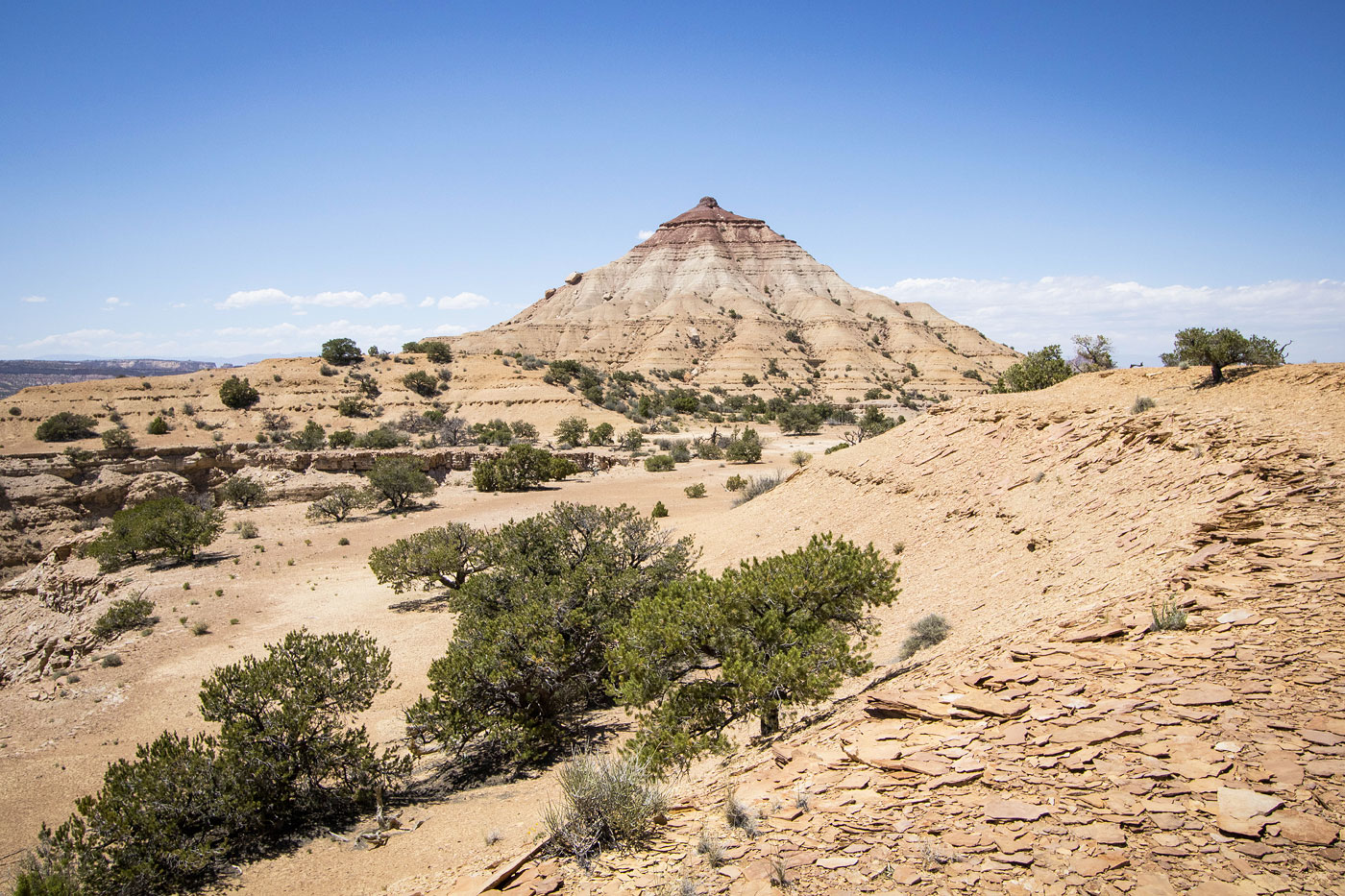
Jun 19, 2023 — After an excellent morning of fun San Rafael Peaks with friends, I set out on my own for one more small summer desert hike, clearly another attempt to overheat my body yet again. The Wikiup and Indian Benchmark are a couple of summits just off Interstate 70 that seemed colorful and interesting enough to check out. Head north here (38.88293, -110.65831) on a road suitable to vehicles with at least some clearance. There are a few rocky sections, but the road is overall very good. I parked where I did because it served as a nice access point for reaching both peaks without having to move my car.
First up was The Wikiup, a colorfully photogenic and conical peak with an eroded south face. It seemed the most pleasant option to reach the summit would be to head toward it from a low, wide hump on its southeast side. After some light navigating through the lumpy desert, I ascended a slope and gained the hump. This ended up being the right choice, since the view toward The Wikiup from here was pretty cool, and I was able to just wander along and take in the scenery rather than potentially struggle up the less-good terrain if approaching more directly from the peak's south.
After a few super minor lumps I was at the base of The Wikiup, which appeared far more eroded and steep from here. The ground is soft and a social trail is forming enough that it might be visible from farther away, so do your best not to kick too much dirt off to prevent erosion. I found myself crawling up the narrowing slope at one point, and one of the rock layers forced a Class 2+ move on sandy rock. A weakness to overcome a small lip pushed into the Class 3 realm. Above the lip, the summit perch was visible ahead, one more Class 2+ move required to overcome a loose obstacle.
I backtracked to my car and then headed south through a wash toward Indian Benchmark toward a toe on the northern side of the peak. I encountered a little bit of Class 2 higher up along this slope. I continued south along the flat mesatop, the high point seen ahead. There was a ton of cryptobiotic soil along this portion, most of which I could avoid by keeping close to the east rim, where I picked up a minor wash that took me to the base of a final Class 2 slope. I ascended this final hundred feet and continued on flat ground to the high point.
Please consider helping me out if you find my site useful. I'm not sponsored, so all site fees are out-of-pocket and my time preparing these trip reports is unpaid. You can also hire me as a web developer. I really appreciate it!


If you find my site helpful, please help me replace my many broken cameras, fund my website fees (hosting, APIs, security), or just support my countless hours of work. I pay for all expenses myself, and all trip reports I post are unpaid and unsponsored, so any support is really appreciated!
If using PayPal, please select their option for "Sending to a friend" so they don't take out fees, thank you.
My site is free to use, but consider sending me a few bucks to help keep it running. Thanks in advance!