I provide a free route map, but you can also download a hike/drive GPX to assist you and to help support my site. Before sharing my GPX tracks with others, please remember my site is a free resource and I'm charging nominal fees to offset my substantial costs.
GPX track added to your cart.
Dec 03, 2023 — Thumb Peak is a volcanic plug with an excellent scramble located on the west side of the Palo Verde Mountains. To reach the trailhead, drive south on Wiley's Well Road (33.60654, -114.90171) until reaching the pull-out where we started. An old mining road leads east into the Palo Verde Mountains Wilderness. Thumb Peak isn't in view at the start of the approach, blocked by a large lump. Tyler and I hiked along this road, which ultimately led in the wrong direction. Once it bent away, we changed course and followed a social trail east through uninspiring desert. The area is riddled with social trails, but we managed to choose the same one on the way in and out. Losing the trail is no big deal since the terrain is overall pretty trivial. We crossed in and out of a few minor drainages, and eventually, Thumb Peak came into view.
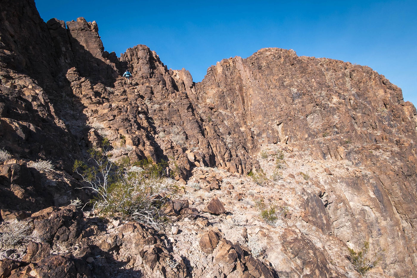
This gorgeous monolith rising from the desert floor seems daunting from below. However, as we approached its north side, we located the steep slope/gully covered with large boulders used for the standard route. Class 2 led us to the top of the slope, where we descended briefly as we traversed around the base of Thumb Peak's substantial cliff to a weakness found along a small, jagged spine on the peak's south side. A Class 3 move brought us over this feature and onto a loose Class 2 ramp, leading steeply up toward the steeper cliffs above. A pleasant set of Class 3 moves took us up a weakness and onto a flatter ledge, where the summit came into view. Tyler stuck to this ledge initially but found it led nowhere. Instead, steppy blocks led away from the ledge and up to the south ridge of Thumb Peak, which appeared to be just a headwall from below.
Cresting the south ridge, we were met with some exposure. A knife-edge weaved to the summit just ahead, but while mostly solid, we'd be sticking to the left of it on less treacherous ground. Moving carefully, we hugged the crest and pulled a Class 3 move just below the final fun scrambling to the summit.
Please consider helping me out if you find my site useful. I'm not sponsored, so all site fees are out-of-pocket and my time preparing these trip reports is unpaid. You can also hire me as a web developer. I really appreciate it!


If you find my site helpful, please help me replace my many broken cameras, fund my website fees (hosting, APIs, security), or just support my countless hours of work. I pay for all expenses myself, and all trip reports I post are unpaid and unsponsored, so any support is really appreciated!
If using PayPal, please select their option for "Sending to a friend" so they don't take out fees, thank you.
My site is free to use, but consider sending me a few bucks to help keep it running. Thanks in advance!