I provide a free route map, but you can also download a hike/drive GPX to assist you and to help support my site. Before sharing my GPX tracks with others, please remember my site is a free resource and I'm charging nominal fees to offset my substantial costs.
GPX track added to your cart.
Apr 03, 2024 — The Tumacacori Mountains are named for an old Spanish mission that has its National Historic Park, but as usual, I was more interested in the unnamed high point of the range rather than the human history. You'll probably want at least some clearance to reach the trailhead, a Crossover SUV being sufficient. In order to drive past where I parked, you'll want an ATV since it's in such disrepair. However, the road walk is actually quite beautiful to hike along, so I definitely didn't mind. The hills to the left were lush with spring greenery. The bright yellow cliffs to my right lined the eastern face of the range, creating serious bands that seem unlikely to provide a fun route. Although tempting since the high point was basically directly above me, I chose to hike the road and gain elevation more slowly. Others have reported a more direct route requiring lots of bad bushwhacking.
I made my way along the road, my goal being to gain the southern ridge of the range. After a bit under two miles, the road ascended more steeply and then started to curve away from the ridge, so I left it and ascended a wide and steep gully to gain the ridge crest. The brush was low and not too much of a problem, the worst of it being at the start. There's a faint, steep social trail up this gully if you can manage to stay on it.
I gained the ridge crest and started north, the views opening up dramatically. The ridgeline actually had a faint trail, which oddly only became better as I progressed, often feeling like a real trail. There were discarded gallon jugs of water and various articles of clothing along the way. To date, I've never seen any undocumented migrants despite my many hikes near the Mexican border, but I thought if it were ever going to happen this would be the day.
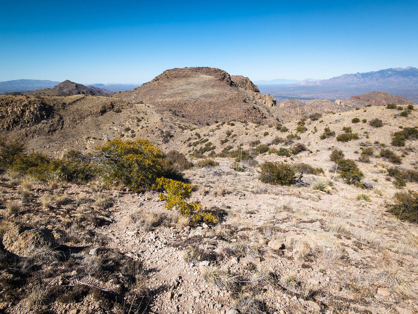
The ridgeline was a bit lumpy, but the trail made progress quick. I gained the minor bump of Tumac Benchmark, which had a great view toward the sloped high point ahead, before dropping down to its saddle with the high point. The last few hundred feet to the summit didn't have a trail, but the grasses were mostly non-prickly and the slope grade was tame. I was very surprised at how beautiful this range was, the cliffy faces very colorful and sort of embodied much of what southern Arizona's landscape has to offer. I was thrilled I had chosen to do this hike today, despite the range seeming quite unassuming from I-19 below. Since the ridgeline required basically no bushwhacking and the lumps along it had been relatively insignificant, I decided to enjoy the views and head back the way I came rather than attempt to find a direct route back down to the car.
Please consider helping me out if you find my site useful. I'm not sponsored, so all site fees are out-of-pocket and my time preparing these trip reports is unpaid. You can also hire me as a web developer. I really appreciate it!


If you find my site helpful, please help me replace my many broken cameras, fund my website fees (hosting, APIs, security), or just support my countless hours of work. I pay for all expenses myself, and all trip reports I post are unpaid and unsponsored, so any support is really appreciated!
If using PayPal, please select their option for "Sending to a friend" so they don't take out fees, thank you.
My site is free to use, but consider sending me a few bucks to help keep it running. Thanks in advance!