

From the end of Old Kingman Highway, we headed toward Union Benchmark, seen here.
Crossing the highway to ascend the slope leading to Union Benchmark.
Steep slope with some side-hilling.
View back as we make our way up Union Benchmark. You can see Sugarloaf Peak top center, and the road we hiked along just above Matt.
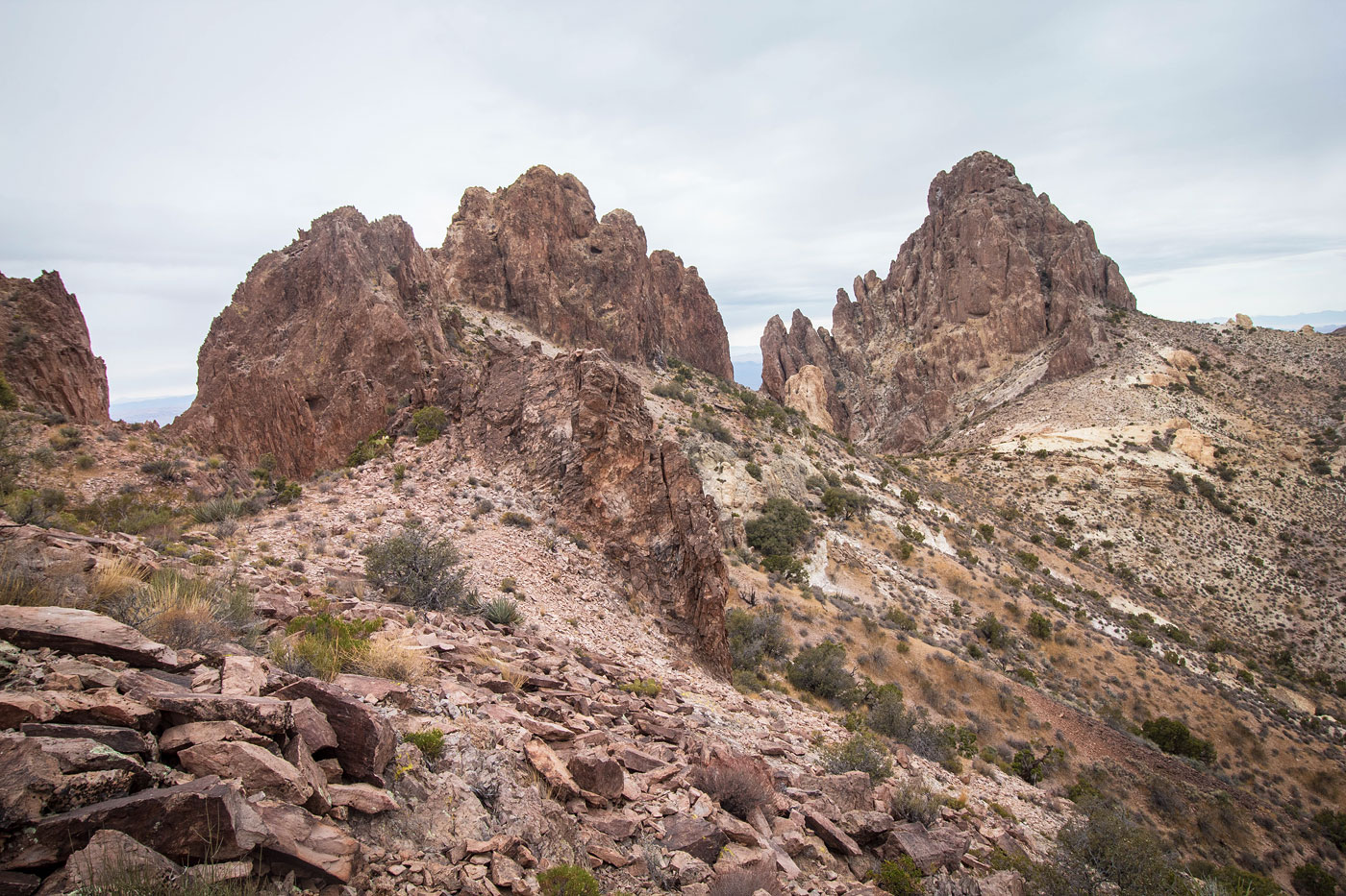
Union Benchmark visible ahead. Keeping to the right of the crest results in a Class 3 summit block move. Alternatively, you can pop over the notch in the center of this photo and ascend via Class 2.
Ascending to Union Benchmark.
Class 3 optional summit block move.
Union Benchmark summit, view toward Mount Nutt and the surrounding peaks.
Union Benchmark, view toward Pyroclastic Peak.
We dropped down and avoided the cliffs on Union Benchmark's north ridge, making our way to Pyroclastic Peak ahead.
View back toward Union Benchmark.
Pyroclastic Peak's daunting summit ahead. We wrapped around on its right.
Wrapping around the summit of Pyroclastic Peak.
Class 4 crack.
Matt on the crux.
Pyroclastic Peak, view toward Union Benchmark.
We came off Pyroclastic Peak and started down back to the highway. Our aim is to get to the right of Sugarloaf Peak, seen center.
View back up as we descend from Pyroclastic Peak.
After crossing the highway, we located a hole in the fence. From here we ascended on the lumpy hills before dropping into a drainage on the left.
Within the drainage.
Sugarloaf Peak ahead. First we headed to the left to get to Peak 4340.
Class 2/3 slope to Peak 4340.
View back toward Pyroclastic Peak as we ascend to Peak 4340.
Talus/scree.
Reaching the ridgeline of Peak 4340. The ridge crest was jagged and scary.
We dropped 50 feet along the cliff's base, ascending again when possible.
Class 4 move on solid rock.
View back at Matt on the Class 4 move to gain Peak 4340. You can see the scary jagged ridge crest in the center, which we avoided.
Close-up of the crux.
Peak 4340, view toward Union Benchmark (right) and Pyroclastic Peak (left).
Shot toward Sugarloaf Peak, our next goal.
We traversed along the base of the jagged crest on our way to Sugarloaf Peak's south side.
Looking back toward Peak 4340's jagged ridge crest.
We reached the southern side of Sugarloaf Peak (left) and wrapped around to the peak's west side.
View back toward the ridge crest leading from Peak 4340 (top left).
Heading up the west side of Sugarloaf Peak. Here you can see the craziness of the peak's fortified face.
Looking back as we ascend to the gully.
Gully to ascend.
Class 2 within the gully.
At the top of the gully, head up this crack in a boulder. You can see the head of the gully behind Matt.
Class 3 just above the crack.
A lightly sloping grass gully, which we followed to its head.
Class 2/3 at the head of the gully.
A prominent juniper. Matt is seen in the center scrambling on Class 3 hollow-feeling rock. There's a grotto-like feature above him, and a Class 3 move above him on the right.
View back at the Class 3 hollow-feeling rock. Prominent juniper visible center.
Above the grotto-like feature, we emerged on a grassy bench. It will be tempting to follow the lightly-colored rock on the left, but don't. Head for the grassy chute in the center of this photo, beneath the overhanging rock.
Class 3 beneath the overhanging rock.
Matt coming up the Class 3 under the overhanging rock.
Just after the overhanging rock, here was a Class 3+ pull move.
Summit of Sugarloaf Peak.
Sugarloaf Peak, view toward Union Benchmark and Pyroclastic Peak. Mount Nutt visible top right.
Back at the base of Sugarloaf Peak, we followed the prominent drainage in the center back to our cars.
Hire me or show me some love!
Hire/refer me as a web developer or send me a few bucks if you find my site useful. I’m not sponsored, so all fees are out-of-pocket and my time preparing trip reports is unpaid. I really appreciate it!