

Wabayuma Peak Trailhead.
You can see the rocky southeast slope (false summit) of Wabayuma Peak ahead. The trail heads along the ridgeline.
Progress along the ridgeline.
View back. You can see the road I came in on (right).
After a pretty gradual ascent, the trail descends a bit.
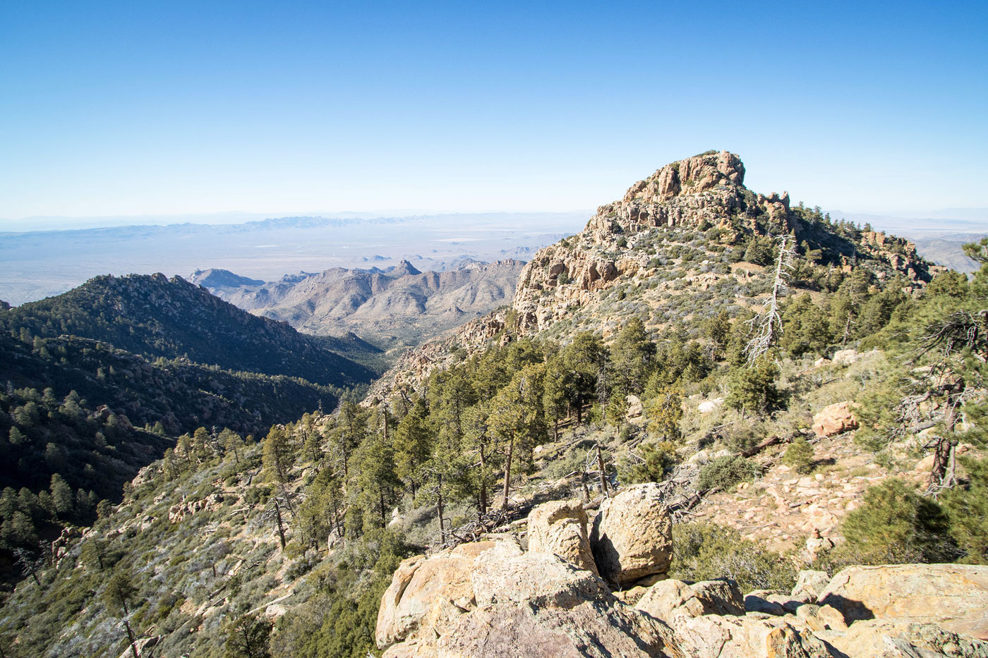
False summit seen ahead. The trail wraps around the lump seen center.
Wrapping around a lump.
Approaching the base of the false summit, where the road sort of ends. The trail continues up the slope in the center, switchbacking around the little gully in the center of this photo.
I left the road-trail and started up this overgrown trail.
View back.
Ascending the trail as it heads up the slope on Wabayuma Peak's southeast side.
View back at the ridgeline I came along earlier.
The chapparal makes way for some pines.
View back just before reaching the false summit.
A second false summit seen ahead.
View back the way I came as I avoid the second false summit.
View back, Copper World Peak seen right of center. I wanted to hike to that one today as well, but it would probably be a hell of a bushwhack.
A nice view of Wabayuma Peak. I recommend dropping into the trees below rather than side-hilling.
Close-up of Wabayuma Peak.
Ascending to the peak's southeastern saddle.
Class 2 and some brush initially.
View back. I came from the rocky outcrop just left of center in this photo.
After some Class 2, a flatter section before the summit block.
Class 3 ahead.
Class 3 option leads left of the brush.
View back down at the Class 3.
Wabayuma Peak, view back the way I came (south). The Class 3 section is seen on the right.
Class 3 section from another angle. The summit is just behind me.
Wabayuma Peak summit block (Class 2).
Wabayuma Peak, view toward Hualapai Peak.
Hire me or show me some love!
Hire/refer me as a web developer or send me a few bucks if you find my site useful. I’m not sponsored, so all fees are out-of-pocket and my time preparing trip reports is unpaid. I really appreciate it!