I provide a free route map, but you can also download a hike/drive GPX to assist you and to help support my site. Before sharing my GPX tracks with others, please remember my site is a free resource and I'm charging nominal fees to offset my substantial costs.
GPX track added to your cart.
Aug 25, 2021 — West Elk Peak is a prominent 13er separated from all of its 13er friends, positioned atop the West Elk Mountains. The summit is reached either via the Mill Castle Trail coming in from the east, or more commonly via this route from the south. I chose this route because it spends more time along the ridgeline rather than in a canyon, maximizing views and adding on a few little peaks to the day. I parked at the Rainbow Lake Trailhead, situated a half mile or so north of the actual lake. Any car can make it to the trailhead.
I started along the Rainbow Lake Trail, which led through the forest before emerging into a meadow and reaching a junction with the Beaver Creek Trail. I took a right onto this trail and ascended to the south ridge of South Baldy Mountain. I located a decent social trail which brought me along the meadowy ridge with some very minor brush around the halfway point and made it to the summit of South Baldy Mountain. I headed along its tundra-filled northeast slope and met back up with the Beaver Creek Trail, though only for a split second. Instead of taking the Beaver Creek Trail I ascended the south side of Middle Baldy in order to reach the ridgeline I'd be following for the duration of the hike. The base of this peak is unpleasant due to some bushwhacking and then Class 2 small talus, but afterward the route became nice tundra. A false summit a half mile or so before Middle Baldy tricked me into thinking I made it, but the short section of ridge from this false summit to Middle Baldy might be my favorite part of the ridgeline. A social trail led along a narrow section of tundra-filled trail lined with cool hoodoo formations, and the views in all directions were really stunning.
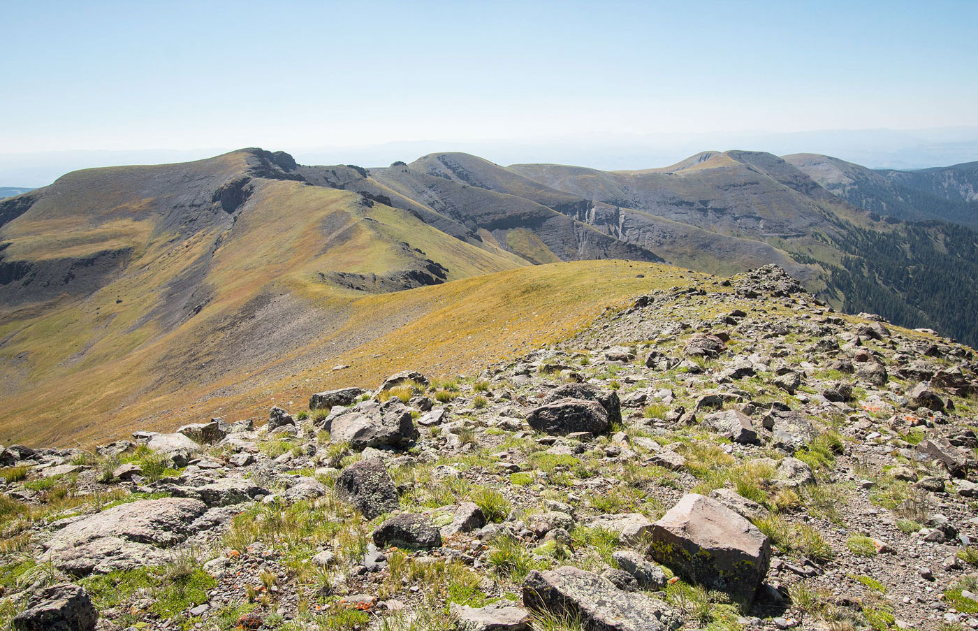
The tundra slope from Middle Baldy all the way to North Baldy Mountain and then down the north side of North Baldy was gorgeous and easy tundra strolling, though otherwise unremarkable. Once at the northern saddle of North Baldy Mountain, the character of the hike would change for a short time. A social trail led past a bunch of cool rock hoodoos on the side of the ridge, then kept to the left of a couple of pesky rock outcroppings situated along the ridge crest. Soon I made it to the base of an intimidating-looking buttress that protected Nutter Butter Peak, the next peak along the ridgeline. Rather than attempt this insane cliff directly, head to the left around it, keeping to the base of the rotting cliff. The route becomes Class 2 at this point due to the steep and somewhat loose side-hilling. Keep an eye out for a gully on the right. It should be visible shortly after starting around the cliff base, and will be the only viable-looking option to get to higher ground. This gully went at low Class 3, the only remotely technical section on the entire hike. The move consisted of a couple of quick ledges followed by a short Class 2+ rocky gully leading to the ridgeline above.
Now on Nutter Butter Peak's summit, I took in the unobstructed view of The Castles, a totally out-of-place and striking feature of eroded pinnacles to the north. I then scoped the route to West Elk Peak, nothing more than another pleasant tundra stroll. I dropped the few hundred vertical feet from Nutter Butter Peak and asccended to West Elk Peak.
I feel the need to warn you that there seems to be a pretty extensive trail system on some maps on the east side of the ridgeline I took, and you might be tempted to use it rather than just go back along the ridge. However, the trail system is basically nonexistent and it's definitely most efficient to just backtrack. Instead head back along the ridge and take the Beaver Creek Trail, which wraps around South Baldy Mountain's east side rather than require you to re-ascend that peak.
Please consider helping me out if you find my site useful. I'm not sponsored, so all site fees are out-of-pocket and my time preparing these trip reports is unpaid. You can also hire me as a web developer. I really appreciate it!


If you find my site helpful, please help me replace my many broken cameras, fund my website fees (hosting, APIs, security), or just support my countless hours of work. I pay for all expenses myself, and all trip reports I post are unpaid and unsponsored, so any support is really appreciated!
If using PayPal, please select their option for "Sending to a friend" so they don't take out fees, thank you.
My site is free to use, but consider sending me a few bucks to help keep it running. Thanks in advance!