Dec 07, 2019 — I met up with local peakbaggers Eric, Anji, and Kevin for a remote Lake Mead peak, White Basin Overlook. They're a great group and I was happy to meet some locals and tag along for an obscure peak. Eric drove us to the trailhead, which included a bumpy drive on the absolutely awful Bitter Springs Trail Backcountry Byway from the north, only passable by the best vehicles. I certainly would have been shut down with my car. Apparently the road is a bit better if coming from the south, but I don't know. I was also happy to be able to check out the Buffington Pockets as we drove in, which included beautiful sandstone similar to or Bowl of Fire.
I should mention that our ascent route was quite fun, but definitely made this peak much more difficult than it had to be. Our descent was only Class 2, but significantly less interesting. I have rated this hike based on the more fun option, because despite my recent excitement to hike all the peaks, I still get more into fun route-finding than just bagging peaks. Anyway, keep in mind that the southwest side of the loop on the attached map is a good alternative to get the peak (Class 2), while the northeast half of the loop is Class 3/4.
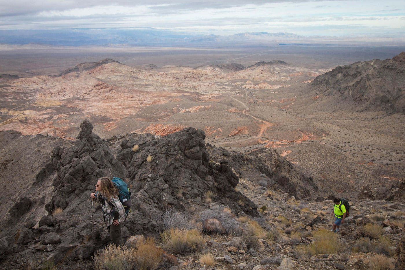
We parked off the side of the road and chose a route, a not so super obvious ridge/slope feature that headed south. White Basin Overlook was well out of view, but there was a rock outcropping above that looked like it could cause some difficulty. As we continued on the fun Class 2 ridge, we noted a potential weakness on the right side and went for it. A Class 3 chute on dubious rock led to the first false summit, where we could see the grassy, pleasant ridgeline leading to White Basin Overlook. We followed the ridge and then split up at the base of the peak, where a cliff blocked easy access. Kevin and I spotted a potential route that ended up being some really enjoyable Class 4 on solid rock, which popped us right to the summit. Anji and Eric continued farther south and located a slope that brought them to the summit, which we later used partially as our descent route.
After some time on the White Basin Overlook summit admiring the nearby Lake Mead peaks, clouds seemed to be rolling in and we headed down on the west side, realizing the Backcountry Byway was just to the west, an easy Class 2 descent away. Like I mentioned before, this was a much easier option, but loses out on a lot of the best stuff we experienced on the ascent.
Please consider helping me out if you find my site useful. I'm not sponsored, so all site fees are out-of-pocket and my time preparing these trip reports is unpaid. You can also hire me as a web developer. I really appreciate it!


If you find my site helpful, please help me replace my many broken cameras, fund my website fees (hosting, APIs, security), or just support my countless hours of work. I pay for all expenses myself, and all trip reports I post are unpaid and unsponsored, so any support is really appreciated!
If using PayPal, please select their option for "Sending to a friend" so they don't take out fees, thank you.
My site is free to use, but consider sending me a few bucks to help keep it running. Thanks in advance!