

We followed the Lava Flow Trail until it meets up with the Whiterocks Trail.
Along the Whiterocks Trail.
View back into the park.
Ascending along the Whiterocks Trail.
Heading into the Whiterocks Amphitheater.
Whiterocks Amphitheater. End of the official trail. We headed up to the false summit seen top right.
Scrambling out of the amphitheater.
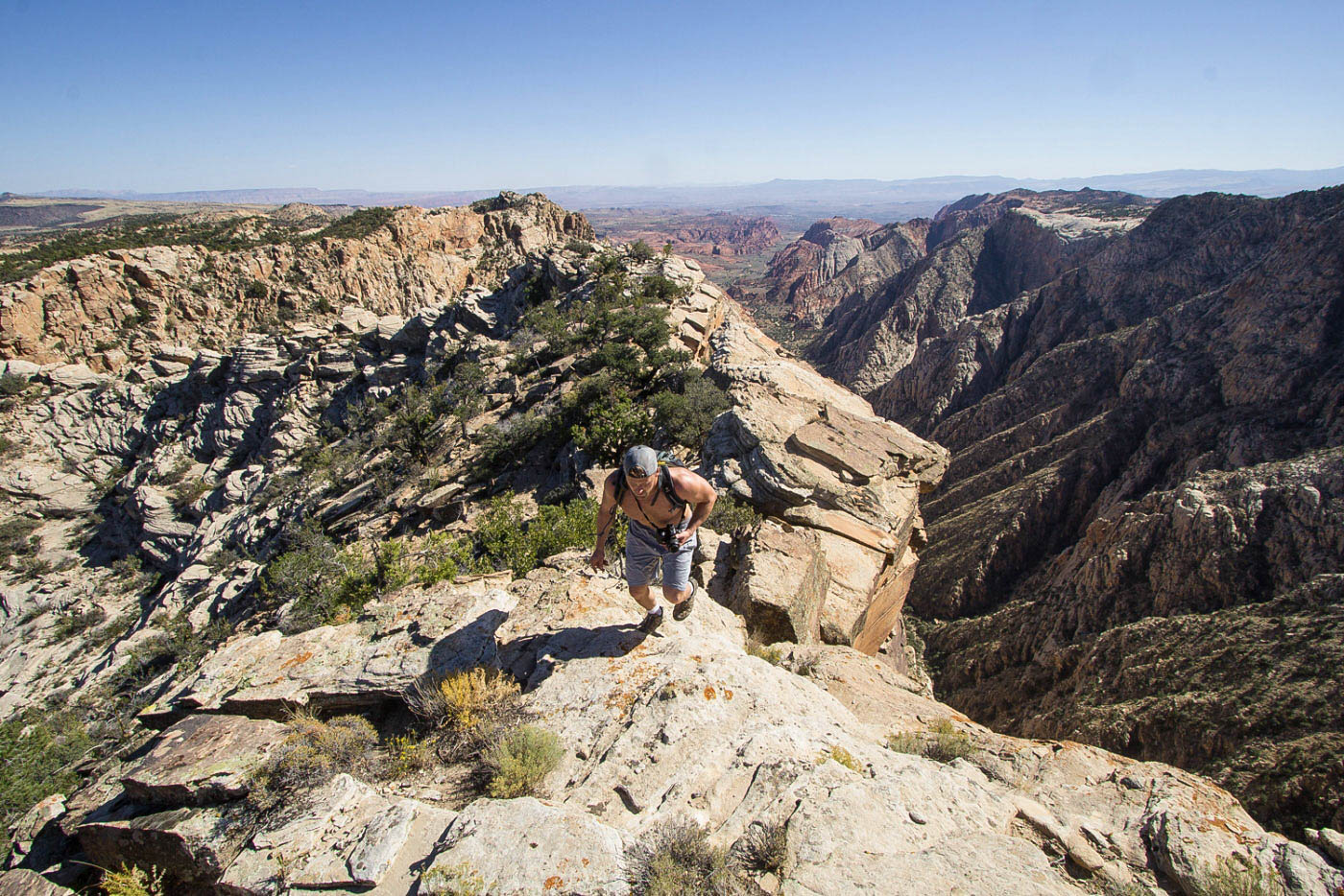
View back into Whiterocks Amphitheater after scrambling out, on our way up to White Rock Peak.
Class 2/3 scrambling up the slope.
Navigating ledges and slopes.
At the ridge, White Rock Peak seen ahead.
Cool formations along the ridge to White Rock Peak.
White Rock Peak summit looking back the way we came.
Continuing along the ridge to Peak 5024.
Amazing views along the rim.
Looking back toward White Rock Peak.
Pretty slickrock along the way to Peak 5024.
Summit of Peak 5024, White Rock Peak behind Mike.
Summit of Peak 5024, looking toward the long rim trek ahead.
Unnecessary knife-edge next to a really cool chasm.
Gorgeous chasm, view down into Snow Canyon.
Mike looking into the hundreds of sheer feet below.
Onward north.
More gorgeous rim views.
We came upon a horse trail that helped navigate through the brushy terrain.
Overlook of the east fork of Snow Canyon. You'd miss this view if you take the Red Mountain Trail.
Light bushwhacking from the head of the east fork to the head of the west fork.
At the head of the west fork.
Unnecessary scrambling, but added some great views.
Continuing along the rim toward Snow Benchmark.
We reached the Red Mountain Trail and followed it for a short time. Snow Benchmark ahead. We left the trail to reach the summit.
Snow Benchmark summit, Snow Canyon in the distance.
Heading back down toward the west rim of Snow Canyon. We left the Red Mountain Trail to enjoy the slickrock wonderland.
Incredible slickrock.
View back, Snow Benchmark above Amanda.
Headed out to the point seen ahead.
Why not a cartwheel?
View back as we ascend to the point. Snow Benchmark seen top center.
Nice overlook.
A neat puddle on the way south.
The slickrock faded away. We navigated south through lumpy terrain.
And then we stumbled on more beautiful slickrock along the rim.
View back, Snow Benchmark seen distant left.
We stayed pretty close to the rim, then wrapped to the right around the hump seen center.
Another shot back toward the rim and Snow Benchmark.
Wider shot of Snow Canyon.
That minor lump on the right has a ridge descending east, our exit route (Class 2/3).
Looking back after we descended into the bowl.
Navigating a small slickrock bowl. Our aim is the left side of the lump ahead.
A tricky wall obstacles we worked around.
Short scramble ascent to gain the descent ridge.
Gaining the ridge and enjoying the sunset.
Heading down Class 2/3 ridge.
View of the full ridge. The sand on the right is the Red Sands Trail, which follows that wash and takes you back to the road.
Close-up of the gorgeous ridge.
This is the photo I was taking when I stepped on a human-sized boulder that started rolling and almost squashed me.
Approaching the base of the ridge.
Following the Red Sands Trail.
Looking back toward the Red Sands Trail from the Petrified Dunes Trail. Take this back to the road, and follow the road to the car.
Along the Petrified Dunes Trail to get back to the car.
Hire me or show me some love!
Hire/refer me as a web developer or send me a few bucks if you find my site useful. I’m not sponsored, so all fees are out-of-pocket and my time preparing trip reports is unpaid. I really appreciate it!