

Dropping north into the Wilbur Canyon drainage.
Entering Wilbur Canyon.
One of many obstacles within the drainage, though rappelling is not necessary. You can avoid a few of the obstacles if you follow the rim for a bit before dropping in, but where's the fun in that?
Some minor potholes.
A log/pool obstacle that had all of us giggling.
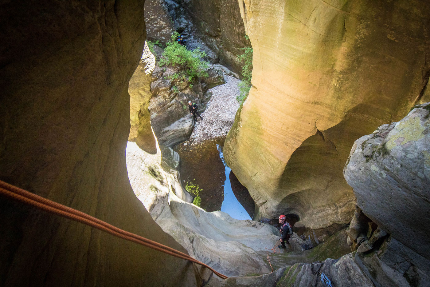
First rappel.
Bottom of the first rappel.
Looking back up at the first rappel.
Second rappel, two stage.
Second part of the second rappel.
Third rappel, which we hand-lined to reach a log roll below. The fourth rappel starts directly after the log, where Shawn is in the center.
Fourth rappel.
Another shot of the fourth rappel.
Down climb obstacle in a narrower section of Wilbur Canyon.
Looking back at the down climb obstacle.
More fun obstacles.
Looking back into the tighter section as we near West Clear Creek.
Final rappel into West Clear Creek.
Looking back at the final rappel.
West Clear Creek, view back toward Wilbur Canyon (left).
Continuing down West Clear Creek.
Looking back.
We used this gully as the escape from West Clear Creek.
It's very steep and loose, and we encountered two rattlesnakes. Keep your helmets on and watch out.
Looking back down one of the steeper sections.
Nearing the top of the escape gully. There was a decent social trail the whole way up.
Looking back as we work our way out of the gully and along the short ascent back to the car. The social trail disappeared at this point.
Hire me or show me some love!
Hire/refer me as a web developer or send me a few bucks if you find my site useful. I’m not sponsored, so all fees are out-of-pocket and my time preparing trip reports is unpaid. I really appreciate it!