Mar 09, 2019 — I decided to head down to join Adam Walker and some of his friends in AZ, all of whom are accomplished climbers. Woolsey Peak required a long dirt road drive with a couple of tough spots until a point where the road was too poor for any of our cars. High clearance is needed, and only burlier vehicles can get as far as we did, so expect to add a few miles of walking depending on how far you can make it on the poor road. To reach our starting point, turn southwest here (33.25868219, -112.81207006) and continue south/southwest, ensuring you're on this road (33.2382529, -112.8261058) as you continue. Keep right at this split (33.20486375, -112.85257411) and keep on this road until you can't stand the block volcanic rocks anymore. We strolled along the deteriorating road toward the base of Woolsey Peak, then headed cross-country to get to its northern base.
Update from November 2021 regarding a trailhead: although this won't be reflected in my attached map, we found an alternative road into the area that is much better a couple of years later. This will require a little bit more cross-desert walking, but I think it would ultimately work better for reaching Woolsey Peak. To reach this alternate trailhead here (33.1922958, -112.916359), navigate here (33.25495, -112.88906) and continue southwest on Agua Caliente Road, which becomes Woolsey Wash Road. It's overall a decent road and a Crossover vehicle can make it to the trailhead. The terrain along the route to gain Woolsey Peak's base would likely be pretty similar to the trip report described below.
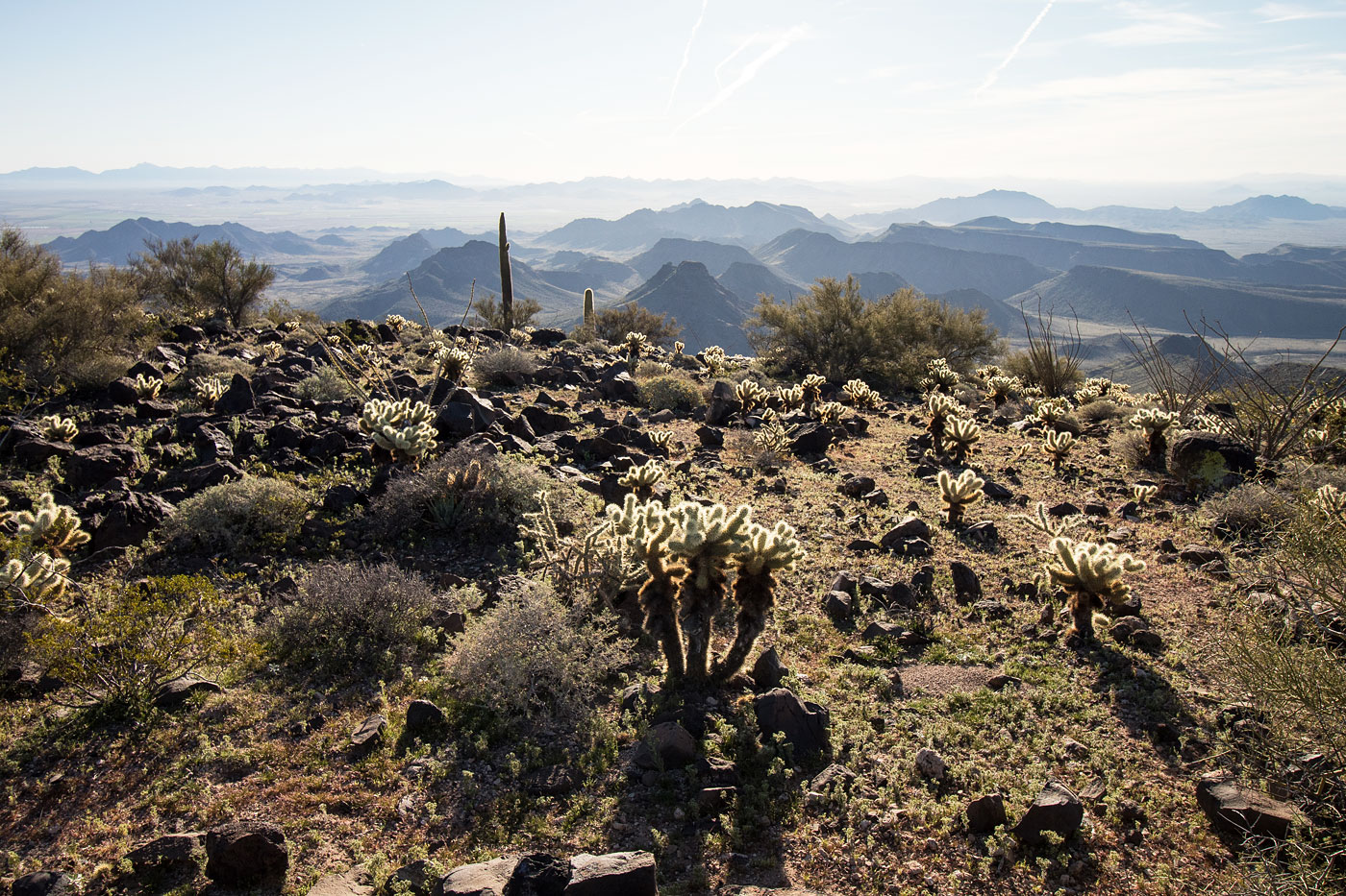
Once at the base of Woolsey Peak's northwest slopes, we noted two breaks in the major cliff band that surrounded the peak. Both had a fan of boulders and rubble that would create reasonable ascent options, but the one farther to the right was what we went with. This big volcanic slope with ample Class 2 boulder-hopping and some cactus obstacles led to the summit without too much fanfare. Woolsey Peak is a fairly boring desert bump, but the views looking southeast toward distant mesas from the summit were really nice. There were two peaks - one had a register, the other had two registers (??).
Please consider helping me out if you find my site useful. I'm not sponsored, so all site fees are out-of-pocket and my time preparing these trip reports is unpaid. You can also hire me as a web developer. I really appreciate it!


If you find my site helpful, please help me replace my many broken cameras, fund my website fees (hosting, APIs, security), or just support my countless hours of work. I pay for all expenses myself, and all trip reports I post are unpaid and unsponsored, so any support is really appreciated!
If using PayPal, please select their option for "Sending to a friend" so they don't take out fees, thank you.
My site is free to use, but consider sending me a few bucks to help keep it running. Thanks in advance!