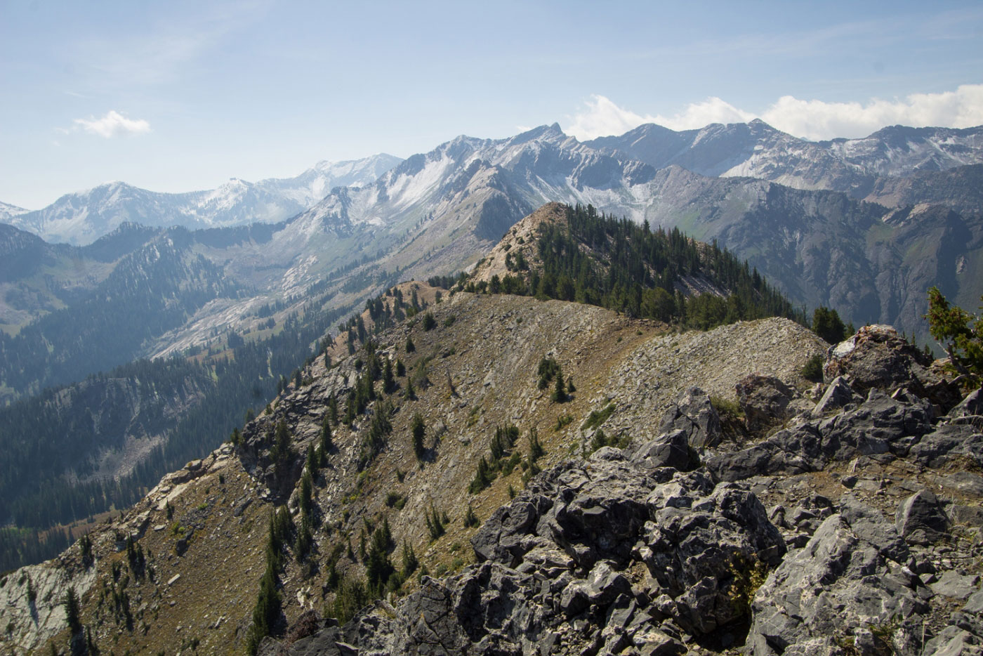
Sep 16, 2017 — This was supposed to be a super epic traverse of Cardiac Ridge, but I fell a bit short... very short. It was still a great hike over the easier part of Cardiac Ridge, though my ego was hurt a bit. I even scouted the area yesterday to see how the ridge looked from the summit of Mt. Superior. Oh well.
Park at the Donut Falls lot and shortly after you cross the creek over a bridge, you will get to a sign pointing toward Donut Falls, and there is a small use trail behind the sign. Take this trail and you will end up on a gravel road. Take this for a few hundred feet and you'll see a small use trail on the right. This is the Kessler Peak Trail. Follow the trail to the summit and take in the views of Cardiac Ridge. I was super psyched at this point. The ridge looked fantastic and totally reasonable. A short Class 2+/3 scramble takes you down the south side of Kessler Peak and onto the ridge. There is nothing past Class 2 after this until you reach a Class 4/5 knife edge. It's absolutely stunning, but extremely intimidating. I started on this ridge, Cardiac Ridge, but turned around very quickly when I realized a massive drop along the knife edge blocked my way. Maybe I could have downclimbed? A quick Google search let me know that later, the ridge becomes solid Class 5, and so, the rational part of my brain realized continuing would only have me turn around anyway, and so I didn't complete the ridge to Mt. Superior. Bummer. I backtracked until I found a nice gully to head into the Cardiff Fork Bowl and soon came upon a dirt road, which I followed back to my car. The dirt road gives some pretty scenery, but the entire area is Private Property, and big red signs constantly remind you.
If you're feeling it, definitely head over Cardiac Ridge and hit Mt. Superior and Monte Cristo, then shoot through the basin back to the Mill D Fork Trail. I'm sure it would have been really incredible. Maybe I'll try one day if I have climbing gear.
On the way back I stopped by the absurdly popular Donut Falls. I included some photos at the end of this trip report.
Please consider helping me out if you find my site useful. I'm not sponsored, so all site fees are out-of-pocket and my time preparing these trip reports is unpaid. You can also hire me as a web developer. I really appreciate it!


If you find my site helpful, please help me replace my many broken cameras, fund my website fees (hosting, APIs, security), or just support my countless hours of work. I pay for all expenses myself, and all trip reports I post are unpaid and unsponsored, so any support is really appreciated!
If using PayPal, please select their option for "Sending to a friend" so they don't take out fees, thank you.
My site is free to use, but consider sending me a few bucks to help keep it running. Thanks in advance!