I provide a free route map, but you can also download a hike/drive GPX to assist you and to help support my site. Before sharing my GPX tracks with others, please remember my site is a free resource and I'm charging nominal fees to offset my substantial costs.
GPX track added to your cart.
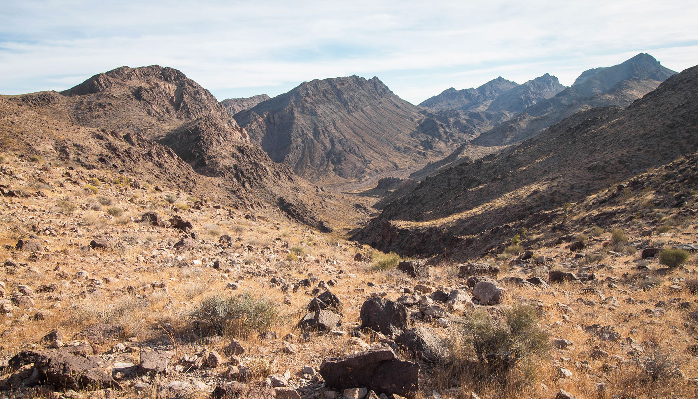
Jan 03, 2021 — There is an Eldorado Wilderness in Lake Mead National Recreation Area, but this hike is within the northern end of the BLM-managed Eldorado Wilderness, just next door. I wanted to approach the area from a different direction rather than from the standard trailhead for the Eldorado Wilderness, so I took my car along a decent dirt road leading to the northern end of the region. Mid-clearance required, and the sand gets a little deep sometimes, so 4WD recommended.
I started south through a wash and headed first to Peak 3400, a straightforward Class 2 slope on boulders. It might be a little easier to approach this peak by following the wash to its head and heading east to the summit, but I liked being on the ridgeline for longer. I used this recommended ascent route as my descent. The views toward the Eldorado Wilderness from up here were really wonderful. I then dropped down to the head of what seems to be labeled Oak Creek Canyon (Class 2) and followed it down to its mouth. It was rocky, but nothing exceeding Class 2. I headed east within Lonesome Wash in order to wrap around the north end of Peak 3510, and then continued wrapping around its base until I was within the drainage between Peak 3510 and Peak 3320. I continued to the saddle between these two peaks, first heading to Peak 3320. Heading directly to it would result in Class 3, but I did a light ascending traverse below the rumbly-looking cliffs up to the ridgeline and kept it Class 2. Once on the ridge I headed south to the summit, where there were more lovely views.
I headed back to the saddle with Peak 3510 and started up its east ridge, encountering a couple of Class 2+ obstacles along the way. Toward the summit, the route stayed Class 2, but did get a little airy-feeling. The large boulders were easy to scramble on and the summit here was nice as well. I recommend returning the way you came. However, I marked my silly descent route off Peak 3510's west side in purple on the attached map. It involves loose Class 2+, followed by awful scree (the kind that can't be "scree'd", because the pieces are slightly too big) that seemed to want to form rockslides at every move.
Please consider helping me out if you find my site useful. I'm not sponsored, so all site fees are out-of-pocket and my time preparing these trip reports is unpaid. You can also hire me as a web developer. I really appreciate it!


If you find my site helpful, please help me replace my many broken cameras, fund my website fees (hosting, APIs, security), or just support my countless hours of work. I pay for all expenses myself, and all trip reports I post are unpaid and unsponsored, so any support is really appreciated!
If using PayPal, please select their option for "Sending to a friend" so they don't take out fees, thank you.
My site is free to use, but consider sending me a few bucks to help keep it running. Thanks in advance!