I provide a free route map, but you can also download a hike/drive GPX to assist you and to help support my site. Before sharing my GPX tracks with others, please remember my site is a free resource and I'm charging nominal fees to offset my substantial costs.
GPX track added to your cart.
Apr 19, 2020 — A few weeks ago I noted Palo Verde Peak from a distance for the first time and immediately wanted to hike it. It's prominent enough to be seen from most directions, but is still a relatively small mountain. The approach I took came in from the west, after driving a sandy road suitable by mid-clearance. I parked shortly before the ideal start point because the road became more narrow and turning around would be difficult. A tiny canyon with a short chockstone Class 3 move seemed to be the starting point for most, so I began there.
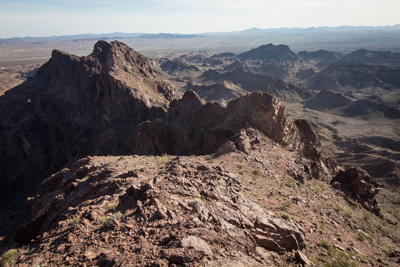
A wash followed the tiny canyon, and the beautiful Palo Verde Peak summit ridge above came into view as I continued through the wash. For the most part I stayed within the drainage, navigating some brush and rockiness for a bit, and then headed up an annoyingly steep and loose slope. Seriously, this slope sucks. Toward the top it got more scree-filled and I found myself using all four limbs to grab at talus/scree to make progress. I topped out on the southern ridge of Palo Verde Peak and was amazed by the views. The jagged ridge had a sheer cliff on the east side and the sunset accentuated the curves.
I followed the ridge toward the summit, initially easy and pleasant terrain. I encountered a short down climb to avoid a sketchy notch. A Class 3 move on the right brought me into the notch, and then some fun scrambling brought me back up on the other side. I then continued just to the right of an interesting-looking optional ridge, but it seemed to add more danger than it was worth, so I kept just below the rocky crest. I found myself on a false summit just south of Palo Verde Peak. I had two options: stay along the ridge and step across an airy one-move knife-edge (Class 3), or down climb a small chimney on the left, which looked a lot safer (Class 3+). I did the knife edge on the ascent, and on my way back came up the chimney. I generally always recommend the less-exposed feeling option, but either way works fine. The rest of the route is quick Class 2 to the summit of Palo Verde Peak.
Please consider helping me out if you find my site useful. I'm not sponsored, so all site fees are out-of-pocket and my time preparing these trip reports is unpaid. You can also hire me as a web developer. I really appreciate it!


If you find my site helpful, please help me replace my many broken cameras, fund my website fees (hosting, APIs, security), or just support my countless hours of work. I pay for all expenses myself, and all trip reports I post are unpaid and unsponsored, so any support is really appreciated!
If using PayPal, please select their option for "Sending to a friend" so they don't take out fees, thank you.
My site is free to use, but consider sending me a few bucks to help keep it running. Thanks in advance!