I provide a free route map, but you can also download a hike/drive GPX to assist you and to help support my site. Before sharing my GPX tracks with others, please remember my site is a free resource and I'm charging nominal fees to offset my substantial costs.
GPX track added to your cart.
Jun 20, 2020 — This hike summits Roan High Knob, Round Bald, Jane Bald, and Grassy Ridge Bald. Starting from the absurdly crowded Carvers Gap Trailhead, I took the Appalachian Trail west first, ascending Roan High Knob. I'm embarrased to admit I had trouble finding the start of the AT, so I spent a few minutes backtracking through the parking lot until I located it along the main road. The trail switchbacks slowly up toward Roan High Knob, the coniferous trees a nice change from the otherwise deciduous forest I'd bee hiking in the last few days. Make a left at the junction along the AT a few hundred feet from the summit, where a sign points to the AT shelter. The summit is located just past the shelter, a small cluster of boulders.
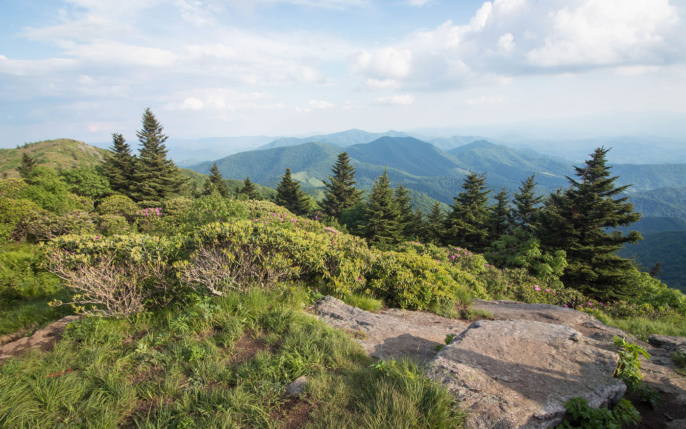
Back at Carvers Gap, I put on my headphones and hiked quickly to disconnect from the major crowds taking the popular trail leading to Grassy Ridge Bald. I saw only one other party on my way up to Roan High Knob, so I kind of knew the crowds must have been migrating this way. The hike was gorgeous from the very start, meadows stretching in every direction and views like I'd never seen before in the southeast. The trail first ascends to Round Bald before dropping down a few hundred feet to the saddle with Jane Bald. The trail begins to steepen as it ascends through a rhodedendron tunnel from Jane Bald to Grassy Ridge Bald. Absolutely stunning. I was thrilled the fog from the last few days cleared for me to get to enjoy this one.
I recommend continuing past Grassy Ridge Bald's high point to check out a nice viewpoint that I also included on my attached map. Thanks to my friend Yossi for recommending Grassy Ridge Bald, and despite the crowds, I couldn't recommend it more as well.
Please consider helping me out if you find my site useful. I'm not sponsored, so all site fees are out-of-pocket and my time preparing these trip reports is unpaid. You can also hire me as a web developer. I really appreciate it!


If you find my site helpful, please help me replace my many broken cameras, fund my website fees (hosting, APIs, security), or just support my countless hours of work. I pay for all expenses myself, and all trip reports I post are unpaid and unsponsored, so any support is really appreciated!
If using PayPal, please select their option for "Sending to a friend" so they don't take out fees, thank you.
My site is free to use, but consider sending me a few bucks to help keep it running. Thanks in advance!