I provide a free route map, but you can also download a hike/drive GPX to assist you and to help support my site. Before sharing my GPX tracks with others, please remember my site is a free resource and I'm charging nominal fees to offset my substantial costs.
GPX track added to your cart.
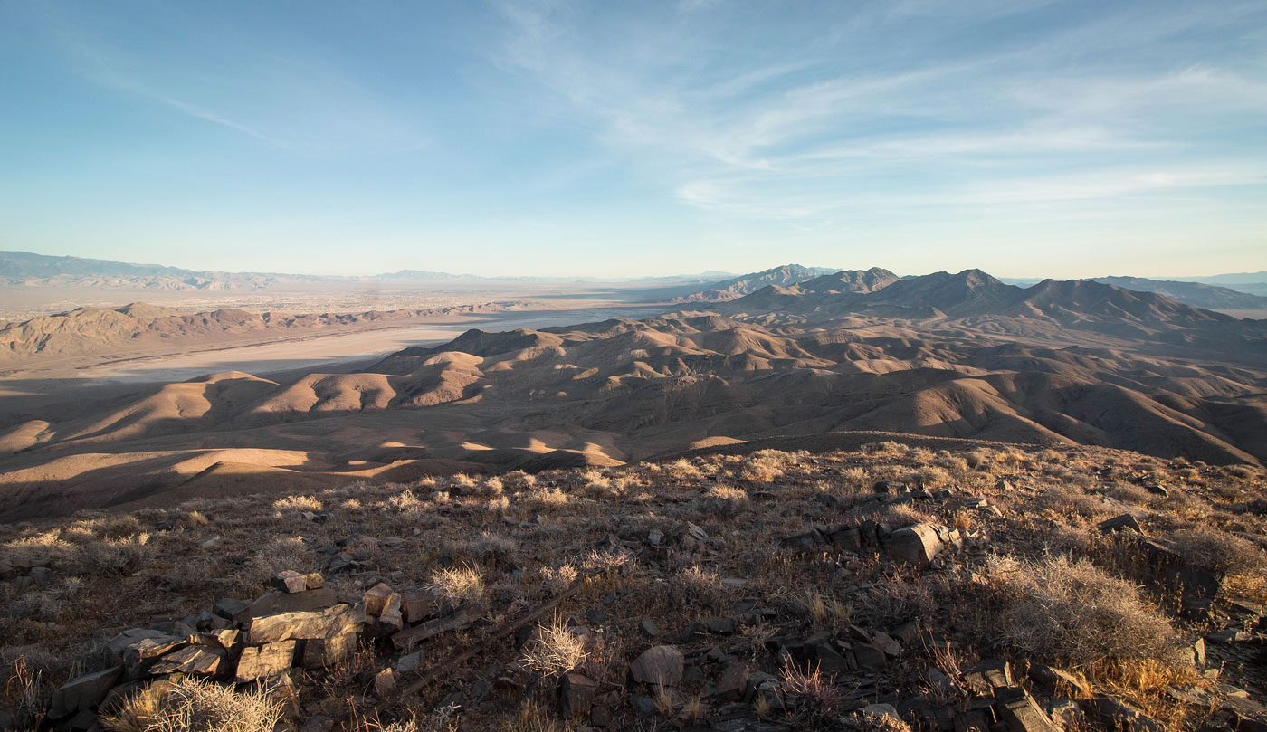
Jan 05, 2021 — Shadow Mountain is a boring-looking peak when viewed from any direction. I really only recommend it if you're interested in some good cardio; the slope is gradual enough that you can hike pretty much non-stop at a relatively low angle. I found myself getting into a nice meditative state as I huffed my way up. The views from the summit are nice, but nothing you wouldn't see anywhere else in the area. I might even call the peak dull. It didn't help that I hiked at weird time of day/year when the sun was always right in my face, hence the relatively low number of photos. Also, every photo sort of looked the same since the peak isn't exactly photogenic. Aside from a couple of steeper sections and a really light section of barely-scrambling, this was a Class 1 route. Despite my less-than-positive notes, I actually had a good time on Shadow Mountain.
I parked at a turn-off from Bell Vista Road and started south. There are so many options you can take to get to Shadow Mountain since all the sub-ridges and washes leading to the main north ridge are easy-going and you can start gaining elevation as soon as you want. Seriously, don't analyze a map too much and don't try to stick to my route exactly because everything is a good option, as long as you get to the main north ridgeline before the final mile to the summit. My goal was to be along the ridgeline as long as I could, so after a couple of miles walking through the desert and up washes I headed to the northernmost-stretching finger leading from the peak. Being below the many options made it a little unclear which ridge was the tallest since the grade was so mellow, but once I was high enough above the desert floor it became clear where to go. I continued along the sloping, mellow north ridge and stumbled on a cairned and faded social trail. I don't know where this came from or where it originally led, but I followed it. I marked this is purple on my attached map. If you lose the social trail and stick to the ridge crest instead, you might encounter some light Class 2 and an additional 100 feet of vertical gain, so it's really not a big deal. But I was able to stick to this trail until it clearly ended about a mile later. From here, a few spurts of uphill led to the summit of Shadow Mountain.
Please consider helping me out if you find my site useful. I'm not sponsored, so all site fees are out-of-pocket and my time preparing these trip reports is unpaid. You can also hire me as a web developer. I really appreciate it!


If you find my site helpful, please help me replace my many broken cameras, fund my website fees (hosting, APIs, security), or just support my countless hours of work. I pay for all expenses myself, and all trip reports I post are unpaid and unsponsored, so any support is really appreciated!
If using PayPal, please select their option for "Sending to a friend" so they don't take out fees, thank you.
My site is free to use, but consider sending me a few bucks to help keep it running. Thanks in advance!