I provide a free route map, but you can also download a hike/drive GPX to assist you and to help support my site. Before sharing my GPX tracks with others, please remember my site is a free resource and I'm charging nominal fees to offset my substantial costs.
GPX track added to your cart.
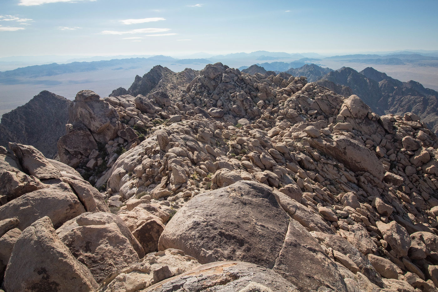
Apr 13, 2020 — Despite the relatively low mileage, Sheep Hole Mountains High Point took significantly longer than I thought it would. It's got the same rocky personality you'd expect from the Joshua Tree area's granite boulders. I started from a pull-out off Amboy Road and dropped into the sandy drainage on the west side of the Sheep Hole Mountains. I followed the sandy wash into a prominent drainage on the right, and then continued through this drainage, ultimately to its head. Along the way, there was a fair amount of boulder-hopping and some trickier obstacles. About halfway up the drainage, a wall of boulders blocked easy access. Going straight up this blockade would result in some fun Class 3 movement, but keeping the route Class 2 requires leaving the drainage and keeping to the right side slopes to get to higher ground, avoiding the bouldery blockade.
Eventually the drainage rock-hopping simmered out and I reached the head of the wash. Two sets of cairns marked possible routes up. The left leads up a steep slope and then a Class 3 face (my initial ascent route, which I removed from my attached map; it was loose and steep), and the right, which continues to a low saddle and includes a fairly well-eroded social trail. The social trail continues just south of the ridge crest, avoiding much of the difficult rock-hopping and maze-like nature created by the massive boulders. The route is a little confusing to describe since all the boulders kind of look the same, but I had to drop down into a small basin-like formation before making the final ascent on Class 3 boulder-hopping fun, and the summit block required a low Class 3 move. Great views of the surrounding desert.
Please consider helping me out if you find my site useful. I'm not sponsored, so all site fees are out-of-pocket and my time preparing these trip reports is unpaid. You can also hire me as a web developer. I really appreciate it!


If you find my site helpful, please help me replace my many broken cameras, fund my website fees (hosting, APIs, security), or just support my countless hours of work. I pay for all expenses myself, and all trip reports I post are unpaid and unsponsored, so any support is really appreciated!
If using PayPal, please select their option for "Sending to a friend" so they don't take out fees, thank you.
My site is free to use, but consider sending me a few bucks to help keep it running. Thanks in advance!