I provide a free route map, but you can also download a hike/drive GPX to assist you and to help support my site. Before sharing my GPX tracks with others, please remember my site is a free resource and I'm charging nominal fees to offset my substantial costs.
GPX track added to your cart.
Dec 19, 2020 — Smith Mountain is a secluded peak at the southern end of Death Valley National Park. I approached it from Gold Valley, which is what seems like the standard route. The turnoff from Furnace Creek Wash Road onto Lost Section Road is located here (36.05580850807945, -116.50775655378493), and Lost Section Road continues to be in great condition until about 3/4 the way up. The road then begins to introduce obstacles that are only going to get worse in years to come, but for now are passable by a mid-clearance vehicle, a couple of large ruts being the big issue, plus a steep section that 2WD could likely overcome with some speed. Having a low clearance vehicle would add around 5 miles to the route. Turn left here (36.021559007764246, -116.62293635091942) and right here (36.015824927092, -116.63566590986738) and park when you feel content along this unmarked road.
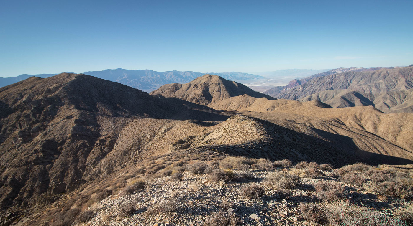
I started west through the desert, a bunch of minor drainages adding some up-and-down as I went, my goal being the major east-draining canyon. The canyon began to narrow quickly and became steeper than expected, ultimately gaining 1000 or so vertical before reaching the flatter desert above. There weren't any big surprises within the canyon, but there was a Class 2+ obstacle at the top of a scree slope, and the final couple hundred feet followed a steep and dirty slope. Coming out of the canyon/gully via this slope was a little disorienting - I wasn't sure which way was south, the direction I intended to go. I kept to the right and ascended a sandy slope to gain the saddle of Smith Mountain and Smith Mountain - East Peak. From here I continued to Smith Mountain, just some steep hiking to a false summit, followed by a minor dip to gain the true summit. Absolutely gorgeous views into Death Valley, plus Funeral Peak looming to the north.
I dropped back to the saddle and headed east toward Smith Mountain - East Peak. An animal trail led me along the steep slope (not even Class 2) to the summit, which had more great views.
Please consider helping me out if you find my site useful. I'm not sponsored, so all site fees are out-of-pocket and my time preparing these trip reports is unpaid. You can also hire me as a web developer. I really appreciate it!


If you find my site helpful, please help me replace my many broken cameras, fund my website fees (hosting, APIs, security), or just support my countless hours of work. I pay for all expenses myself, and all trip reports I post are unpaid and unsponsored, so any support is really appreciated!
If using PayPal, please select their option for "Sending to a friend" so they don't take out fees, thank you.
My site is free to use, but consider sending me a few bucks to help keep it running. Thanks in advance!