

Starting along the West Maroon Trail.
A short forest walk starts off the hike.
I passed this old cabin and then ascended into a gorgeous valley.
I emerged into the meadowy valley.
Wildflowers everywhere!
View back at my progress through the valley.
Belleview Mountain seen right of center.
A stream crossing.
West Maroon Pass seen left of center, Belleview Mountain top left.
View back as I head up toward West Maroon Pass.
A trail junction along the way.
Another shot back, just before the West Maroon Trail steepens signifcantly.
West Maroon Pass seen center.
Switchbacks leading to the pass.
A shot back from West Maroon Pass.
West Maroon Pass, view toward the Maroon Bells.
Wider shot, Belleview Mountain seen left of center.
Starting along the ridge crest. A social trail weaves around various pinnacles.
It's overall a good social trail initially, not exceeding Class 2.
Pretty well-defined social trail, at least for the beginning.
Approaching the first notable obstacle, a Class 2 ledge with some exposure.
View back at the obstacle. The trail then ascends to the crest.
View back at my progress from West Maroon Pass.
The trail continued along the crest for a bit along the crest toward the headwall seen center.
Wrapping left around the headwall.
Class 2 ascent back to the ridgeline.
Onward to the false summit, seen ahead. Belleview Mountain's true summit seen far right.
More Class 2 obstacles along the way.
View back toward West Maroon Pass, right of center.
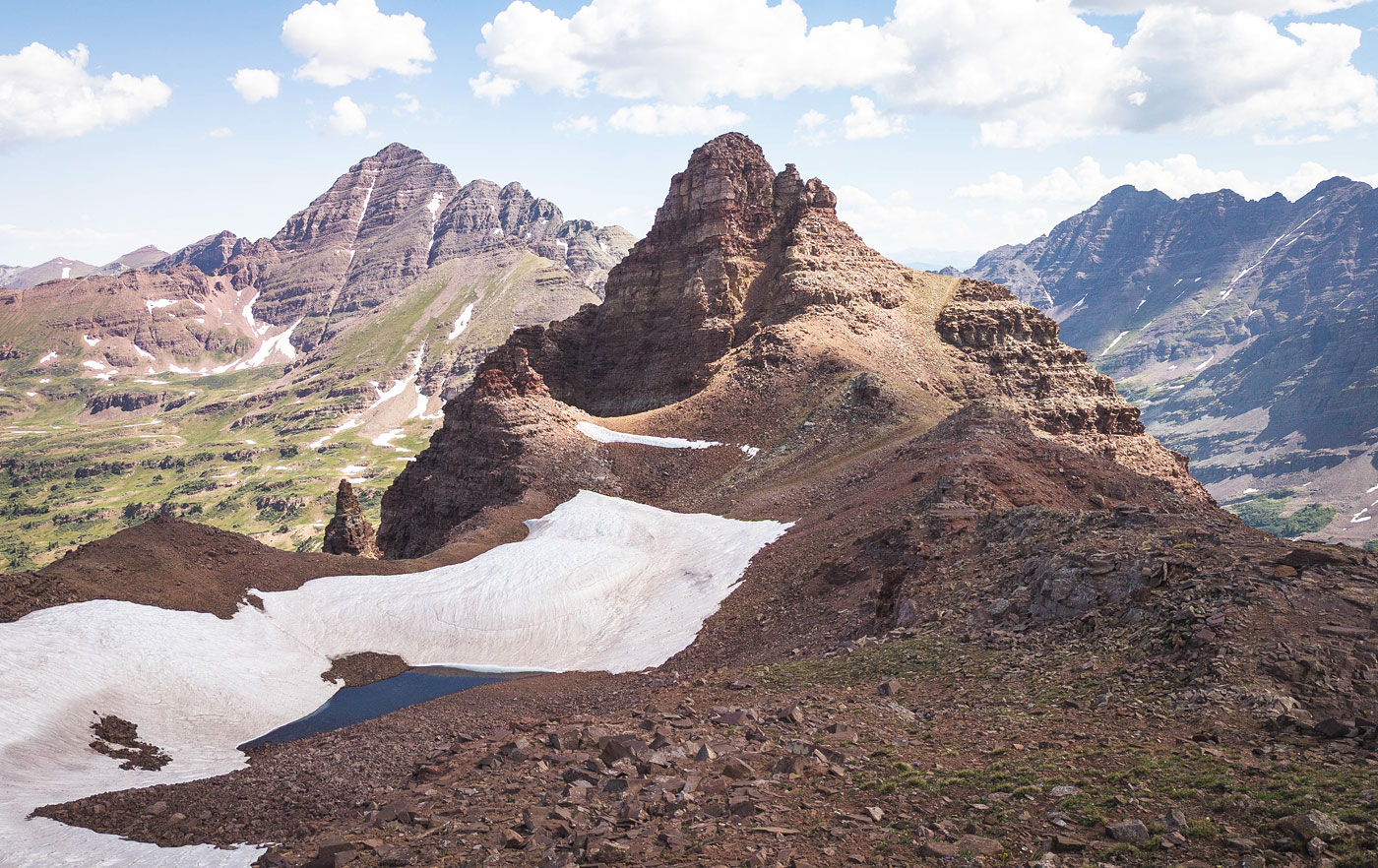
False summit, view toward Belleview Mountain's true summit.
Close-up toward Belleview Mountain. I headed to the shoulder on the right. Maroon Peak seen on the left, Pyramid Peak on the right.
Class 2+ steep stuff to gain the summit.
View back at the Class 2/2+ ascent to the summit.
Belleview Mountain summit, view toward the Maroon Bells.
Belleview Mountain summit, view north. The four-pass loop goes through the wide valley seen here.
On the way back, more wildflowers.
Hire me or show me some love!
Hire/refer me as a web developer or send me a few bucks if you find my site useful. I’m not sponsored, so all fees are out-of-pocket and my time preparing trip reports is unpaid. I really appreciate it!