I provide a free route map, but you can also download a hike/drive GPX to assist you and to help support my site. Before sharing my GPX tracks with others, please remember my site is a free resource and I'm charging nominal fees to offset my substantial costs.
GPX track added to your cart.
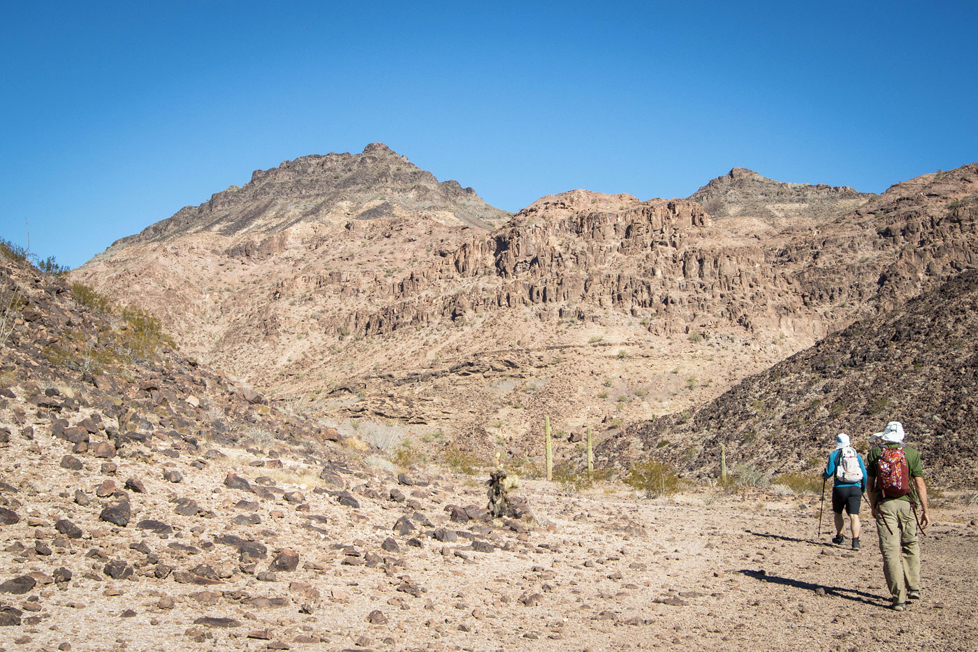
Dec 09, 2022 — Black Dome is unlike most peaks I've done in the region, the rock overall very solid and the spurts of light scrambling enjoyable. It's just too bad it's located deep within the Kofa Wildlife Refuge and probably won't get much traffic. We drove in using the well-graded King Road, leaving pavement here (33.26690, -114.23893). We kept right here (33.28261, -113.97513) took this less good road here (33.27091, -113.95517), where the road then deteriorates more. We then headed south at this junction (33.21349, -113.85840) to reach the trailhead. If not for a few deep ruts, I'd say a Crossover with really good tires could possibly make it, but even Chris' burly Wrangler tires managed to get a flat so I don't recommend driving out here unless you have a very capable vehicle. The road is overall easy to follow, though a couple of washes with misleading tire tracks could get confusing. Throughout the day we could hear loud concussions from the nearby Yuma Proving Ground, and Chris said he later saw a small explosion on nearly the outskirts of the testing range. We were still very much on public lands, but this was definitely unnerving.
We could see Black Dome ahead, its humped form not looking particularly interesting from afar, though as we hiked through the open desert for a bit over a mile the peak started looking more colorful and with distinguishable layers to the rock. The peak looked steep enough that we paused to talk our route through. Our initial idea was to ascend via a draiange on the south side of Black Dome, but a weakness on the southwest side looked closer and had the potential for some fun scrambling. A large butte to the north popped in, adding some drama to the landscape. We ascended a casual slope with lots of black embedded boulders to our weakness, a minor drainage off the face of the peak.
Pretty much right from the start we found ourselves on fun Class 2/3 using solid rock and large boulders for a few hundred feet. Eventually we reached a heavily pocketed slab that offered some very unqiue Class 2/2+ scrambling leading up to a short cliff band above. We scrambled up the cliff band (Class 3) on the ascent, but wrapped around it on the descent. Past this band, we were now in a lightly-colored slickrock drainage, which ascended on some eroded rock for a hundred feet or so before entering a black volcanic landscape where tons of cholla decided to call home. We all did a good job keeping our skin unpunctured for the most part as we made our way up the blocky, steep slope to the base of the summit dome. Black Dome is aptly named, the final 50 feet requiring us to wrap around to the peak's southeast side to ascend on Class 2 since the other faces of the dome were much more difficult. We took in the views for a bit, noting Signal Peak and recently renamed Squaw Peak (now Hoodoo Peak) far to the north. Looking down in search of another route option, we noted the southern drainage route we'd skipped earlier looked pretty brushy and loose, so we decided to return the way we came.
Please consider helping me out if you find my site useful. I'm not sponsored, so all site fees are out-of-pocket and my time preparing these trip reports is unpaid. You can also hire me as a web developer. I really appreciate it!


If you find my site helpful, please help me replace my many broken cameras, fund my website fees (hosting, APIs, security), or just support my countless hours of work. I pay for all expenses myself, and all trip reports I post are unpaid and unsponsored, so any support is really appreciated!
If using PayPal, please select their option for "Sending to a friend" so they don't take out fees, thank you.
My site is free to use, but consider sending me a few bucks to help keep it running. Thanks in advance!