

Starting up the slope on the west side of Tank Mountains High Point, seen ahead in the center.
Class 2 slope to gain the ridge just south of the summit block (summit top left).
View back toward the wash we parked the cars in.
Class 2/3 to gain the ridgeline, summit block seen ahead.
Morning light on Courthouse Mountain to the south.
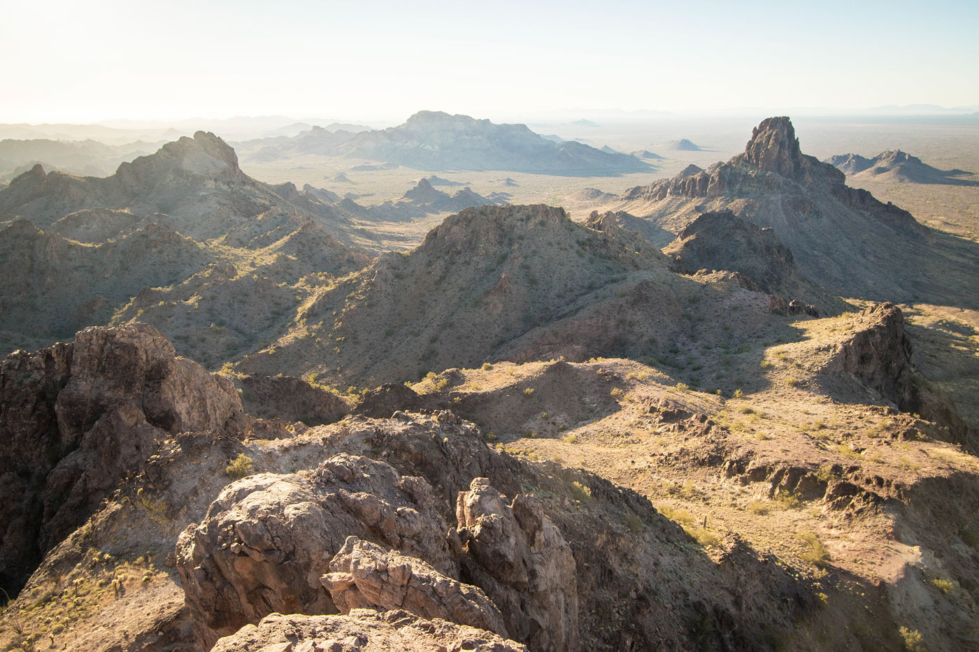
View back along the ridgeline. You can see the wash where we parked below.
Approaching the summit block. The route starts in the center of this photo using a chute.
Up a brushy chute leading to a crack.
Matthew on the crack, Class 3+. Pat the crack, the route leads through the notch left of center.
Chris coming up the crack. Just behind me is a narrow gully.
View back at the narrow gully, just before Chris ascends toward me.
The Class 5 (less exposed) face is just to the right out of frame. Seen here is Bob scrambling an extremely exposed Class 4 slab to the left of the face we used.
Chris preparing to solo the low Class 5 face.
Close-up toward the upper reaches of the Class 5 portion.
Matthew at the top of the face.
Tank Mountains High Point summit, view south. Courthouse Mountain seen on the right.
Bob, Chris, Matthew on the summit.
After returning to our cars, we drove down to Courthouse Mountain and started up. The summit is seen on the left.
We ascended this Class 2 drainage on the ascent, using the ridgeline on the right as the descent.
Above the first few hundred feet, almost at the southern ridge. We passed underneath the outcropping ahead.
View back toward the outcropping pictured previously.
Fun Class 2/3 along the ridgeline, the summit seen ahead.
Some Class 3 ahead.
Some fun scrambling.
Some light route-finding to keep the ridgeline Class 2/3.
And then we reached the base of Courthouse Mountain.
The route leads up the weakness just left of center in this photo.
View back along the ridgeline.
At the base of the weakness. The first chute is seen on the left.
View at a Class 3 crack at the top of the first chute.
Second chute. We ascended partway, then scrambled to the right onto the exposed rib, Class 3.
View down the exposed rib.
Final set of chutes. The route leads up the initial shadowy crack, then traverses left a few feet before ascending steeply.
Taken where I hesitated, watching the others do a step-across more on loose, chunky rock. Matthew seen above after the step-across, continuing the scramble.
Matthew in the upper reaches of the third chute.
Close-up of Chris scrambling the dangerous third chute.
View down the loose crap at the top of the third chute.
After some more light scrambling, we made it to a viewpoint of both summits of Courthouse Mountain. Chris is visible on the top of the western summit.
View toward the eastern summit from the western one.
A shot of Matthew climbing the Class 4 crack.
Bob starting up the Class 4 crack.
Close-up of Bob at the chockstone move.
View down at Chris scrambling up the Class 4 move into the loose chute above.
Summit of Courthouse Mountain, view back, the chute we ascended seen bottom right.
Eastern summit, view toward the viewpoint (center) we were at earlier. Western summit on the right.
Hire me or show me some love!
Hire/refer me as a web developer or send me a few bucks if you find my site useful. I’m not sponsored, so all fees are out-of-pocket and my time preparing trip reports is unpaid. I really appreciate it!