I provide a free route map, but you can also download a hike/drive GPX to assist you and to help support my site. Before sharing my GPX tracks with others, please remember my site is a free resource and I'm charging nominal fees to offset my substantial costs.
GPX track added to your cart.
Some might consider this route a technical canyon, but it only has two very short drops that can be downclimbed, making the technical label feel silly. You may prefer to rappel the two drops, the result being two rappels under 20 feet each. This would consequently reduce my Class 4 rating to Class 2 since there's otherwise only some light scrambling within the canyon. Also, since I didn't have a friend with me to set up a car shuttle the stats reflect a descent and subsequent return up the canyon.
Dec 08, 2022 — On previous visits to the granitic foothills surrounding Spirit Mountain, I checked out Pipe Spring Canyon and Grapevine Canyon, but for some reason I never ventured into Bridge Canyon, odd because this feature is the reason behind the naming of Bridge Canyon Wilderness. Without any expectations and a morning to kill, I determined I'd check this canyon out and if there were any technical sections I'd just turn back and return with a group and gear. Fortunately the canyon was passable, though just barely. Bridge Canyon passes underneath the Laughlin Highway, so I could have just parked off the highway and entered the canyon there, but I didn't want to leave my car on the side of the road. Additionally, I wanted to make sure I could check out the canyon's upper reaches, and not knowing if the canyon would have dryfalls I figured it was best to start high and descend until I couldn't anymore. After considering my options I decided to park at the end of Upper Bridge Canyon Road, a dirt road that's in good shape until the last mile, where passenger cars likely won't be able to continue. I made it almost to the end, but the road became much more steep and a sign informed me it would be ending in 0.2 miles anyway. From where I parked I headed on foot along the remainder of the road to a barrier blocking vehicular access into the wilderness, so I dropped into Bridge Canyon and started down.
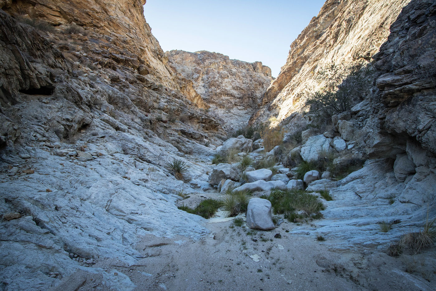
Right from the start, Bridge Canyon boasted pretty granitic formations on either side of the drainage, but they weren't as intense or dense as other areas nearby. I found myself often walking through a wide wash opposed to the narrows I was sort of hoping for. I was also surprised to see ample footprints, considering the canyon isn't publicized and poorly documented, though the footprints faded away after about a mile down anyway. Bridge Canyon had a couple of particularly nice narrower portions, but these sections were wide enough that any obstacles could be avoided with trivial Class 2 tasks rather than true scrambling. I was surprised a few times by prettier sections and these made the canyon a lot more interesting, and aside from one particularly bad section of thorny bushwhacking that lasted about 20 feet I was able to avoid getting hurt by desert plants.
As I approached the highway, though it was still far enough away that I couldn't hear cars, Bridge Canyon surprised me as it narrowed significantly into a deeper section. I grew more excited, but also dismayed that it was likely I'd stumble on an impassable portion. Just after entering there was a short drop that I hopped down, knowing I could climb back up if I encountered a larger drop in a bit. With taller and more colorful walls, I was thrilled to continue strolling until I reached a second obstacle. At first glance I thought this drop's slick walls and large chockstone would prevent further progress, and the extremely old piece of frayed rope tied around didn't help my confidence in downclimbing. On the right side of this boulder I was able to lower myself slowly and wedge myself into a gap below before stemming down, the whole affair lasting about 15 feet. I wandered out of the narrows and continued through a metal drainage pipe under the highway and continued through the now wide wash. I decided to turn around when the canyon seemed to have lost most of its charge according to satellite imagery, and I'd reached a grouping of thick vegetation. I had dinner calling me anyway.
If you set up a shuttle just return to Laughlin Highway, and if not you can hike back along the pavement. Alternatively, reascend the canyon (hence my Class 4 rating due to the tricky manuevers in the narrow section) to see Bridge Canyon in reverse.
Please consider helping me out if you find my site useful. I'm not sponsored, so all site fees are out-of-pocket and my time preparing these trip reports is unpaid. You can also hire me as a web developer. I really appreciate it!


If you find my site helpful, please help me replace my many broken cameras, fund my website fees (hosting, APIs, security), or just support my countless hours of work. I pay for all expenses myself, and all trip reports I post are unpaid and unsponsored, so any support is really appreciated!
If using PayPal, please select their option for "Sending to a friend" so they don't take out fees, thank you.
My site is free to use, but consider sending me a few bucks to help keep it running. Thanks in advance!