I provide a free route map, but you can also download a hike/drive GPX to assist you and to help support my site. Before sharing my GPX tracks with others, please remember my site is a free resource and I'm charging nominal fees to offset my substantial costs.
GPX track added to your cart.
The first mile or two is on private property. I do not recommend taking the initial approach I did. Read on to learn more details.
Jun 02, 2022 — Black Mesa High Point is a prominent mesa on Navajo Tribal Lands. It's known mostly to county high pointers, but it was a point of interest for me because of my unfathomable lust for summits that I can't seem to shake. Once a peak is on my radar, it's near-impossible to get rid of it. Plus, the hike has a trail most of the way and is located in an area I've never explored before. The trail is reportedly known as the Yazzi Trail, and it's not listed on any maps anywhere. I have no idea who built it or for what purpose, but I was drawn to it for some reason. I got a little too deep into the prospect of getting to Black Mesa High Point's summit despite plenty of red tape, but somehow this pushed me to want to go for it even more *shrug*. My research revealed most people approach Black Mesa High Point from just south of the town of Kayenta, AZ. Unlike most topo maps that delineate the land ownership for an area, this is all Navajo and was only noted as such. Generally a permit is required to hike on Navajo Nation land. That being the case, I set out on my first leg of the process for tackling this hike: the phone. It's going to be hard to believe me, but I called no fewer than 10 different numbers in an attempt to get a permit. Each agency I called (tribal parks, region chapters, and even the town of Kayenta) referred me to someone else, but ultimately I was dead-ended with a simple "I don't think you need a permit to hike in that area". Getting frustrated, I took this as permission being granted. A week later I was parked at an open and unlocked gate, my start point. Reaching this spot is likely doable by any vehicle except for the last quarter mile, but you likely won't want to park here regardless of vehicle type. TL;DR: Don't park where I did and do more research as to where the private property boundary might be before setting out for the Yazzi Trail.
Previous hikers stated there could be trouble if you park within the area past this gate so I took heed and stayed clear. I placed a long-winded note on my car (see the first photo below) outlining my due diligence in trying to obtain a permit and explaining why my car was parked here if anyone did come by. Leaving the note felt like a nice gesture since my random out-of-state car might be parked near someone's house and some folks might be concerned about what it was doing there. I saw no signs reading "No Trespassing" or otherwise, so I felt confident enough in leaving my car and starting along the road. Along the way I passed a few houses and a couple of small, unleashed dogs that followed me at a distance. My confidence waned. Quick jump cut to my return to the car later when there was a note on my windshield and of course the gate that was previously open was now locked. Happy I had left my car outside, I read the polite, firm note: "Please respect our property. This is private residential property. Please don't share this experience of hike on social media. This is our home. Please no hiking". Of course I was still determined to write a trip report, if only to make sure future hikers know not to use this approach. Plus, what else would I do with all of these photos I took?? I honestly have no idea where the private property portion begins, especially because land ownership maps don't differentiate Navajo public land from Navajo private land. You'll have to look more into this if you want to take the Yazzi Trail to Black Mesa High Point.
Despite the private property restriction, I'll describe what I did anyway. After hiking for a bit past the open gate on a nice dirt road, I saw a couple of large water tanks a bit ahead. I dropped south a bit before reaching them since there was a private residence nearby and I wanted to stay clear, and located a poor dirt road that I followed south until reaching a rim overlooking a wash. I continued along the rim as it slowly gained elevation and narrowed into an eroded ridgeline. A more significant ATV-looking road materialized and then this narrowed into a wide trail. I looked back and noted I was just above a small farm/ranch/house. After some time I had distanced myself enough from the residence and was well along the ridgeline as it continued south. I'm not completely sure, but I think this is the Yazzi Trail I was so looking forward to hiking along.
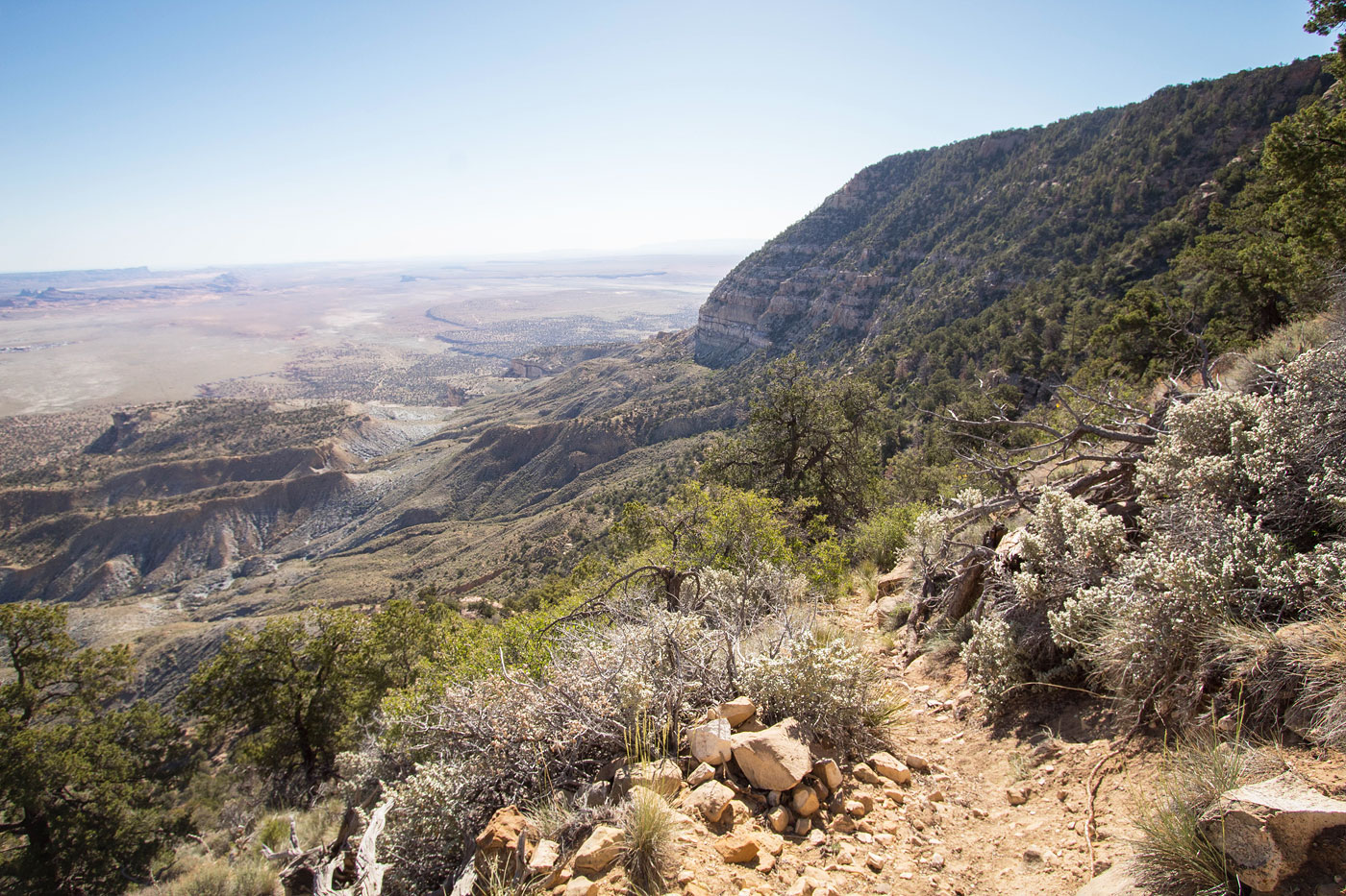
The ridge was easy to follow and occasional cairns marked the way, but there was a point when it curved around to the west side of the ridge and a more narrow social trail stuck to the crest. Aside from this easy-to-miss junction, I encountered no issues as I neared the base of the steep north face of Black Mesa. The trail curved east and slowly ascended along the base of the face. I was pleasantly surprised at the excellent quality of the trail. The trail then curved back west and ascended more steeply before curving south again and making many tight switchbacks to get up to the rim. With the exception of only a couple of downed trees and some well-cairned confusing spots I made quick work with basically no hassles all the way to the rim.
Once on the rim, I took in the views and noted a picnic table and fire ring with a road leading south and away. I assume that's another potential approach to get up here from the south using a vehicle? Sticking to the rim, I continued east to find the high point, still about a mile away. The trail is hard to follow most of the time, but the bushwhacking is minimal and an occasional cairn helps a little. About 1/3 of the way along the rimI was funnelled onto a cute, narrower section where I was able to pick up the trail again for a little bit. Otherwise it was just a sparsely-vegetated woods walk to the forested summit where I found a register. I got some nice views by heading just north of the high point and peering toward Kayenta and the many interesting buttes farther north, as well as west toward the rim's cliff face I had just traversed above.
Please consider helping me out if you find my site useful. I'm not sponsored, so all site fees are out-of-pocket and my time preparing these trip reports is unpaid. You can also hire me as a web developer. I really appreciate it!


If you find my site helpful, please help me replace my many broken cameras, fund my website fees (hosting, APIs, security), or just support my countless hours of work. I pay for all expenses myself, and all trip reports I post are unpaid and unsponsored, so any support is really appreciated!
If using PayPal, please select their option for "Sending to a friend" so they don't take out fees, thank you.
My site is free to use, but consider sending me a few bucks to help keep it running. Thanks in advance!